Titcomb is a nice trip, though not my favorite. This trip was marked by poor weather which added a little bit of charisma to the place, though it being deserted is what made it truly memorable.
➤Quick Facts
Information at a Glance
- Time of Year: 24-26 Aug
- Notable Features: Elkhart Park, Photographer’s Point, Elkhund Lake, Barbara Lake, Two Top Lakes, Hobbs Lake, Seneca Lake, Little Seneca Lake, Island Lake, Titcomb Lakes
- Total Miles: ~30 miles
- Elevation Gain/Loss: +/-5360′
- Elevation Min, Avg, Max: 9334, 10229, 10698
- General Route: Elkhart Park Trailhead ⭢ Pole Creek Trail 119 ⭢ Seneca Lake Trail 123⭢ Titcomb Trail 046; Trail 160 ⭢ Return to Elkhart Park Trailhead
- GPS Track Download Download from “data” on the top left with a free account.
- Housekeeping: Images delivered at lossy quality via CDN; contact me if you’d like better copies.
Interactive Map (Click/Tap)
Elevation Profile (Click/Tap)

⤷Introduction
I had 2.5 days to hike, and my mother wanted a partner to go with, so we looked at our options and selected Titcomb Basin, as it was the 1/2 way point for each of us to meet up.
Because I’ve reviewed Titcomb and the trail in detail, this review will be very brief and focus mostly on pictures. For a more detailed narrative of what you’re getting yourself into, you can read my report where I camped in the basin and climbed Fremont Peak by myself, or you can read my hike from Elkhart to Titcomb and thence onward to Green River Lakes.
⤑Day 1: Elkhart Park to Barbara Lake
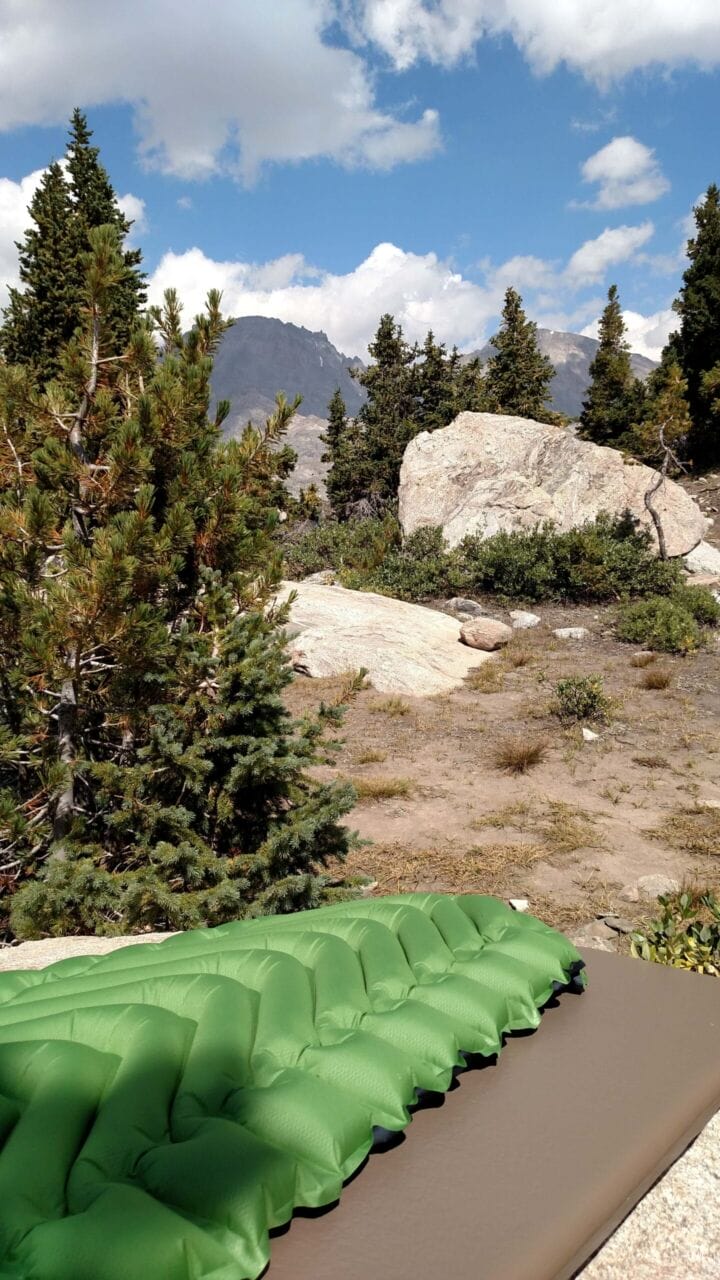
I worked early in the morning. After literally talking to Harrison Ford, I hit the road, arriving at the trailhead just before 5PM, which is pretty late. The forecast was for stormy weather to stall over the area intermittently, so my mom and I had both packed some warmer gear.
As a brief overview of the trail to Titcomb, it begins in forests, going gradually uphill over dirt trails studded with boulders. Past Photographer’s Point it passes Barbara and Hobbs Lake (and Elkhund if you go the least efficient way), descending down, and features a great deal of undulation. Once you’re at Seneca Lake, most of the tree cover will be behind you.

In any case, we went by Photographer’s Point and saw a pine marten. They’re cool creatures. A couple of people going out looked at us funny for taking pictures of it but had zero interest in the animal. That was weird.

We avoided Elkhund Lake and noted snowy-looking virga as we descended toward Barbara Lake. It was 7:30 and getting dark, so we broke off right and downhill prior to reaching the lake, finding a very hidden and nice spot to camp with the lake nearby. It was nippy, so we made dinner and hit the hay rather than stay up yacking.


Day 1: 5.6 miles.
⤑Day 2: Island Lake Camp and Titcomb Exploration in Snow
Clouds persisted in the morning and the weather was cool, so we didn’t get underway until 0930. The cool weather helped us make better progress than we would have on a hotter day, so we blasted through the miles and arrived at the hill overlooking Island Lake around 1 PM. As the lake and basin typically have a bunch of campers, we decided to camp on top of the overlook, which has a hidden meltpond that we could get water from and is quite secluded. This seemed a little nicer than trying to vie for spots past Island Lake, and it meant that we could continue onward without heavy packs, which we’d just have to pack back out anyway. The downside of course was the increased mileage for the day.

With the tent erected and everything stowed, we valiantly pressed on into increasingly stormy-looking weather. If you paid attention to my report of climbing Fremont, you’ll know that there is a certain area that I prefer to cross the river below the Titcomb Lakes, and we took that crossing as is our wont.


Although I had brought my fly pole with me, the weather grew windy before we even made it to the first lake, and it began to rain, which soon became snow pellets, which became snow flurries that quickly melted on the ground. I have to say that we both appreciated the storm, as it gave the basin depth and atmosphere that was truly remarkable.


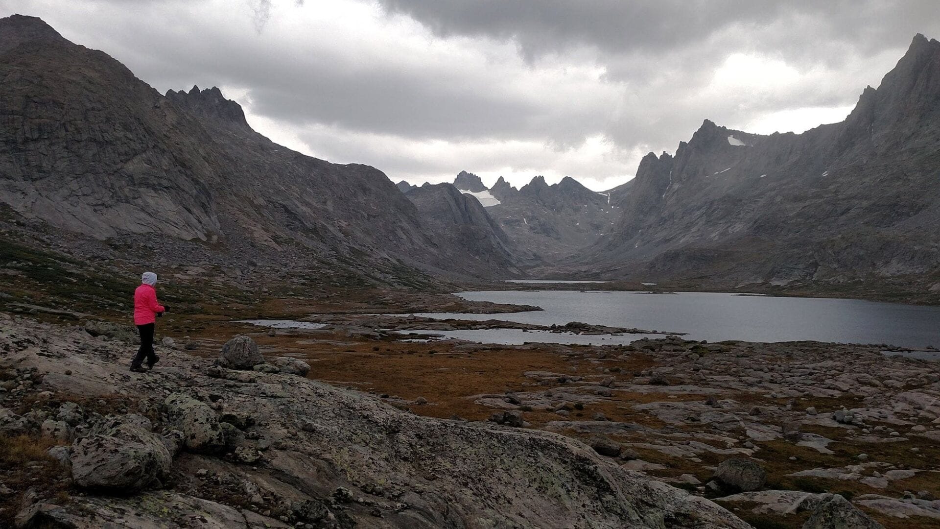


We hadn’t seen anyone the entire day either, which made our walk feel more akin to Middle-earth than Wyoming. We crossed back to the trail upon reaching the bridge between lakes, and at that point the storm died down.


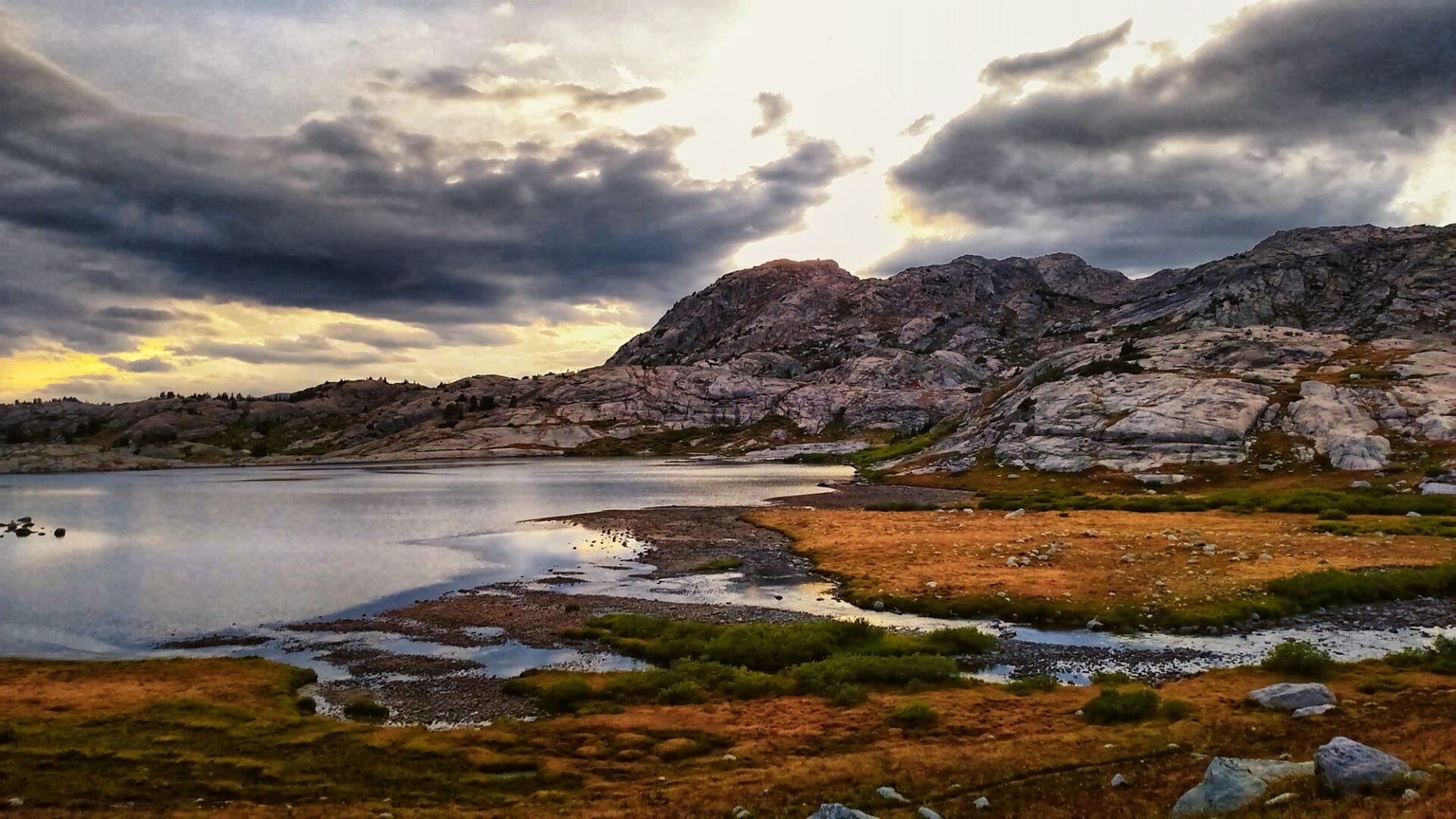
We made our way back to camp with wet feet, and the temperatures dropped as we walked, but the air went completely still, making for rare reflections for the range. The sunset was absolutely stunning and we even got to see a fox lope by looking for lagomorphs or ground squirrels.


I don’t care for fires, but it was quite nippy, so we made one upon our return, setting our socks and shoes on a nearby log to dry out as they could. The night was quite cold and still, but we both slept well.


Day 2: 13.1 miles.
⤑Day 3: Egress
Waking up in the morning sucked given the low temperatures and the fact that it had snowed a little bit overnight. We waited inside the tent as things armed up, and soon all of the snow was gone. Our shoes and socks were both damp which made getting ready less pleasant. When mom finally had her coffee and some food in her it was already 1030, but at least a bit nicer out. I popped over the hill and got a last photo of Island Lake.


Just past Hobbs Lake the weather turned crappy again and we got pelted with snow pellets and wind. This continued for some time, and arriving at Barbara Lake we met a middle-aged couple who were headed into Titcomb. They were wearing shorts and T-shirts and appeared pretty cold. The wife asked us what the weather was like and was dismayed when we reported that snow was in the forecast, and that we’d been snowed on. She got pretty snippy with her husband telling him, “I told you that we needed to bring jackets and pants! All this way and we’re going to freeze to death!” The lesson is to always be prepared for bad weather, especially in late August!
The rest of the trip out was uneventful and I made it back to Jackson by 8PM.
Day 3: 11.2 miles.
➤Conclusion and Rating
Titcomb is fine and pretty, but not the best that the range has to offer, and the approach is tedious, just as the walk out is. If you only have 2 night available, Big Balls of Cowtown Trail in the Gros Ventre or Stough Creek Basin to the southeast are both better options.
- My scientific rating system. I liked this hike, and wished that I’d had more time to spend on it.
- Beauty. It’s not the prettiest, but a couple of the locations are just very…well, pleasant!
- Camping spots. A plethora.
- Crowds. This isn’t that popular with folks, so despite being an Elkhart ingress, it’s not crowded.
- Difficulty. This hike is fairly easy for anyone who’s used to hiking at higher elevations. It can be very dusty and hot, though.
- Fishing. Lots of brookies!
- History. Not so much.
If you have any questions, comments, or anything else, feel free to post below. I’m here to serve you, so let me know if this wasn’t helpful, or if there’s anything I can do to make this better.
