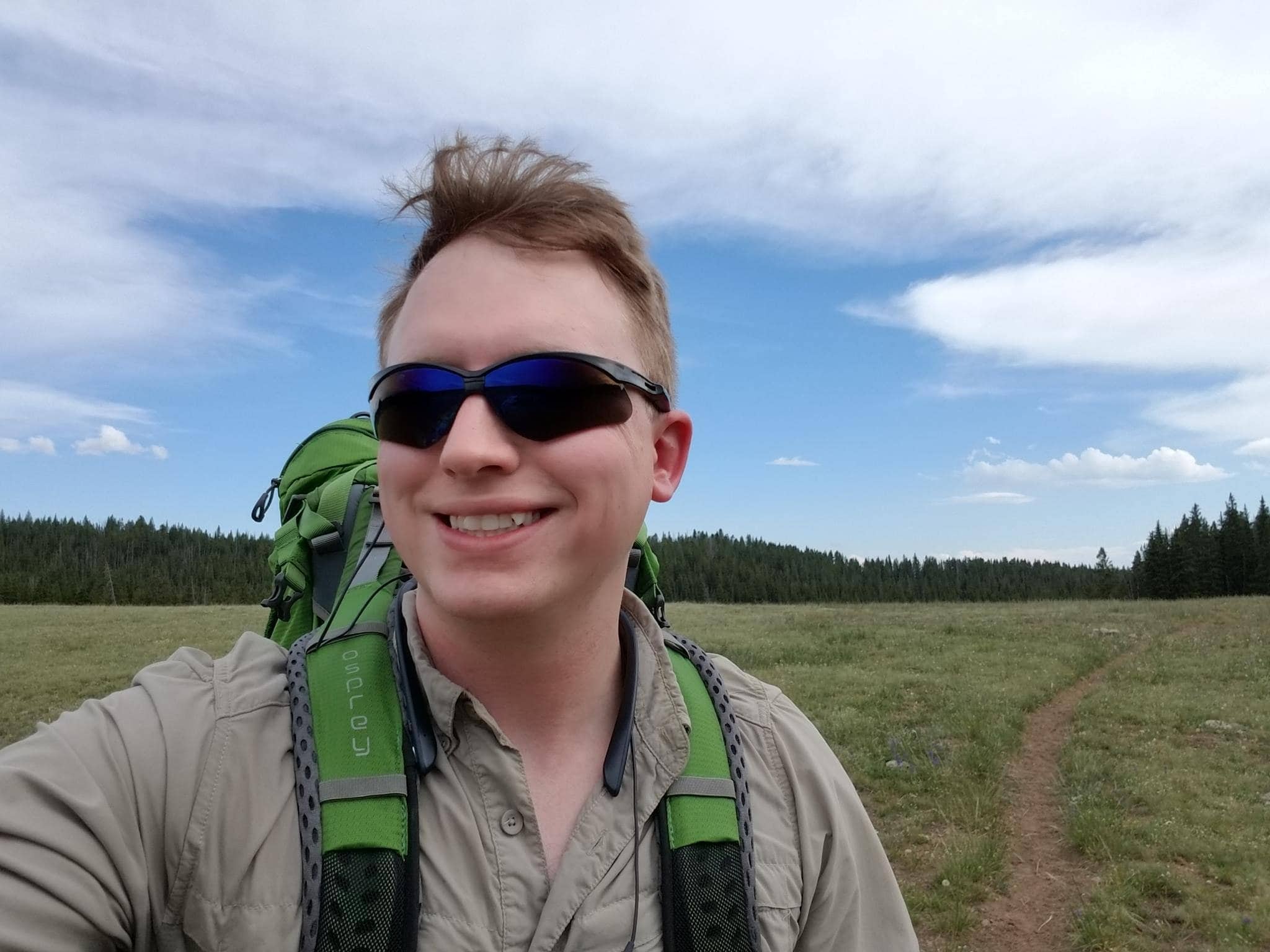
Review: 20 Miles to Gorgeous Middle Cloud Peak Lake, Wyoming!
This is a relatively short hike with decent fishing and some amazing waterfalls. While not the most spectacular for the area, its ease of access makes it a great choice for those with 2 or more nights available to camp.
In this post:
- ➻ Quick Facts
- ⤷ Intro—I’m 30
- ⤑ Day 1—July 10, Battle Park to Grace Lake
- ⤑ Day 2—July 11, Grace to Middle Cloud Peak Lakes
- ⤑ Day 3—July 12, Cloud Peak Lakes to Home
- ➤ Conclusion and Rating
➻ Quick Facts
—Date of Visit: Jul 10-12, 2018
—Notable Features: Grace Lake, Solitude Lake, Cloud Peak Cascade, Cloud Peak Lakes, Wyoming
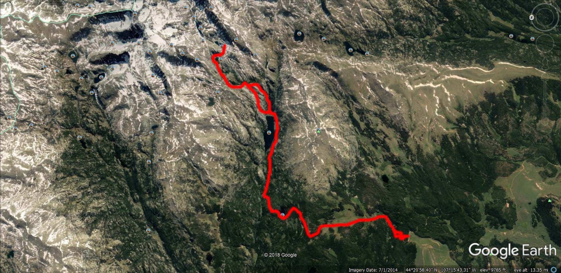
—Total Miles: 20.1 miles (sans excursions)
—Elevation Gain/Loss: +/-4837 feetNote: Utilizing an elevation gain threshold model with DEM (for GPS estimates, see GaiaGPS and AllTrails variants; accuracy is decreased, but you can download the GPX/KML)
—Elevation Min, Avg, Max: 9096, 9596, 10,440
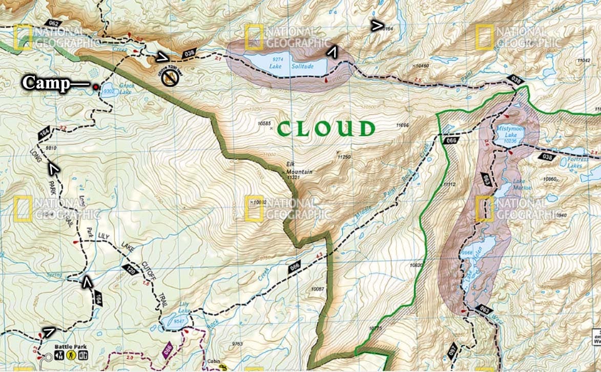
—General Route: Battle Park Trailhead → Tr 164/Long Park Tr → Tr 038/Solitude Tr → Off-trail → Cloud Peak Lakes, Wyoming → Off-Trail → Tr 038 → Tr 164 → Battle Park TrailheadGPS Data: You can visit the GaiaGPS site below and make a free account to download my GPS data, which I have made available for all of my trips. They won’t email you, and it only takes a click or two.
⤷ Intro—I’m 30
It was going to be my 30th birthday, so what was I going to do? Obviously I was going to go hiking. I’d been thinking about it since Fiji, and I decided that I’d go to Middle Cloud Peak Lake in the Cloud Peak Wilderness. I’d hoped that perhaps someone would accompany me, but my family and friends were, as usual, busy—this has always happened to me in the CPW, due to the remote location, including when no one went with me on the most jaw-dropping hike ever to nearby Loomis Lake, which I find preferable to even this hike here. Plus I really don’t have any friends that like backpacking for days at a time…, but even if I did, low seniority means mid-weeks off. The positive aspect is that there are always fewer people clogging the outdoors. I always do have my buddy, the esteemed justice John Hodgman with me.
I worked the night before the big trip, and I wasn’t home until 10:30PM. The distance without stops to the Battle Park Trailhead is 351 miles from my door, so about 5 hours and 55 minutes at maximum speed. Sadly, this good timing wasn’t to be.
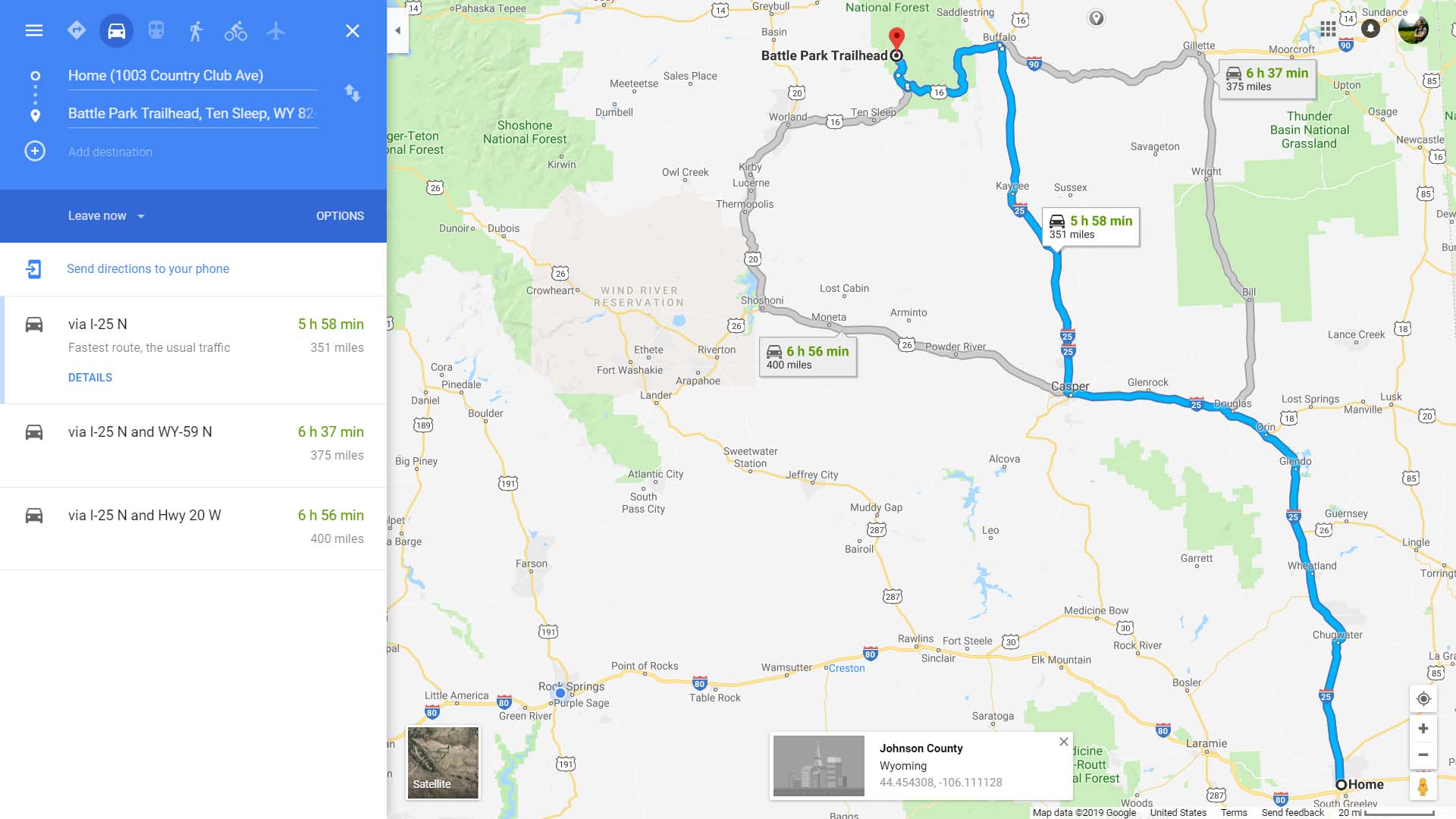
Not only did I get something of a late start, but I got multiple calls from my next employer requesting documents, so I had to stop in Casper and spend a lot of time working on my phone, and then verifying that everything was copacetic. This killed hours of my trip and set me far behind, though I did do Crazy Woman Canyon at least, which is a beautiful little drive. The valley floor was 99F.
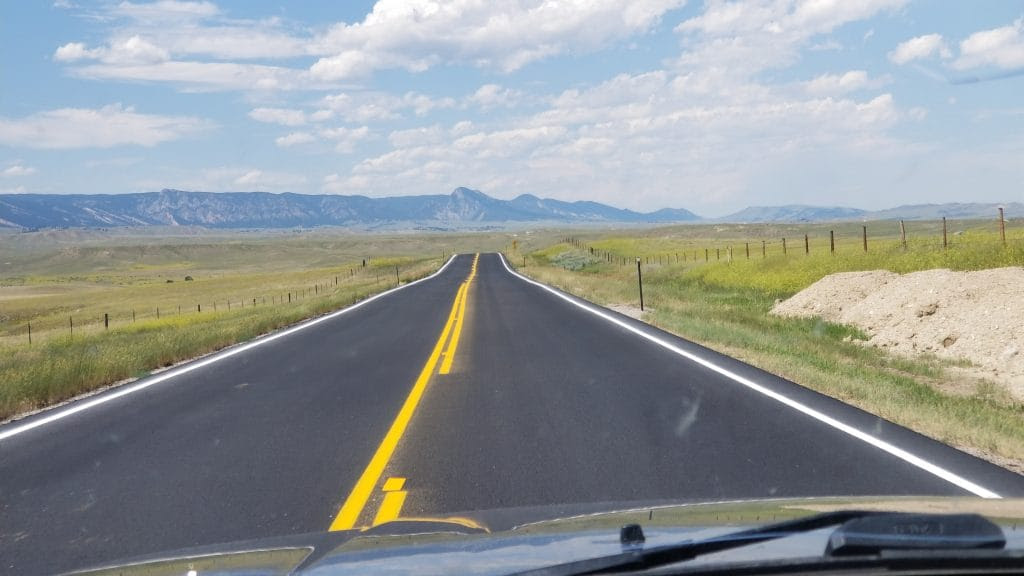
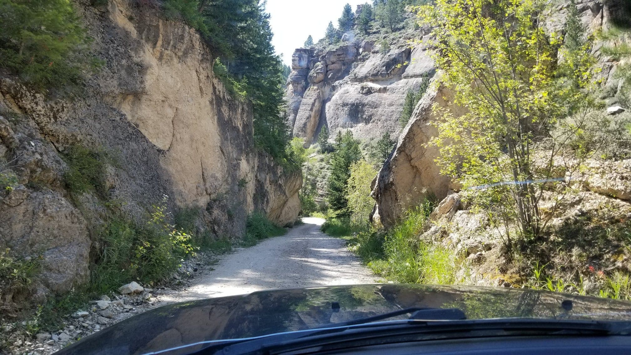
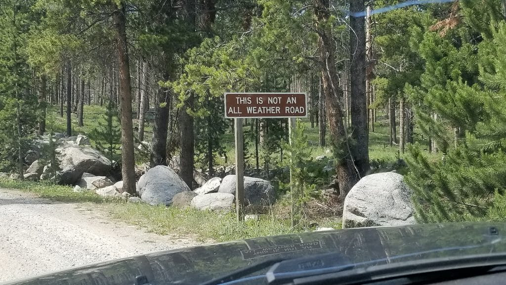
Following driving up CZI Canyon came the paved road, and then the very long dirt segment to Battle Park Trailhead.
⤑ Day 1—July 10, Battle Park to Grace Lake
I arrived at the trailhead around 5PM, and was on the trail, swatting mosquitoes, by 5:30, in a pleasant temperature of about 72F. But crap, no way I was going to make Solitude Lake this night (around 7 miles in), so I revised my plan and decided that I’d head for Grace Lake.
Finding the actual trailhead was remarkably difficult, as multiple, well-worn paths head off into the woods. I elected for one that looked right, but wasn’t, and I wandered past a cabin that I think was used for backcountry stuff by the USFS, as it had water and a little corral. Coming back, I’d also take a wrong turn, follow a great path that petered out into nothing, and end up going by the same cabin, re-orienting myself. Weird place.
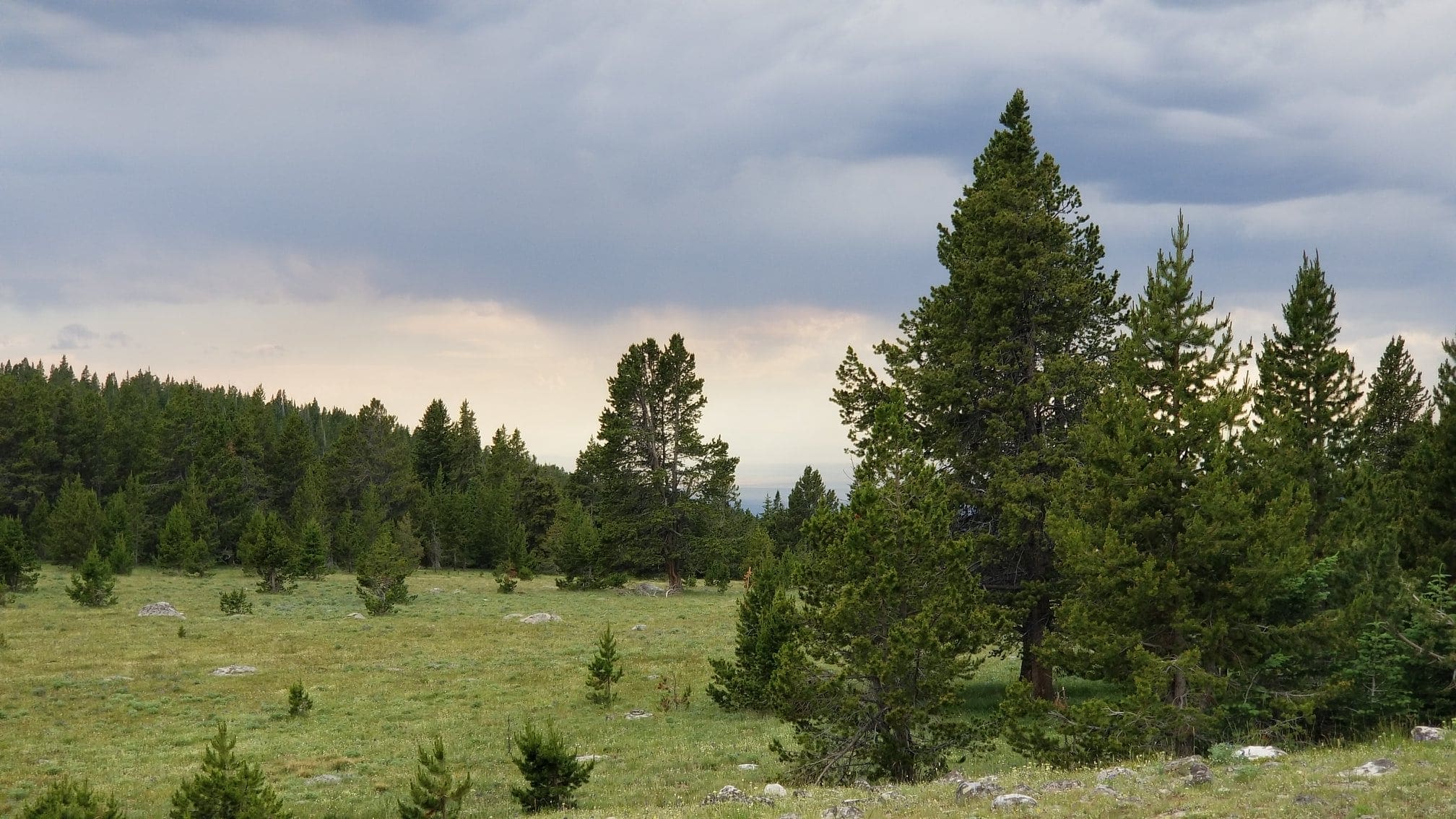
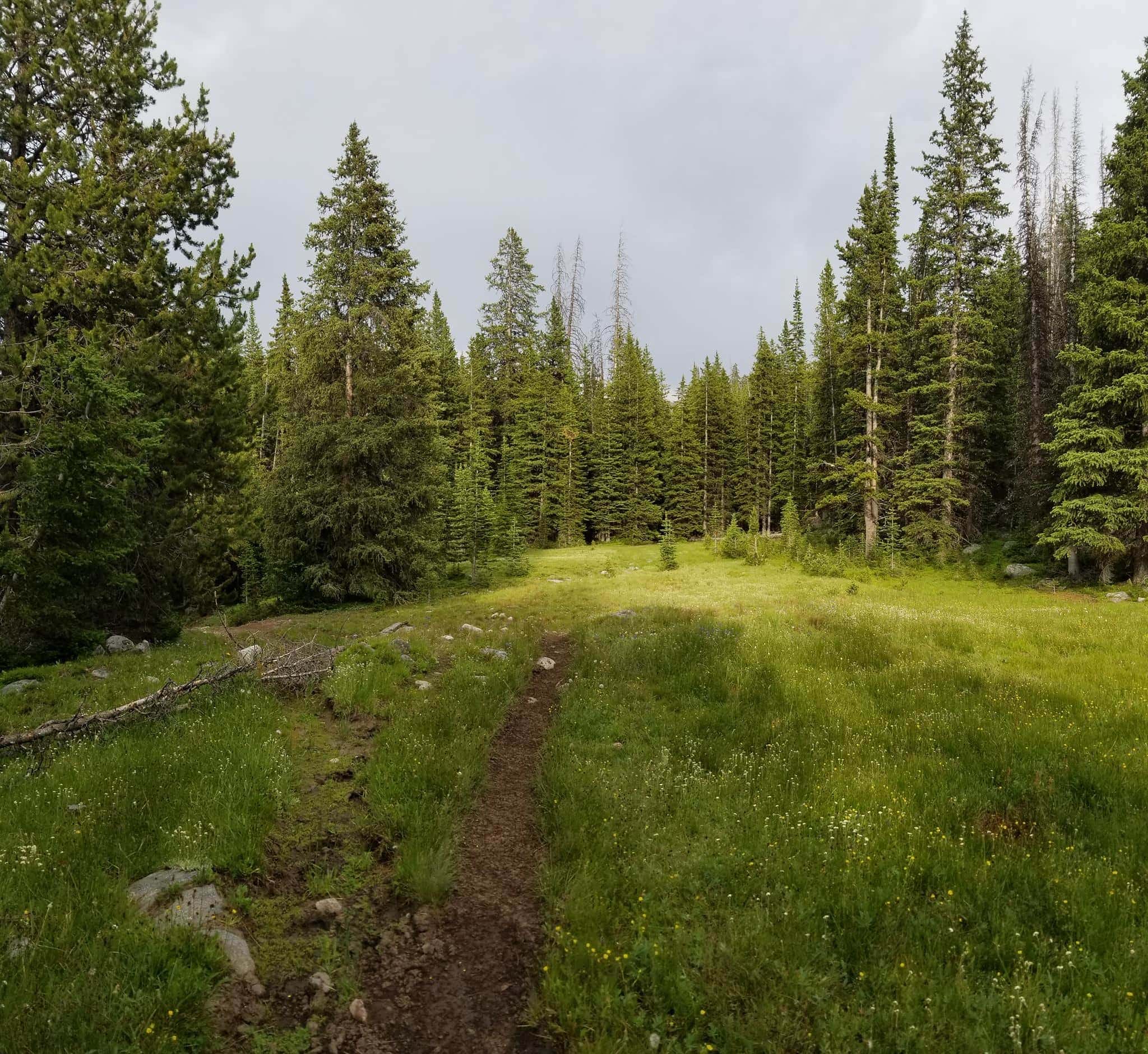
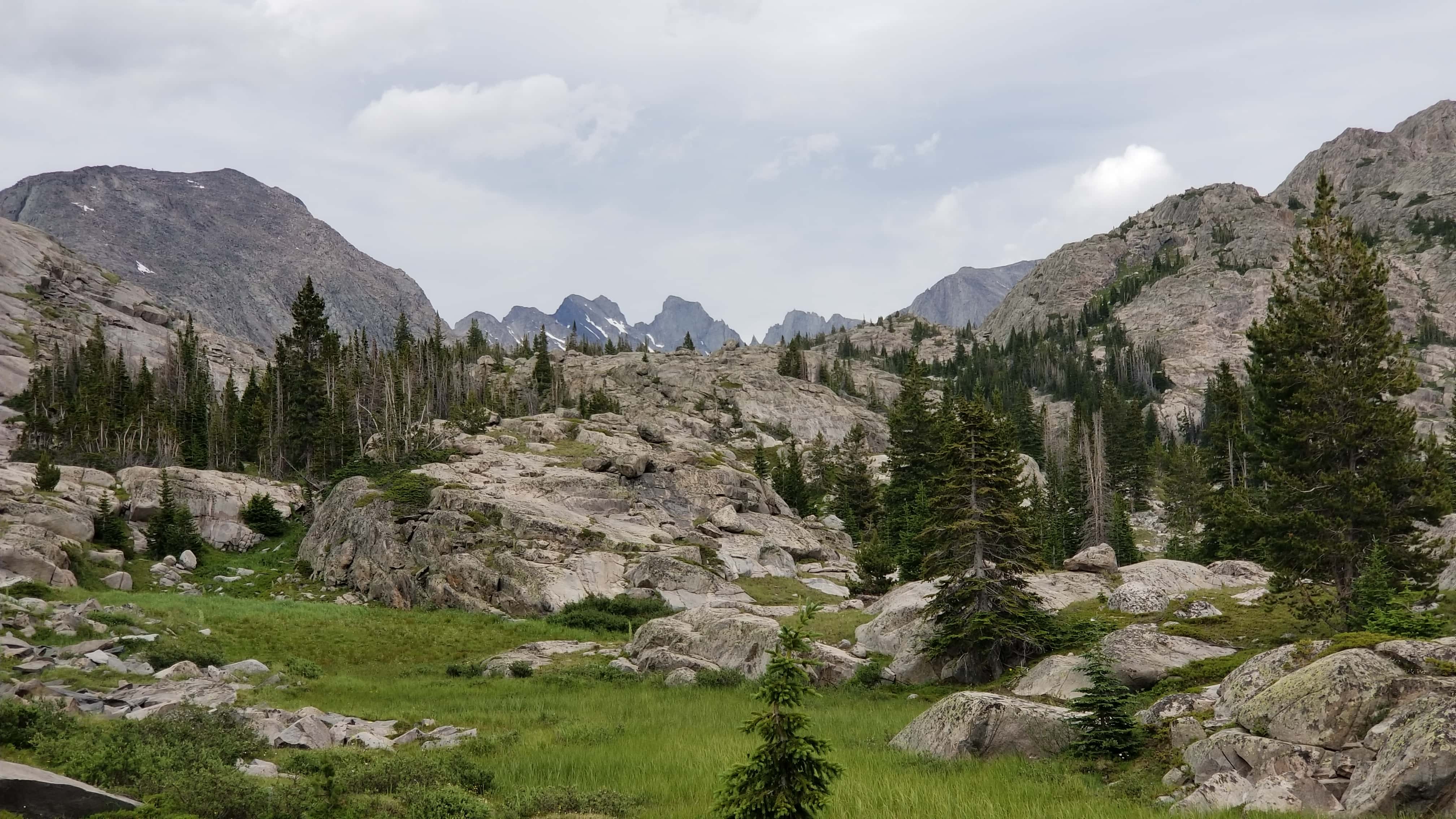
The path soon becomes easier, as all the little trails merge and begin the uphill climb to the first, big park area (aptly named “Long Park”), which, IIRC, is around mile 1. There is no actual lake here, though my map showed one—perhaps there’s a meltpond during the spring? The park goes on forever, undulating, and there’s supposed to be the Lily Lake Cutoff trail once you’re past the creeks, which is a trail that heads off to the the east-northeast on my map toward the Bomber Mountain/Mistymoon area. Later on, I ended up hiking Bomber Mountain and that area, which I loved.
I wanted to do a loop and come back on this trail, but par for the course, that trail never became apparent. I think that I may have spotted it on what I thought was an outfitter’s trail about a mile off of where the maps said it should be, but it was also heading the wrong direction…hard to know. Anyway, the temps were pleasant with some broken, cumulus-filled skies, and a gentle breeze, but the mosquitoes loved the temps as much as I did.


Going through the park, you descend and cross a creek—my phone beeped! Oops, it wasn’t on airplane mode. I turned it off and kept going. At the edge of the park as one approaches the forest, some tarn-like lakes are below the trail. I stopped here for a snack as rains occasionally fell on me, eating some Krispie treats, sour gummy worms, and Woody’s Smokehouse beef jerky, which is the best jerky in the world.
Quick aside about that: I was once flying British Airways and United back to America, and connecting through Trinidad and Tobago. The terminal at Piarco is quite modern and there was a shopette open until 2AM, so I got something to drink prior to my late-night boarding. While having a beverage around midnight, I overheard a couple people talking about one of them having to fly to Houston for business. The other, having visited the area, but only being a transit passenger, immediately started talking about Woody’s Smokehouse and how it’s worth the drive to get their jerky. (IT IS.) I certainly include it in every trip.

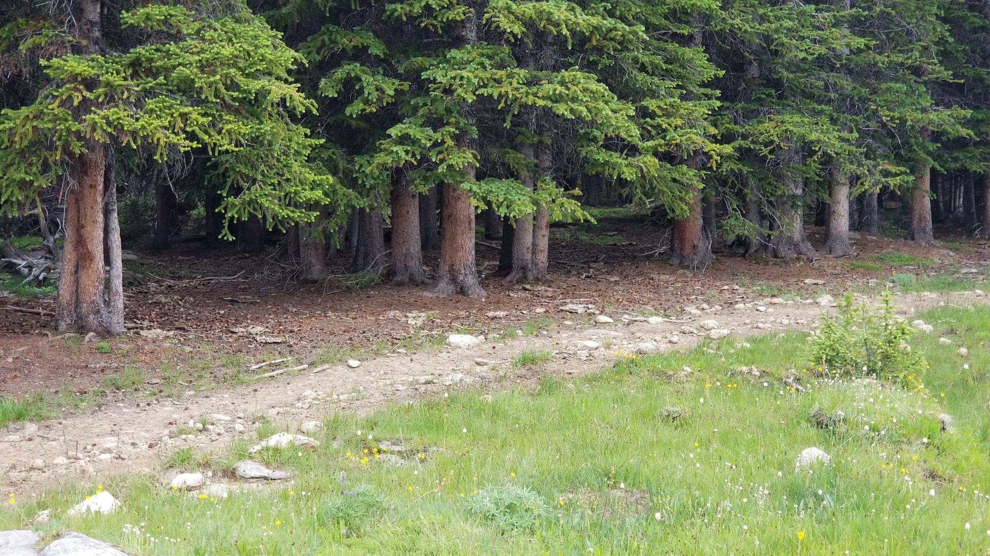
As thunder began to rumble, I packed up and pushed on, entering intermittent forests and climbing a bit more. Soon enough I could tell I was at the highest point before going down, and I began the trudge—the path down this section seemed much longer than coming back up for some reason.
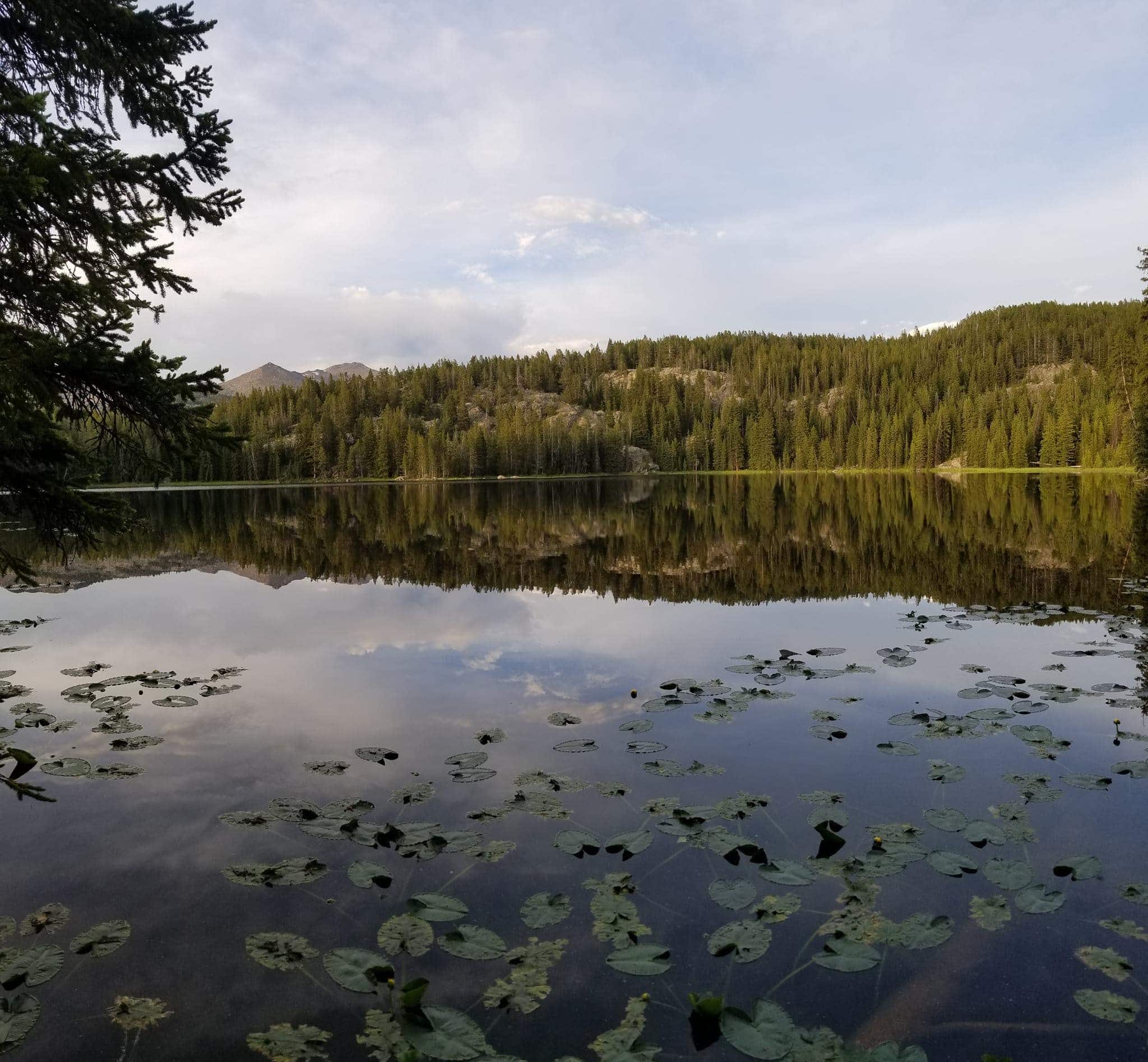
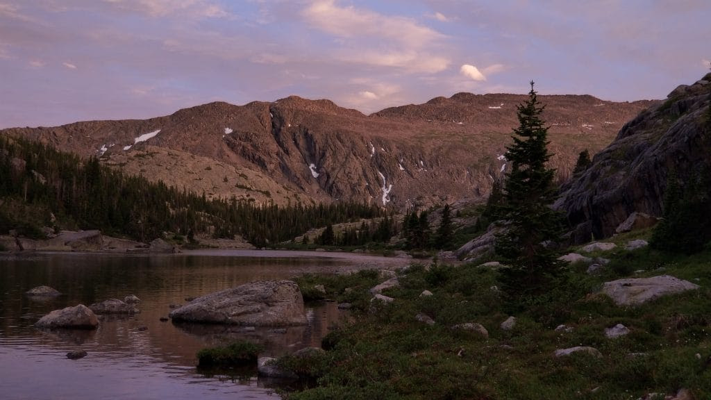
Regardless, I reached Grace Lake with about 90 minutes of light left, but struggled to find a good camping area…at least a good one that was responsibly far from the water, because many good places existed on the trailhead-side of the lake. I went down exploring all of them and saw what appeared to be a lot of outfitter use, and then to my horror realized that I’d lost my sunglasses! OH NO! I can’t tell you how bad I hate the bright sun in my eyes. Luckily I backtracked and found them only 200-feet back, when I’d left the trail to head down to the edge of the lake. Whoo!

I then made the mature choice to continue on, cross the outlet (saw a leech), and then head up and to the left, putting my camp on a hill between two rock features.
This location was also very nice and hidden from view, plus it had some easy places to sit and a very old fire ring. I fished for a while, but had no luck. It looked like it would be mostly brookies, so no big loss. Then I returned and made some dinner, ate it, strung up the bear bag, and washed myself in the dark, when the mosquitoes were less terrible.


I had brought some reading material on my phone, as well as some movies, which I watched until I was ready for sleep, which was around 11:30PM. It sprinkled briefly overnight, which I noticed when I woke up to pee, and really noticed all the more as I hadn’t put on my rainfly. I elected not to bother, though, as it was very light.
⤑ Day 2—July 11, Grace to Middle Cloud Peak Lakes
Speaking of waking up, I didn’t wake up with dawn, but rather woke up with the sound of a bear attacking my tent. Ever wonder if you’re fight or flight? I’m fight, and was reaching for my bear spray as I was waking up. Turns out that the loud banging against my tent was an angry squirrel literally throwing itself against the walls. Why? Dumb animal.
I quickly got ready for the day, had a brief munch, and took off into the increasing heat. Down, down, down the trail went, until I approached a park with a river at the opposing end, where another trail went down to the left and off into the lower lands. What is the name of this river, you don’t ask? Well I’ll tell you! It’s Paint Rock Creek, and you run into it about 5 1/2 miles into the trip. I fished in this area and caught several brook trout, then began the slog uphill, now on trail 038.
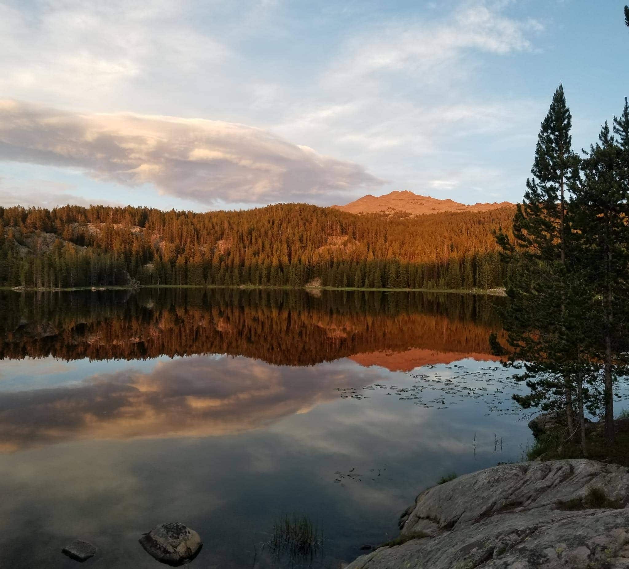
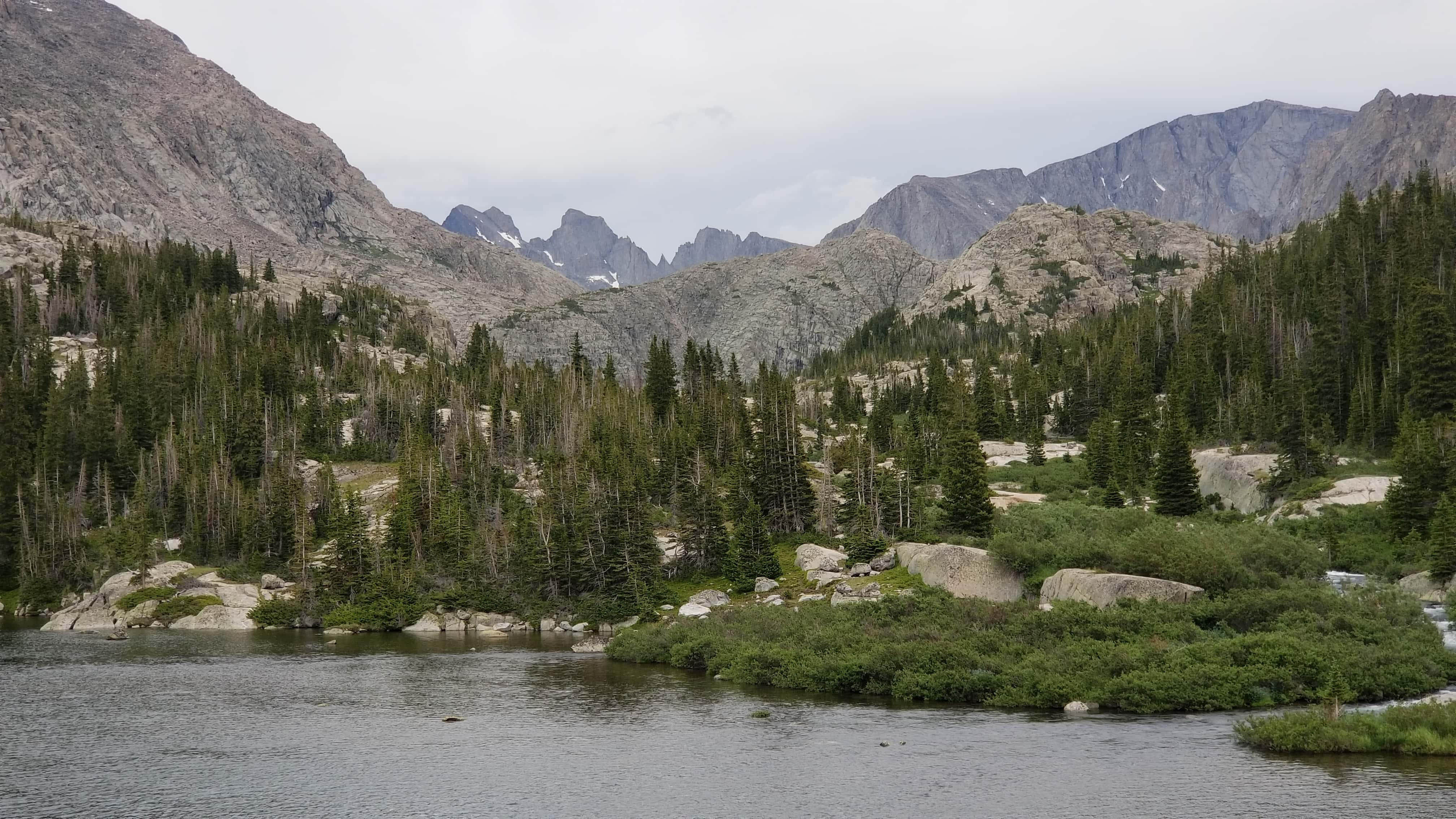
This section is far too long to make anyone happy, at least around noon on a hot day, and it seemed to go on and on. I stopped to fish at a few promising pools, and the catch was fine. Then it was up and up and up, and finally I saw Solitude! What a pretty lake.


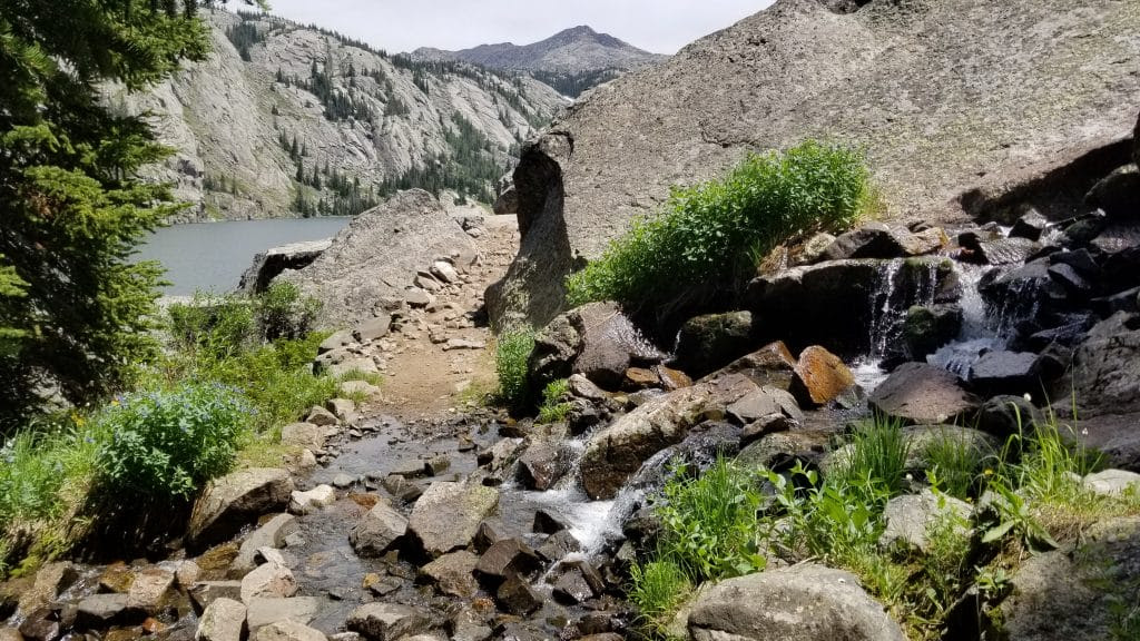
The right side of the lake looks impassable, but the Forest Service has done incredible work in making this trail. It’s a real feat of engineering. Right before leaving the forest, there’s a stream, so I filled up with some water and then continued on my way for a few minutes.
I ended up stopping because the fishing looked tempting, and I ate a snack as well…at one point, my hook caught my graze-bag and tossed it into the water! GAH!!! I managed to recover everything and all my vacuum sealing was a godsend, as nothing got wet. Talk about freaking me out! BTW, the lake is VERY deep right along the very edge. No way to see the bottom.
Leaving from my fishing endeavors, I reached the far end and angled to the left, crossing the creek (you have to cross no matter where you are going), which was very cold and swift. I used a magic stick that I found to keep me from falling in, but dadgum that got my toes numb.
By the north corner of the lake were a couple of tents and hammocks. I chose to make my ascent near this area, climbing through the rock piles, and found indications that others had done the same. When I was sussing out the route, I had thought that there was a sort of rock-chute further up the trail that I might climb, from looking at Google Earth, but investigation in person revealed how inaccurate that supposition was.
I had a developing headache, and stopped about every 300 feet as I was feeling like crud. I also ate a Reese’s and a gummy worm about as often…


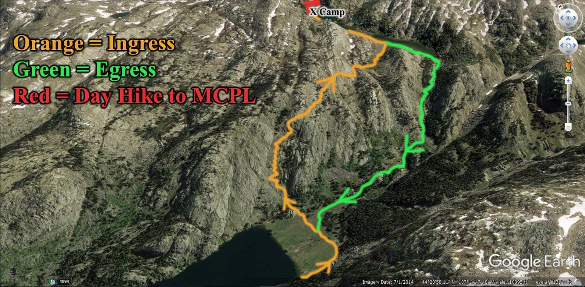
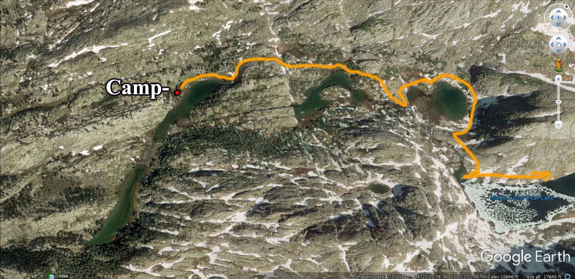
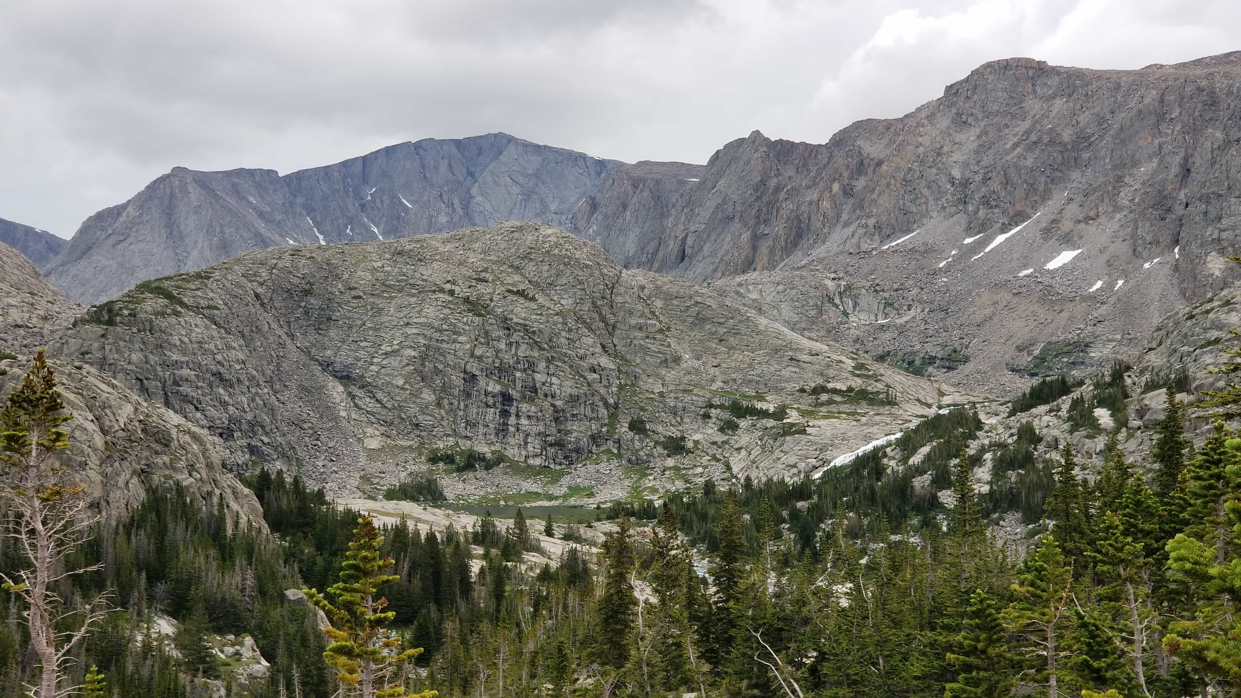
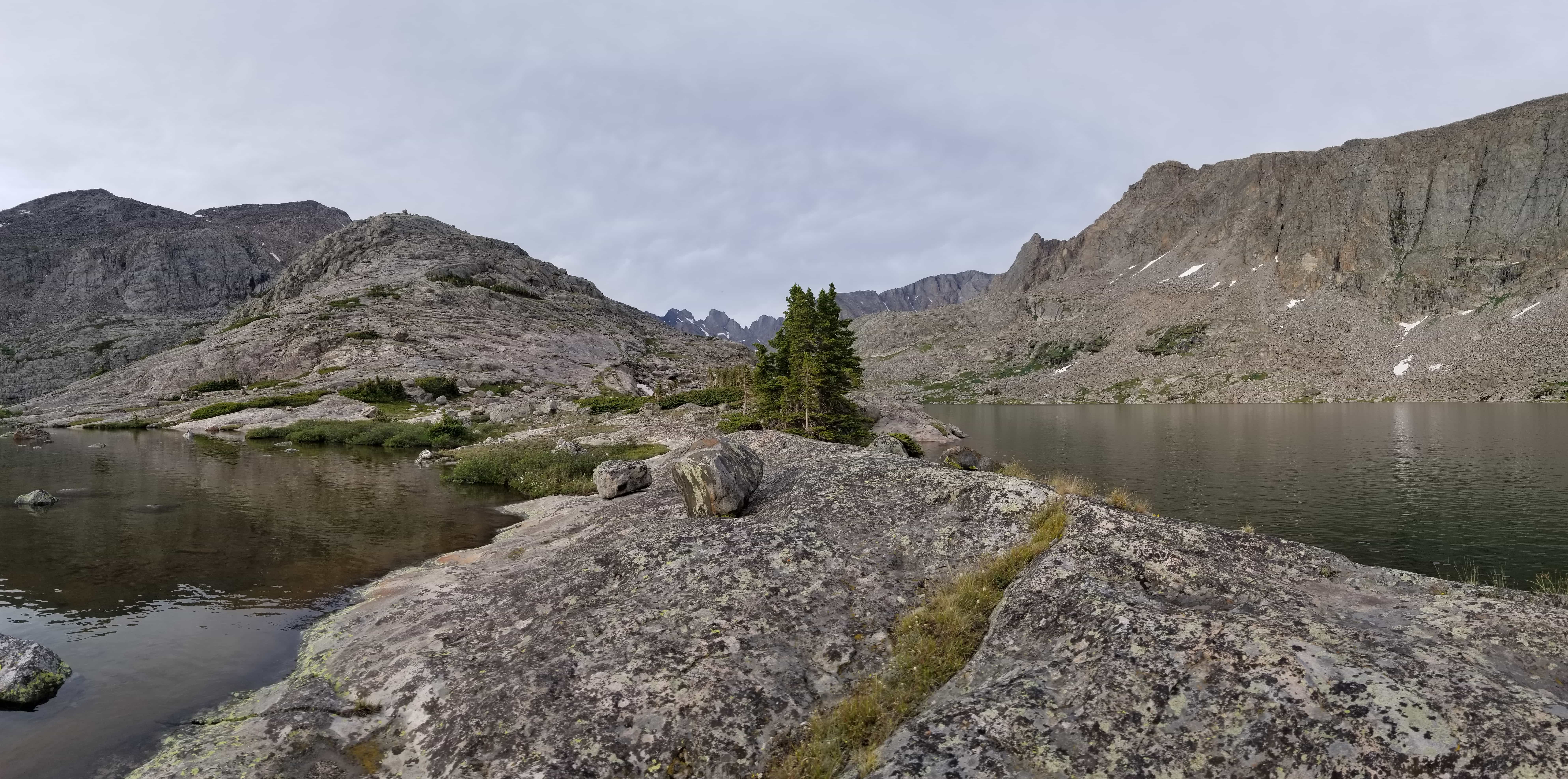
Ugh. Finally I had climbed about 700 feet and decided to angle to the right, aiming for the low-lying depression that seemed to intercept the river. I ended up having to descend a little bit, and walked through beautiful, flower-laden meadows, with small coniferous trees all around. Gorgeous. I reached the lake/river hybrid and tried my hand at fishing. No joy. Saw some tents in prime camping space on the eastern edge of the lake. From what I can tell, if people are ever in the area before you, you’ll find them inhabiting this area. I wasn’t so blessed, so I headed off on the Western edge. By this time it was about 6 or so, and I just wanted to take my pack off. I found an angled spot that wasn’t great, but it kept me out of view of the other campers, and it was also as far from the water as it was supposed to be. Would have been much nicer closer to the lake.


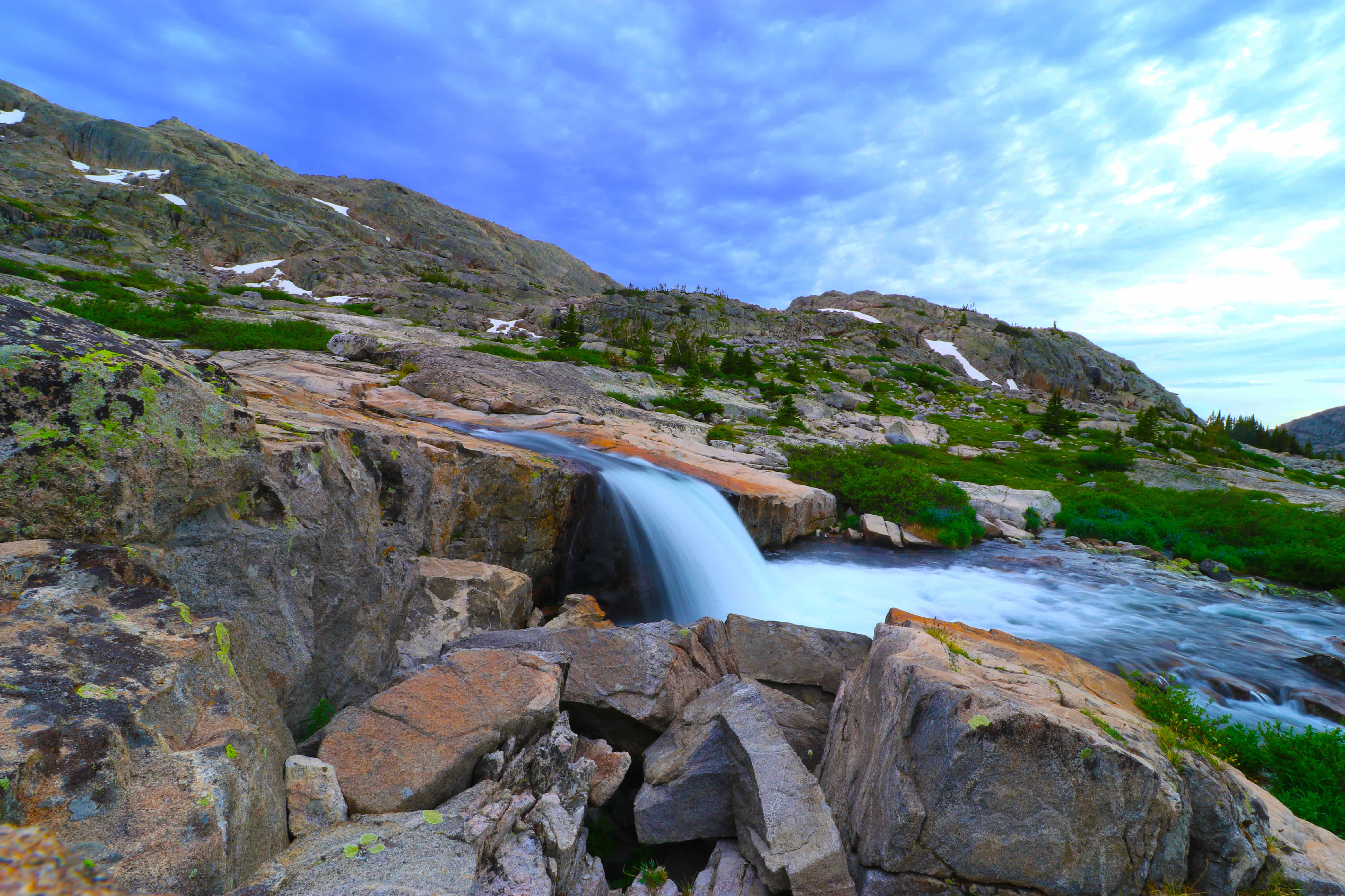
After setting up camp, I explored around the lake, fished, and then climbed up and around the western edge of the adjoining river and lakes, up to the Middle Cloud Peak Lake. The route I went on was obviously not preferable, and there was no way to cross the river, either, without one heck of a swim. This meant that I had to walk a lot farther, and through more brush, than if I’d crossed immediately and gone through the camp of the hooligans I’d seen earlier. Still, it has a spectacular waterfall exiting it, and I climbed the smooth granite dome down which the water flowed, until I got to the lake—I will be back, and with more time to spend in the area. When I do go, I’ll also make a break for Summit Lake, which is close by.

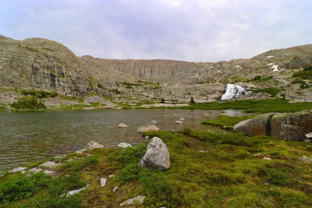

Pretty, little cascade.


I fished Middle Cloud Peak, caught the sunset and 10,000,000,000 mosquitoes, and headed back as it grew dark with distant thunder grumbling, getting to my camp at the edge of usable daylight. I filled my water up enough so that I wouldn’t have to get any overnight and then ate dinner. I watched A Quiet Place with Emily Blunt and her husband, which I found more quizzical than scary, but enjoyable nonetheless. Emily’s too pretty. It ruins any fear that the movie tries to instill.
⤑ Day 3—July 12, Cloud Peak Lakes to Home
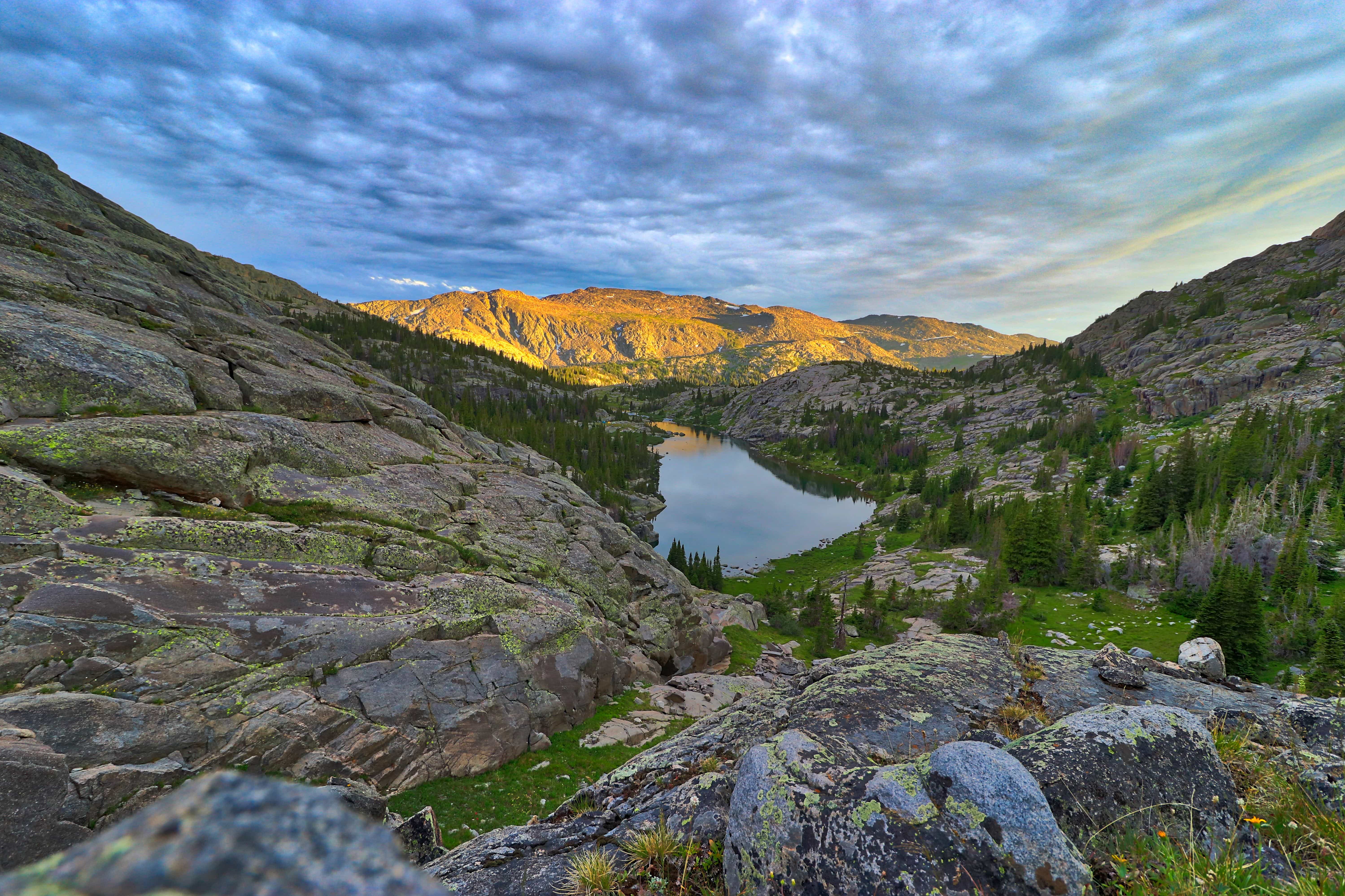
I woke up a year older, a ripe-old 30. A birthday by myself with no one around…a strange feeling, but certainly blessed. I don’t even know when I conked out, but I was up early enough, packed in great time, and fishing on my way down. I decided to descend the main waterfall, which is more treacherous, but dang if I didn’t catch some great goldens before the falls. Shh, don’t tell anyone…


This is the main trail, anyway, though at times hard to find, and slippery. Use caution, especially if you’re alone. I was soon to the main trail, and I thought about climbing up to Mistymoon and back that way, but elected not to, just because I had work the next day, and I’d been behind this whole trip, plus the extra miles didn’t encourage me—I’d do Mistymoon and the rest later on this summer, anyway.
The hike out was pretty dang quick, and the climb back up the mountain was great. The ashwaganda I used seemed to really help, and I didn’t feel the miles on my feet at all. In fact, the whole length of the hike out felt much shorter than my first 1/4 day ingress.
I should mention, too, that when I got to the top of the hill outside of Grace Lake, at the base of Elk Mountain, I FaceTimed Kristi. She was out with family visiting a city. She wished me a happy birthday. I really have always wished that she’d hike with me, but alas! (Note: Kristi and I called it quits later on, but she’s an amazing and good friend who I know that I can always count on! Blessed years with her, and it’s too bad that we were so different.)
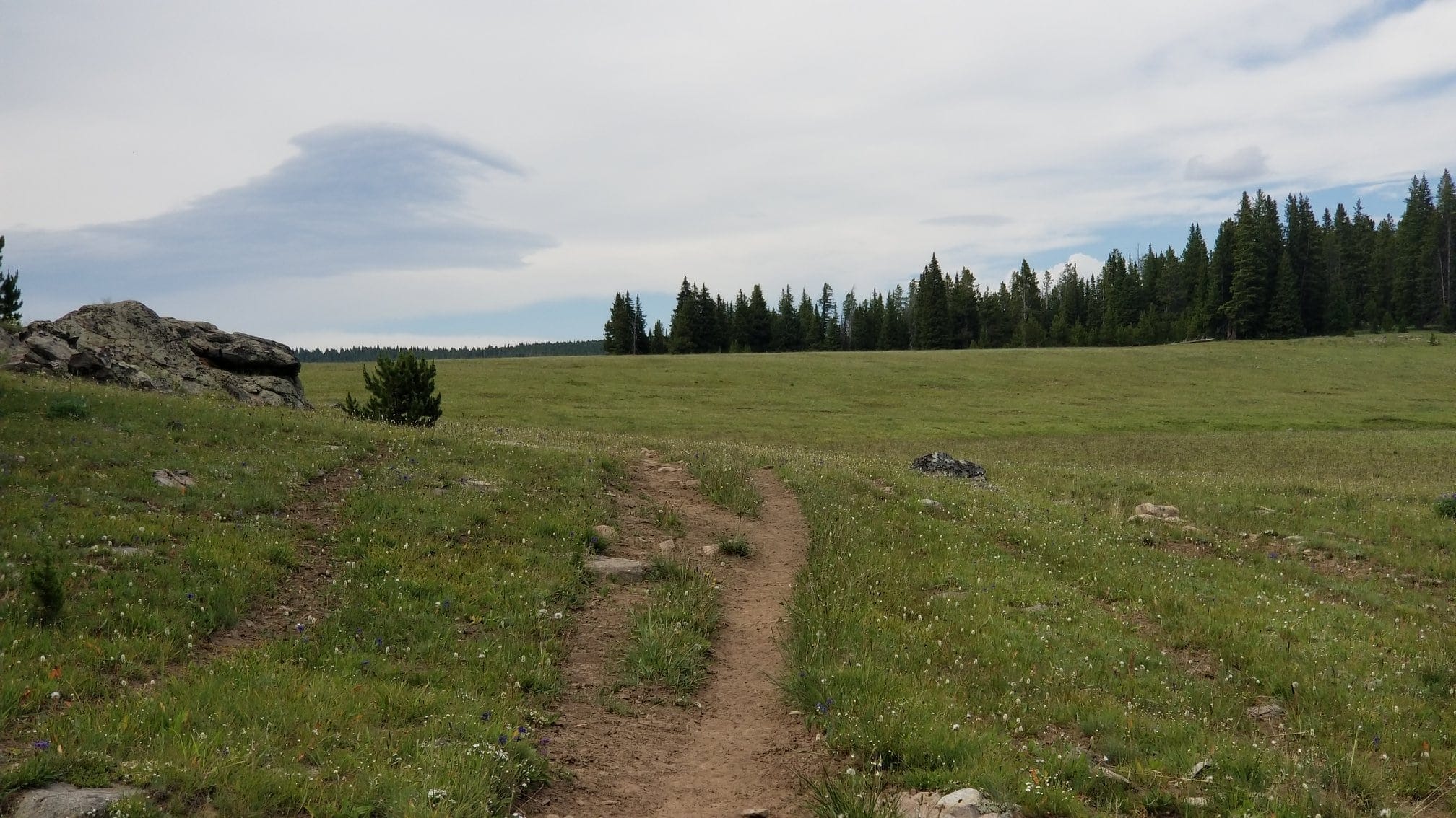
Descending out of Long Park, of course I got “lost” and had to re-orient myself with this:

I arrived at my vehicle earlier than I’d left and met a man in his 70s, who was doing a 77-miler rather imminently, and as I changed, he asked me for some route-finding tips for the area, which I gave him; I also told him of the mosquito flocks, which he decided to prepare a bit better for, as well as told him some nice locations to cache food near the trailhead. In return, he told me about the Powell Lakes and the excellent fishing that they have. WHAT A TIP! I was concerned about these lakes as I could find no reviews, and they’re off-trail in a hanging valley, so whether or not they were worth it was an unknown. For information on that trip, see my report!
➤ Conclusion and Rating
This is an easy, gorgeous hike with a killer payoff in the form of peaks and cascades! It’s not quite as nice as the hike to Loomis Lake just over the hill from it, but only because it’s shorter—so if you’ve got less time, it might be a better choice.
⭐⭐⭐⭐⭐ (5 stars)
Detailed explanation:
- Beauty. From dense forests to verdant parks to soaring spires and cold cascades, this hike has it all, and in a very short distance.
- Camping spots. There are no difficulties finding campsites, but during busier times (weekends), I think that you might have a harder time getting the choice places to park it.
- Crowds. This is a moderately high-use trail system. Expect to see multiple backpacking groups on the main trail. I went mid-week and saw 2 large groups.
- Difficulty. I believe that this is a moderately-strenuous hike. The climb up to the MCPL area is abrupt and very steep. If you’re under the weather or have a headache, it won’t be fun. This section is entirely off-trail. That said, the return out of the wilderness seemed stupidly easy to me, so I believe that my cephalgia was partially responsible for my ranking.
- Fishing. Heh heh.
- History. I saw one interesting, old fence…not much here!
Let me know if you have any questions, comments, or if there is any way I can help you. With love, always,

—Lucas
4 thoughts on “Review: 20 Miles to Gorgeous Middle Cloud Peak Lake, Wyoming!”
Dear Luke, Really enjoyed your reports and especially your photos of your trips. I am partial to the Bighorns but have not been able to hike them like you. I have ridden horses on the Edelman trail near the Paintrock Lakes. Horseshoe Lake is a lovely spot but I’m not sure that I’ll ever get to the area around Dutch Oven Pass. The Google Earth views show some very interesting looking rock formations in this general area. If you ever get to hike around in this area your photos would be much appreciated. Thanks again for all the great photos you have posted. from John
Hi John,
Thanks for the comment. My family might themselves be going there this summer, but I’m not sure. I just got married and thus burned up a great deal of vacation time for the year, but it was worth it. I’ll hopefully be posting some more of my hikes towards the end of the summer (as you probably know, during the summer it’s about impossible to find the time) or in the early fall. The geology in the area certainly is amazing. Tons of old claims.
GB,
Lucas
Thanks for sharing this trip. My wife and I completed it last week and your report was a great inspiration. Keep up the good work!
Hi Chris,
Thanks for taking the time to leave that message! Don’t get many visitors to my digital scrapbook, so it’s nice to know that at least one who has ended up finding the same joy I have. I have a backlog of writeups that I need to post, but it’s hiking season, so you can guess where my focus is!
I’m so glad that you and your wife enjoyed the area. It’s a blessing to have it near us!
-Luke