Review: 9 Miles Hiking Gypsum Creek Lakes, Wind River Range
The most value/mile of any short hike in the Winds or Cloud Peak Wilderness. Doesn’t have a trail.
➻ Quick Facts
Info at a Glance
- Date of Visit: Mid July
- Notable Features: Gypsum Creek, Gypsum Creek Lakes, Gypsum Mountain, Big Sheep Mountain, geologic features.
- Total Miles: ~8.9
- Elevation Gain/Loss: +/-2494 feet
- Elevation Min, Avg, Max: 9284, 9821, 10564
- General Route: Entirely off-trail.
- GaiaGPS Page for GPS Track Download Grab a free Gaia account to download the GPS file for your phone or Google Earth.
- Images: I deliver pictures via a CDN at low quality to save speed and increase speed. Feel free to contact me if you’d like full-size images.
Interactive GPS Map (Click to See)
Elevation Profile

⤷Introduction
Wow, what a review this will be! My new employer had agreed to give me a week-ish of vacation for my wedding, but I wasn’t expecting to get to hike. Thanks to some unfortunate events, I ended up being able to hike, though my fiancé couldn’t.
Without much notice and with only one night off, I chose to hike the Gypsum Creek Lakes, which are not named on the map, so that’s just the name I’m giving them. There isn’t a trail listed to them, which is perfectly fine with me, as it typically cuts down on the riff-raff. (Admittedly, I am also riff-raff!)
⤑Day 1: Forest Road 689 to Lower Gypsum Creek Lake
I took highway 352 past Cora and then made the right turn up FR 680, Gypsum Creek Road. The road was fine for the first few miles, if a little dusty, but became rough after the cut off from 684. My SD card in my dashcam became corrupted, so I didn’t get a video of the road (one of a number of unfortunate events to happen my wedding week), but trust me when I say that you want high clearance for this puppy. My goal was to get to 689B, but that just never happened, and I ended about 1/4 mile short of the fork, having taken much longer than anticipated with plenty of 3-wheels-on-the-ground travel. If you’re going without a spare, you should definitely have your satcom on you…
Anyway, I found a nice little parking spot and then got all my gear together, making sure to place my solar shower on my Jeep’s hood. The smoke from all the wildfires was keeping the temperature down, but even a cold shower would feel good the next day.


Not long after 4PM, I grabbed some of the many wild strawberries growing at my feet, and then set off for the lakes, following the road for a few hundred feet before turning south to go down a hill and across a little meadow, which quickly transitioned to thick forest with a lot of deadfall. Hint: DO NOT DO THAT. Follow the road to where the thick forests vanish and then cut across.


I finally got out of the trees and found a game trail that was intermittent. It took me across a dry creek and between some more stands of trees, leading me back to what google calls FR 680 again. This isn’t that road and won’t take you back, but I followed it for a little bit before angling between some more trees and then descending a forested hill, popping out in a little open space looking down on Gypsum Creek.


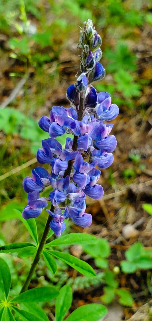
I saw a trail on the far side of the creek which was well-worn, though obviously nothing official or human-caused. After taking some pictures of some very pretty wildflowers, I made my way down to the creek and looked for any fish I might spy! Sure enough, I saw a few. If they were in the creek, perhaps they’d also be in the lake!


I crossed Gypsum and made my way up along the trail, angling for an unnamed lake (maps showing it intermittent/marsh) near the “base” of the mountain ridges. The trail petered out, but I kept going on and then saw a huge bear! No, wait, it was an elk. No! It was many elk. Though I was right upon them, they didn’t notice me, so I went back into the forest and took a more circuitous route that I might not disturb them in their repose.


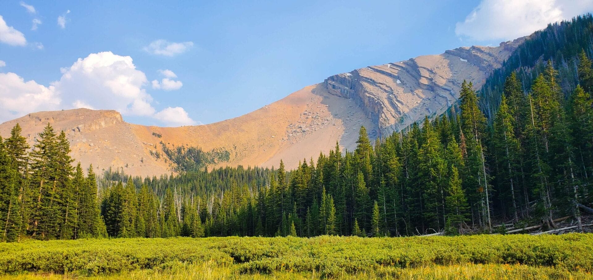
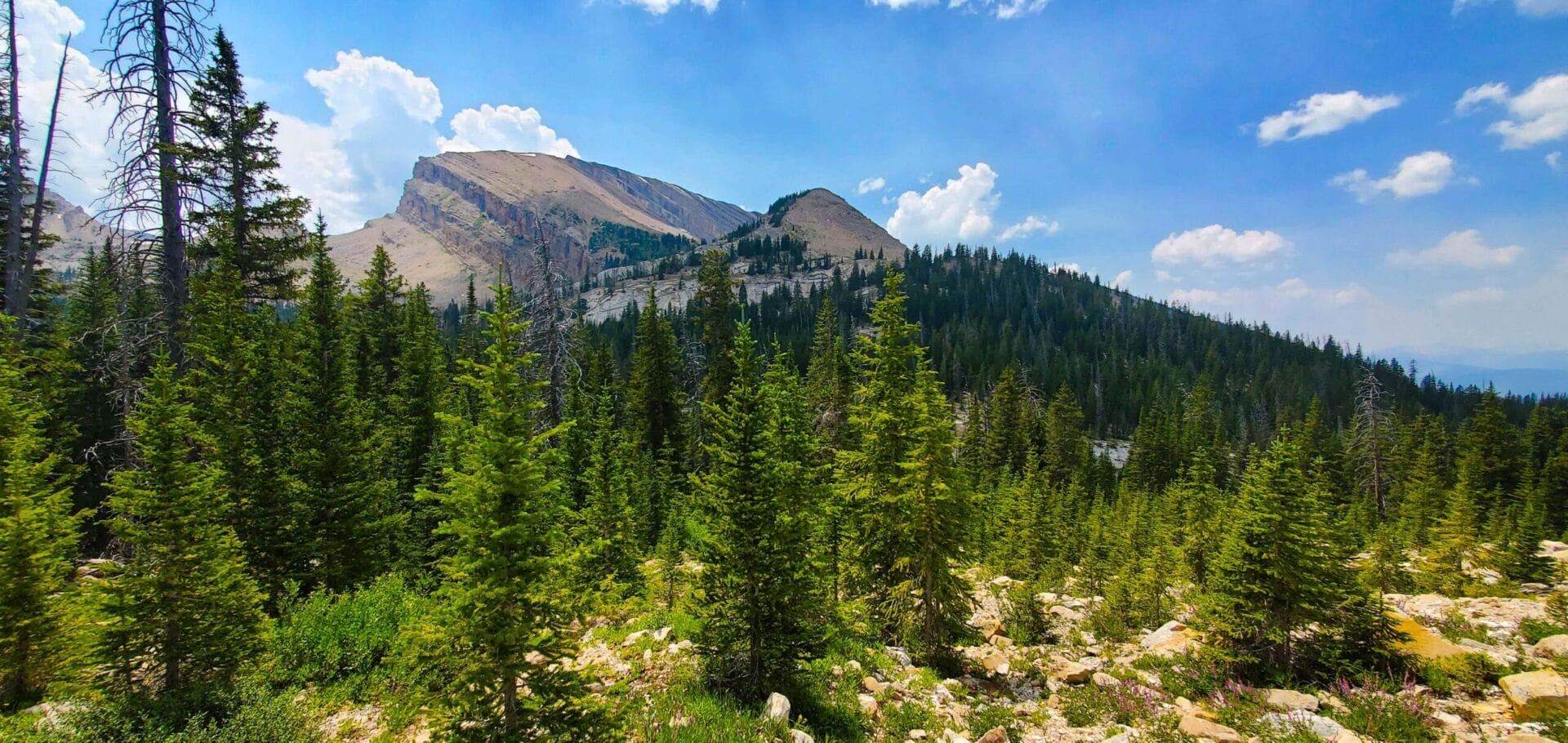
Soon I was to the unnamed lake, or Lake 9530 if you’re using the Google Earth estimation of its elevation. While pretty enough, it was a dead lake with some gas bubbles seeping up; there were neither fish nor amphipods to be seen. I didn’t require any water, so I forged ahead into some trees, which before long gave way to an open park with a tiny stream flowing in it, framed with a beautiful mountain beyond—the mountain was really just a portion of Gypsum Mountain which climbs higher into the sky to the south. I stuck to the edge of the meadow, following trails that came and went, and at the far end went back into the woods for some time, listening to the Futility Closet podcast. The episode involved a theory from way back that the earth had concentric spheres within it that had their own worlds…or at least one world.


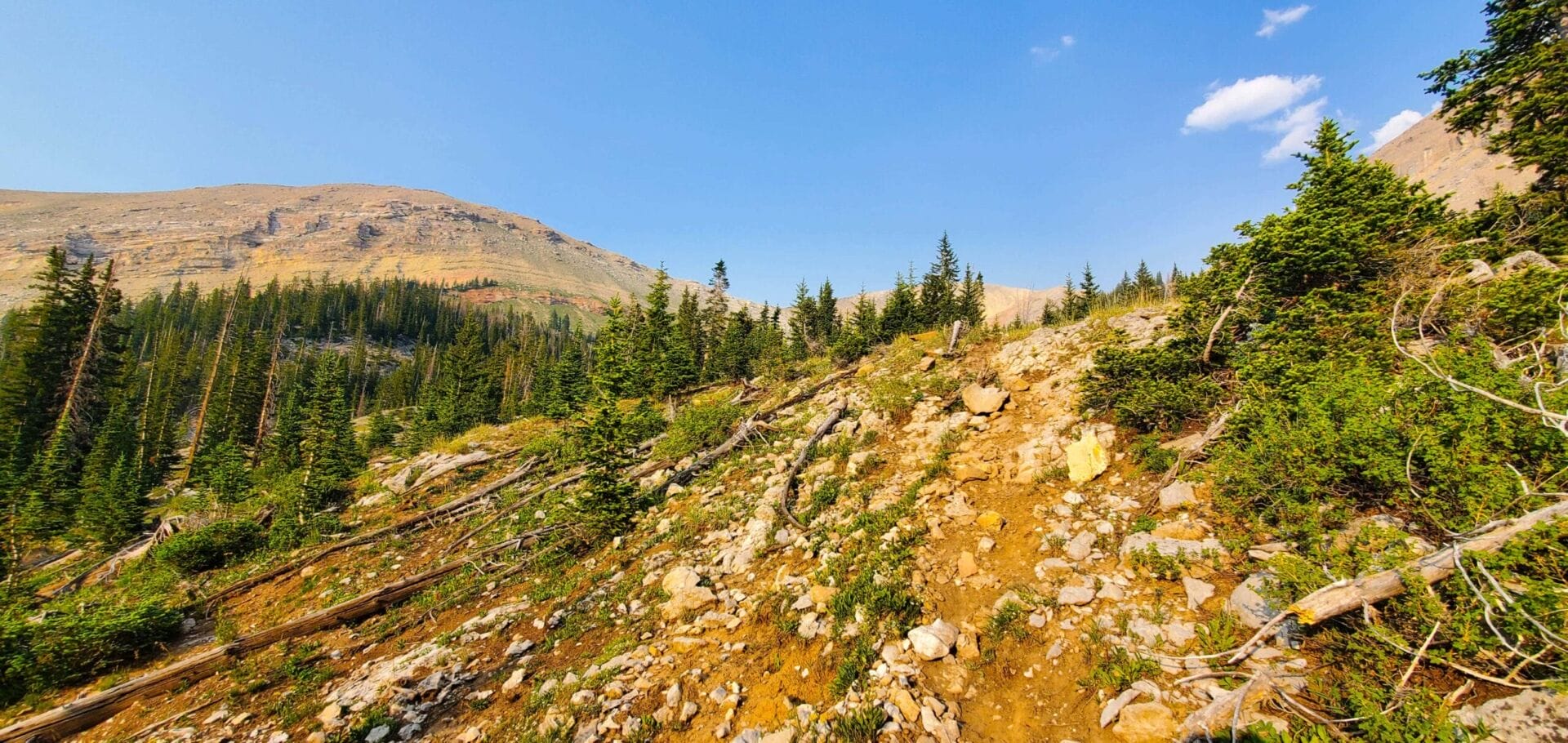

Finally I got out of the woods, wherein there had been no trail of any sort, and arrived at an avalanche chute. Traversing this area was easy in comparison and soon brought me to scraped, limestone flats above the creek. While I was tempted to go look over the cliffs at the creek, I wanted to make the most of my time, so I zipped on uphill via the path of least resistance, entering and exiting woods, finding trees that had to be climbed over, and sometimes happening upon trails. Around 9800 feet., I naturally happened back upon the creek, but chose to follow a trail back into the woods. In retrospect, following the creek would have been a tad easier, but my chosen path was easy-peasey, or however peasey is spelled.


At 7:34 Gypsum Lake came into view below me. The lake has no stream outlet, as it exfiltrates through the porous limestone underground. Fish were jumping all around, and Gypsum and Big Sheep Mountains provided an idyllic framing. Furthermore, I was the only person around! Talk about blessed.


An area on the south side of the lake looked best for camping, followed in choice by a green lawn to the west. I made my way along the side of the lake and settled on the south camping spot, which had old signs of human presence. The area was simply gorgeous, with a nearby waterfall providing the most relaxing sound. (Note: I dislike not being able to hear wildlife.)


After setting up camp I did some fishing, then made myself dinner. The main course was “Mountain House Spicy Southwest Style Skillet,” and let me tell you, it was not a sensory delight. I’d forgotten my salt, and this thing had no flavor to speak of. It was just mildly hot gruel. Oh well, you can’t win them all. My Jackson Hole Buffalo Meat Company elk jerky made up for the Mountain House disappointment, and I followed that up with some jalapeno Cheetos and some mini cherry hand-pies. My Kindle books kept me entertained, but I’d forgotten to download all of the new ones I’d purchased. (Yay free credits.)

My water was still warm from cooking, and for whatever reason there weren’t any mosquitoes, so I washed up outside. Sans a fire, it was pretty dang cold, since the sun had set, but even if the forest hadn’t been dry, I wouldn’t have made one, as I hate my sleeping bag and clothes smelling like smoke.
Thanks to the miracle of technology, various services now let you download movies to your phone (I am not sure what the time limits are for them, so I don’t think that this would work for very long hikes), and I had selected A Quiet Place 2, as well as some indie movie called Settlers. Quiet Place was decent, and around midnight, as I was watching Settlers, a bear decided to visit my camping spot. It was being very loud, so I returned the favor and it departed. Still, as is my wont, I tied my FN-45 and my bear spray to my wrist. I fell asleep sometime around 0200, but hey, I deserve to do what I want every now and then.
⤑Day 2: Upper Gypsum Creek Lake and Hike Out
After about 7 hours of very good sleep, I got up and packed my bag for a quick hike to Upper Gypsum Creek Lakes. I also had a chocolate Honey Stinger waffle and some more jerky, then decided to go ahead and get most of my stuff pre-packed so I could put it in my bag quickly when I got back. Crossing the creek just after 11AM, I grabbed some water and followed the mountain up beside the creek to the east. The topography was stunning, with two creeks coming together, each having severed deep cuts in the limestone.


As I climbed, I came to find that the natural, grassy draw east (maybe a season creek is there?) would have made for easier walking. Regardless, I climbed 540 feet in 1/2 a mile, and from there it was pretty much flat to Upper Gypsum. The views from the top of the area were staggering: a huge sycline sat perched overlooking the lake, which itself was ringed by mountains. Wildflowers added a burst of color to one end, and unlike the name of the range suggests, the wind was more of a cooling breeze, popping up every now and then to refresh me.


Upper Gypsum Creek Lake showed no sign of fish, but I tried a few casts to make sure I was correct. Nothing. I elected to pack it up after 20 minutes, sending a satcom message to my family to let them know when I’d meet them at Green River Lakes. Leaving the area, I was tempted to go up a saddle between Gypsum Mountain and Big Sheep, but there was so much smoke that the view wouldn’t have done me any real favors.


Akin to its downhill counterpart, the upper lake has no observable outlet. I made my way west, electing to try a different way back to camp, as I’d seen a definite trail through a scree pile the previous day. A few springs erupted from the grass around 10,500 feet, as well as Gypsum Creek itself. The walk was pleasant, soft, and devoid of pesky insects.


As I descended, I followed the creek…and somehow ended up between two creeks. From earlier, I’d known that they were there, but had placed myself west of them both in my head. Oops. I found a good crossing and then came upon the trail in the scree. This way was a bit more treacherous and loose than I’d have liked, so again I’d recommend that little draw which I failed to use.


I ended up in some thicketed forests, but it was nothing too bad, and I was back at camp an hour and 45 minutes after leaving. I still had plenty of time, so I made lunch and then packed up and headed out.
Out of curiosity, I decided to follow the other side of the creek back out to my Jeep. Maybe I wouldn’t have to climb the hills I’d descended the day prior? This decision was effectively a disaster: it started off pretty, but then became mounds of small rocks for ages, which transitioned into unforgiving boulder hell. While it seemed like forever in those conditions, it was in reality only 2000 feet or so.


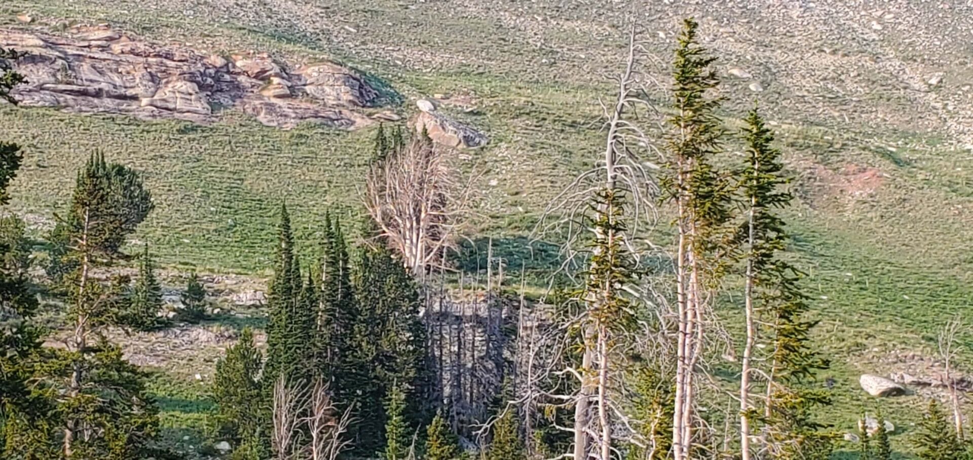
And then I was walking a beautiful, grassy hillside, that was almost unbearably worse. The thing was so dadgum steep that my downhill foot felt like it might collapse sideways on itself and rip off. It was truly painful and other than listening to the Tom Woods Show, there was nothing that I could do to make it feel any better. I happened upon the dead tree that I’d seen the day before from across the draw, and I wistfully considered its lack of mortal agony.


This horrific segment was over a mile long, and presented challenges including navigating a dangerous boulder chute. The upsides were that the smoke cleared a bit and I could see the fields below and outlines of the Gros Ventre. There were no other benefits whatsoever.
Finally I reached the ridge and came upon the terminus of the forest road from the day before. I followed it a little, but mostly chose to cut through the sage, avoiding the forests and heading as directly as possible toward my Jeep. After passing a little stinkpond, I climbed a hill with a trail and came upon the road I’d been driving up with my Jeep. If you ever do this hike, park where I park and just follow my egress path to right near the wilderness boundary, and then switch over to my ingress trail, which crossed Gypsum Creek. It’s by far the swiftest course one can take.


I got back to my Jeep at 3:42 and showered, then changed clothes. Since I was heading to Green River Lakes for wedding rehearsal, I took road 680 out. Some parts of it were nothing but boulders, so use caution if you go out that way.


➤Conclusion and Rating
This hike may not have a trail, but it offers the best value of any short hike in the Winds.
- My scientific rating system. I absolutely loved this hike.
- Beauty. Stunning, with a Colorado feel. Amazing geology.
- Camping spots. You’ll have your pick.
- Crowds. I was the only person.
- Difficulty. Easy if you’re in moderate shape and know how to minimally orienteer.
- Fishing. Fun, but no lunkers.
- History. None.
