Review: Beauty & Ennui Hiking Grizzly Lake
Grizzly Lake offers some nice fall colors, but isn’t worth the hike in any season. A trip to the first pond on the hike might be worth it.
➻ Quick Facts
Info at a Glance
- Date of Visit: Fall
- Notable Features: Views of the Tetons, The Red Hills, a random pond, Grizzly Lake
- Total Miles: ~10
- Elevation Gain/Loss: +/-2248
- Elevation Min, Avg, Max: 7007, 7255, 7626
- General Route: Red Hills Trail, Grizzly Lake Trail
- GaiaGPS Page for GPS Track Download Grab a free Gaia account to download the GPS file for your phone or Google Earth. (Under the “data” tab.)
- Images: I deliver pictures via a CDN at low quality to save speed and increase speed. Feel free to contact me if you’d like full-size images.
Interactive GPS Map (Click to See)
⤷Introduction
I had the opportunity to take an overnight hike after dropping my daughter off to her (awesome) private school, so I did just that. My original plan was to go up to Blue Miner Lake, but that didn’t pan out for a number of reasons.
⤑Day 1: Hike in to Grizzly Lake
I had a ton of tasks to attend to before leaving for the hike, so I didn’t get to the trailhead until very late, around 3:30PM. Since it was going to get dark around 7:30, I realized that I probably couldn’t make it all the way to Blue Miner. It was also smoky again, much to my irritation.
The trailhead itself is really just a pull-off that can accommodate only a few vehicles. The area around is quite pretty, though, and I decided that my family and I would stay at Crystal Creek Campground the following summer. After getting my gear on my back, I started out along the trail to Grizzly Lake. While the various maps show a ton of trails, some of them have had logs placed over ’em. Not sure why.


Unfortunately, I took some pictures and somehow lost my bear spray. I realized this a bit into the hike, and it took me a great deal of going back and forth in search of the thing to find it. That cost me a lot of time. With the shadows in the trees already growing, I knew that making the lakes wasn’t worth it. I checked my topo map on Gaia to see if there were any water sources along the climb up, but guess what…there was a data error. Usually I review my paper maps fully before a hike, but in this case, I didn’t have a paper map to do that with. I’d checked on the topography online before leaving and knew that there was a small rivulet somewhere on the hike up, but I wasn’t sure how far it was or if it was seasonal.
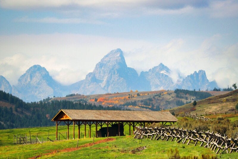
With all of the above considered, I decided that I’d just hike to Grizzly Lake and maybe attempt Blue Miner the next day. The trail initially goes up a little hill and then through some forest, alongside a boundary fence, before spilling out to a grassy area overlooking the Red Hills and the Tetons, with views of ranching fields down the valley. It was really quite hot for being at the very end of September, so I didn’t enjoy this section of trail too much.
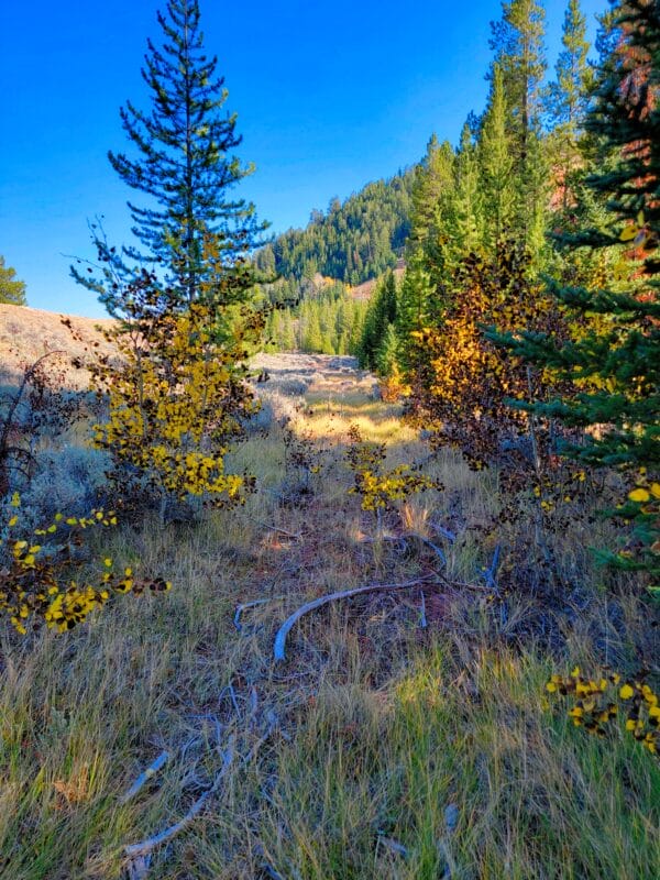
What I enjoyed less than even the sun was the ups-and-downs of the trail. It’s one of the roller-coaster types, where you gradually gain elevation through the 2-steps-forward-one-step-back approach. Still, the leaves were changing color in the aspen groves, and every time I’d descend a draw, I’d typically find a little stream with picturesque reflections of the fall colors.


As I made my way along, the Tetons disappeared from view, hidden by various ridges of the Gros Ventre. One last climb, or so I thought, brought me to the split in trails, one going to Grizzly, and the other going to Blue Miner. On my map, I saw that there was a nearby pond that I might use as a place to overnight. The downside would then be that I’d not get to see Grizzly Lake, which I was curious about. My mother had texted me and said that she really wanted to visit Blue Miner with me, so I started considering simply saving the upper lakes for later, as I’d gotten no hikes with my mom during the whole summer.


I elected to take the right trail toward Grizzly Lake, and then stay the night there. After climbing a little hill just past the intersection of trails, I came upon the pond. It was actually quite pretty at this time of year, and had a couple of swans and a number of ducks on it. Since my Canon was strapped to my chest (mostly as a counterweight), I took a few kinda boring shots and kept moving. (I feel very anti-establishment typing “kinda.”) Beyond the pond was a creek, and let me be upfront: I should have loaded up on water there.


Then I had to climb another ridge, which led to a gradual, grassy downhill slope. I eventually walked down into a little…well, it was almost a ravine, but I don’t know what to call this ridgy, lumpen land. I did SOMETHING to my left foot on the way down, and it cracked along my toes with incredible shots of pain just about every step, almost feeling as if I were bursting blood vessels, which I wasn’t. This was not much to my good pleasure, but I pushed on with no small amount of perturbation over my circumstances.


FINALLY Grizzly Lake came into view. The sight of it caused me some dismay, as it was clearly more of a pond for cows than a pretty lake for grizzlies, or even for me. A few fish jumped, but they were far out. While there were plenty of places to camp, I wasn’t sure where I wanted to. Cow poop was everywhere, and the banks were mostly muddy and mucky, being akin to the fens and spinnies that Nigel Fairservice romped about in his childhood in Surrey. While Nigel undoubtedly loved traipsing about with his friends, I was none too pleased.


I made my way clockwise around the lake and took some pictures of the reflections, which were decent enough. The lake is set in a bowl with no place for water to exit, and while you might see the satellite pictures and assume that there is a creek flowing in from Sheep Mountain, you’d be wrong. On the northern shore, I saw some bushes that appeared to flank perhaps something of a small creek coming in there. That made little geographic sense, but the vegetation was undeniable, so I made my way over. There was nowhere to easily acquire water from the shoreside, as the lake is very shallow for many feet, and the bottom is very muddy and soft, making any approach difficult.
The brush that I saw ended up having what was indeed some water from a spring, but it was obscured by the bushes, and also trampled by cows, forming pockets of still water which were not worth the hassle of trying to access, nor of much benefit. As such, I continued on around. I was quite tempted to make my way back to the pond with the swans and the creek, but by this time it was getting rather dark, plus my foot still hurt. Instead, I fished a bit more and then went to the southern side to set up camp.
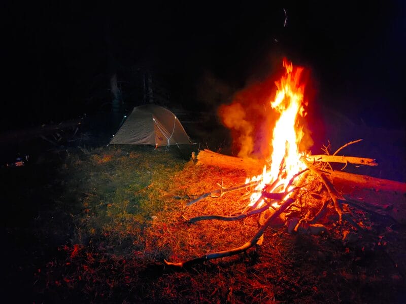
As I set up the camp, I listened to a podcast regarding VAE(R)S data and got a roaring fire going; I also got plenty of water, which took some straining. Dang muck pond. I banged up my hand pretty good getting some wood for the fire, but the weather was relatively decent and I was back in good spirits! I had read a review earlier in the week from way back in 2006 where a man and his hiking buddies had taken a bit of grog and some cigars into the wilds around Sweetwater Gap, so I’d done the same this night.
Dinner was Peak Refuel, which you might recall that I love almost universally, and I gobbled it down like Nancy Pelosi does expensive ice cream while her constituents lose their jobs. It was great! Then I had a sip of Dalmore whisky as I smoked on a cigar. The cigar was probably worth it, but even the slight weight from the Dalmore wasn’t really. Well, not in comparison with soda, which is the one ridiculous item that I’ve been known to cart around before. I have something of an addiction to carbonation.


My Prime videos had finally downloaded, so I watched “Kill Me Three Times” with Simon Pegg. I typically love his movies, but let me tell you about this one: it was SO boring that I’d literally seen it before and forgotten about it completely. 10 minutes in, I remembered enough to remember that I’d seen it and found it boring. I couldn’t recall what it was about or if I’d finished it, so I suffered all the way through the blasted thing. Do you know what it’s about? WELL I CAN’T TELL YOU, BECAUSE I’VE FORGOTTEN AGAIN. It has something to do with a contract killer and a dentist and…well, I don’t know what else. It’s not funny. It’s not exciting. But it does induce amnesia and might be an SCP.
Anyway, the night wasn’t too cold for me, as I’d brought my new down pants and goofy down hat (makes me look like a poor Russian), so I watched that dumb movie by the fire while smoking a cigar, and then I went to my bed. Well, I first did a sniff test, found out that I didn’t smell bad or like cigars, and then went to my bed. I ended up changing into my down hood. It was warm enough that I didn’t require my Transcendent down mittens.
During the night, I had a dream that I was falling into a mud pit and my SATCOM wouldn’t work, which I found to be a poor value. I think it had something to do with the sound of my breathing on my hood. While it put me right to sleep, I certainly wasn’t used to hearing such sounds at night.
⤑Day 2: Hike Out
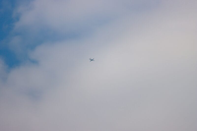
The next morning was quite cold, and I woke up early to the sound of the local tour helicopter going over. I’m glad that he has such a successful little business. Then I heard the HeliExpress helicopter go over. I’m glad that they have such a successful medium-sized business. Below is a sampling of some of the aircraft that zipped around me. The low jets were mostly heading to LEIDY (named after the mountain) to then track inbound to KJAC on the ILS-Z or RNAV approaches.


Then I went back to sleep, because it was cold and I probably wasn’t going to bother day-hiking Blue Miner when I could do it with my mom. I woke back up and found out that my wife wanted me to pick up our daughter from school early, so I decided to pack up and head on out.


The weather was much chillier than it had been, which I appreciated. It was also cloudy and appeared to have all the hallmarks of a fall that was coming without intentions of turning back. I drank the remainder of my meager remaining rations of water, and then headed back toward my Jeep. I stopping at the small creek to hydrate, as I was as thirsty as all get out. I felt quite sad that I hadn’t gotten to see Blue Miner!
Instead of going all the way back the way I’d originally ingressed, I followed an old trail on my map that was mostly well-defined. It bordered the boundary fence and presented much better views than the rest of the trip had, and especially better ones than had been present on the way in from the new trailhead.


I arrived back at my Jeep none worse for the wear and made my way to pick up my kiddo, arriving one minute early to find her roaming around the playground in search of a vehicle! I LOVE HER SO MUCH! She was quite excited and surprised to find me there instead of her mom.


➤Conclusion and Rating
I can’t say that I’d ever do this hike again, as the destination was so very, very unworth the time. As an endeavor of getting out on a neature [sic, my proofer declares, “I know you mean to write this, but I just hate it.”] walk, it was actually rather pleasant in its own right, but only because of the changing on the leaves. As a fall walk, I’d tentatively recommend a walk to the first pond I mentioned, just to get some shots, and to see the Tetons. Camping at Crystal Creek would also make it more palatable. There is no reason
- My scientific rating system. I appreciated that this hike got me out of the house. It is not worth a first visit if you haven’t been, unless it’s fall. Even then, just go to the first pond.
- Beauty. The views of the Tetons and changing aspen leaves are rather pleasant, but it’s otherwise just a walk through some routine countryside.
- Camping spots. Don’t camp on this trip. But also don’t take the trip in the first place.
- Crowds. I saw no other people.
- Difficulty. Easy.
- Fishing. There were some, but not worth the time.
- History. Nah!
Let me know if you have any questions. I’d love to help you do more with that time of yours, and I’m here to serve you!

