Review: Hiking Cook Lakes, Wind River Range (And How to Do It Better!)
This 26-mile hike can be made into a much better hike than I had, though I wasn’t equipped with the appropriate knowledge to make it really fantastic at the time. It’s great for people who want good fishing with camping locations which are downright hospitable.
➤Quick Facts
- Date of Visit: 25-27 July
- Notable Features: Elkhart Park Trailhead, Photographer’s Point, Elkhund Lake, Two Tops Lakes, Marys Lake, Pole Creek Lakes, Pole Creek, Cook Lakes
- Total Miles: ~26 miles
- Elevation Gain/Loss: +/-4387′
- Elevation Min, Avg, Max: 9334, 10053, 10448
- General Route:
—ON TRAIL: Elkhart Park Trailhead ►Pole Creek Trail 119 ► Cook Lake Trail 094 ► Return via reverse route. - GPS Track Download Grab a free Gaia account to download the GPS route to use on your phone or Google Earth.
- Housekeeping: I host my images on a CDN and optimize them to increase website speed. Feel free to contact me if you’d like a full-size, high-quality image.

⤷Introduction
My controlling schedule gave me a good deal of free time to play in the mountains every other weekend (almost 3 days off), so I was excited when July rolled around. Sadly, massive fires broke out everywhere, and the road between Jackson and Pinedale was closed. For that reason, it was late July by the time I was able to sync schedules with my mom and go hiking. Hank and Peggy went hiking with her later on, but this time only I was available. We got it into our heads to hike to Wall Lake, which I’d seen interesting pictures of.

- Smoke as seen from my house in south JHo.
⤑Day 1: Elkhart Park to Two Tops Lakes

- On the way to work.
I got done controlling and got straight into my vehicle and left the air traffic control tower. Naturally, this leaves one a little tired (being up so long), but I’m always excited for hiking. The drive between Jackson and Pinedale was very smoky, and I hoped that it wouldn’t be stagnating over our hike.
I’ve written so many dang times about this trailhead that I won’t provide too much in the way of details about the trail between the parking lot and Two Tops Lakes. For more detail on that section of trail, you can read my report here, given that there was very little different.
We got on the trail around 3 PM and decided to play by ear where we’d stop. We also missed the Photographer’s Point Bypass Trail and so ended up taking photos at PP. Smoke was on the horizon, making for an interesting scene, but thankfully we weren’t subject to any of it. The forecast called for hot, sunny days (which I do not enjoy when backpacking), and the walk in was warm but not too bad. When we got to the green area at the intersection to Sweeney Lakes and Miller Lake (trail 121, which my mom and sister have been on, but I haven’t), we stopped for pictures, and then took the south-side trail out of the meadow, as it goes straight to Elkhund, whereas the north-side trail requires a minor bit of backtracking and provides no extra value unless you’re headed toward Seneca, in which it saves a tiny bit of walking.


- Photographers Point area at top, followed by the trail area at the intersection to Sweeney Lakes at bottom, looking both toward Sweeney and toward Titcomb Basin.
We thought about stopping by Elkhund, but it’s very rocky nearby without too many decent camping spots, so we climbed on up to picturesque Two Tops Lakes and looked at spots there. There were a few other parties camping already, so we instead made our way down to Marys Lake, which is just as pretty. There we found plenty of excellent, flat, grassy spots, and we camped near some trees above the lake. We were basically alone and there was so much dead wood and bark around that we got a careful fire going in a fire ring that was already present. Despite the forest fires, there were no fire restrictions at the time. Go figure. I don’t like fires myself, but my mom does. Fire rings have fallen out of favor in recent times, but this fire ring identified as a natural geologic formation, so there were no issues with it.


- The trail up to Two Tops Lake. The lake with smoke beyond it is Elkhund. The other lakes are Two Tops and Marys. The sunset picture is looking toward Spider Lake.
The sunset over Angel Pass was amazing (well, the clouds catching the sunset were), but my camera wasn’t really up to the task of getting a good picture. I had a little peach tea with dinner, and we stayed up way too late, hitting the hay around 11PM.
Day 1 totals: 6.4 miles, +1550/-500′, 9342 min/ 10050 avg / 10448 max feet.
⤑Day 2: Camp at Pole Creek Park, Visit to Cook Lakes

- From our tent.
The morning started off hot and only got worse! After packing up our crap, we headed back to Pole Creek Trail 119, crossing the still-verdant lawns around Marys Lake. The hike from here became anything but verdant! It was dusty, rocky, with intermittent, stagnant bodies of water in old stands of dead trees, giving way to burned forest. Truly unpleasant. Somehow, in the middle of a rocky bunch of nothing, not near any water, and nestled among a stand of dead trees, we found a camp of young Boyscouts. They were basically perched on an ugly, hot, rocky hill. Was this torture that we were witnessing? What was going on there? Could we report this as child abuse?


- Monument Creek area.
2.3 miles from where we started that morning, we reached Monument Creek. This little creek has a trail that branches off north right before the crossing, and I’d heard rumors that it led as a shortcut to Cook Lakes. We considered taking it, but given that we had no proof that it was a shortcut (and from what I have been able to tell, it might not be shorter at all, as it comes out by where we ended up camping), we elected to just cross the creek, get some water, and stay on the sure thing.
After getting water, tragedy struck, and my sternum strap broke. I’ve had this happen more than once, and now carry a spare, improv strap with me. I managed to tie the chest assembly together, but it didn’t do a great job, and the entire pack became a nightmare for the remainder of the trip. Oh well, nothing to be done. We took off again heading downtrail, though the trail itself has a number of ups and downs, and the lumps in the road weren’t any friends of mine.
About 10 minutes prior to reaching the Pole Creek crossing, which is often written about as one heck of a scary place in the early season, we came across 6 utterly beautiful vixens sitting on the side of the trail. Dang! Gorgeous. We stopped and chatted, and told them that we were on day two. What day was it for them? After conversing some, they asked us what the date was, and on learning that it was the 26th, one of them quickly said, “This is day 24 for us, then.” As it turned out, they were doing some resupplies and caches but were making their way all the way through the range over the course of the summer.
Did you know? Did you know that such women exist? Incredible. Humanity still does have a chance, I guess.
Having sadly (for me) parted ways, mom and I continued down to Pole Creek crossing. On the way down, I noticed that we didn’t see Pole Creek Lakes, so I looked at the map. When we’d been chatting with the girls, we’d gotten within 300 feet of the lakes, but were about 30 feet above it in the trees. Given the area, I didn’t think we were missing much. We also met two old ladies who were coming from Spider Lake below Angel Pass on the Loop Trail. They told us that it had been on their bucket list and that it was a blast, but the mosquitoes up there were bad. So far our own mosquito problems hadn’t been severe!


- Pole Creek crossing.
The crossing itself wasn’t bad at this time of year, getting up to my knees at the deepest spot, but the topography kind of forces you to cross in that location. Upstream there are some waterfalls, that maybe you could jump over (unlikely), but accessing them is difficult due to a boulderfield and heavy, riparian brush. We took off our shoes (I hate doing that) and crossed, with mom noting that maybe magic sticks are good to have. Some of you know my feeling about magic sticks: I detest them and think that they really just encumber you. When I’ve been at a crossing and needed a stick, I’ve always found one within a couple of minutes. Anyway, maybe I just have great balance, but I think they’re overrated.
We crossed and were none to happy with the thought of when we’d next cross it, having to climb the 1000 feet back up to Two Tops. Blech! Resigned to our fate, we started heading uphill again, this time toward Cook Lakes. My pack was really being a burden, so after conferring, mom and I decided to set up camp and use the rest of the day to hike in to Cook and Wall Lakes. Just over 1000 feet past the crossing, we emerged out of the forest by a big field. To the right was a wooded hillside, while to the left were old-growth trees with outfitter-style camping areas (and, in fact, an outfitter’s scale hanging from a tree). Beyond the camping areas, the river was broad and slow, looking more like its own lake. This suited our needs perfectly (outfitters get rid of all the rocks, often have trees downed for sitting, etc.), so we dropped pack and started to set up camp, which we completed by noon.
With the camp setup completed, I put on my mom’s pack and used it as a daypack. It didn’t fit me well since the frame wasn’t long enough, but it was sure better than my broken bag. From the crossing to the upper Cook Lake, it was about 3.4 miles and +850/-400 feet, so easy but with a few ups and downs. Just a bit uptrail from our camp, the trail departed from following the creek and went up a hill that neither of us liked, but it was at least in the woods! The river then became wider with intermittent cascades over granite slabs, though we pressed on rather than stop and look too long.

Prior to reaching Cook Lakes, the Loop Trail/CDT breaks off at a random spot and goes charging up the woods heading toward the pass by Mount Baldy. If you’re thinking that it’s heading to Angel Pass, you’ll be confused, as I was, because I’d gotten it in my head that it was DEFINITELY going to Angel Pass…probably from loving the view of Angel Pass the previous evening. I don’t think that the pass that the Loop Trail takes actually has a name, at least not that I’ve seen. A sign said “Hat Pass,” but when I encountered other signs for Hat Pass, they were far away, by Lake Victor, and my map indicated that Lake Victor was closer to being accurate. Whatever, you can go left to go over Lester Pass toward Titcomb Basin, or right toward Angel Pass. We did neither and arrived at lower Cook Lake 1/2 a mile later. The Cook Lakes have SO many places to camp! I really can’t explain how beautiful they were, especially for not being in the “proper” mountains, but man…gorgeous rivers, ponds and little lake lagoons everywhere, beautiful meadows—they’re nice. We crossed the inlet from Spider Lake and stopped for lunch, then kept going uphill.


- Just prior to Cook Lake looking downstream.
- Spider Lake Creek.
- Lunch! (There was also beef jerky from Jackson Hold Buffalo Meat Company!)
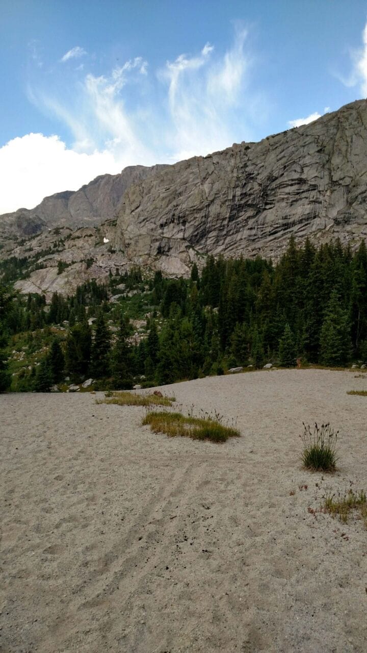
Soon there was a pond to our left, and I wish we’d orienteered NW from there, as Upper Cook Lake has some attached lagoons in that direction that typically have very good fishing. We didn’t because we A.) didn’t know and B.) found that the area around us was all very marshy, unexpectedly. And oddly, there was a creek crossing here that was a bit of a hassle, at least for us, as it had a steep bank and quite the hop to get across. We made it and followed the trail and in just under a mile came to a strange, sandy hill, and then walked down through a meadow to the Upper Cook Lake. STUNNING!!! The grass looked like a lawn that Hank Hill would be proud to call his, and a spit of granite jutted out into the lake, which we made for immediately.


- Walking to Upper Cook Lake and leaving Upper Cook Lake.
On this spit, we took our time fishing, and mom decided that it was pretty enough here that we’d save Wall Lake for another trip. I was catching enough fish that I found myself in hearty agreement. Across the lake from us, we saw a man…well, playing on the cliffs. It was strange, because he dislodged a huge boulder, but he seemed to be freeclimbing his way down toward the lake. He was by himself, but eventually he made it.
As we fished, a couple set up their camp over where we’d walked in, by the sandy hill. It was getting towards the evening and clouds with virga were piling up, making everything so much more beautiful. I wanted to stay there forever, but alas, mother didn’t want to walk back in the dark, so at 5:40 we left and headed back the way we’d walked in.
The walk back was incredibly nice under increasing cloud cover, and we didn’t see anyone, which made it perfect. Actually, that’s a lie, as we did encounter a duck along the section of trail where it leaves the river, just prior to the hill climb that we both hated, though this time it was a hill descent, which wasn’t as terrible.


- The walk back between Upper Cook Lake and our camp. The bottom picture was taken from our camp. The ugly picture above it on the right is from the hill-climb area. You can also see a picture of Lower Cook Lake!
We arrived back at 7, and our camp was undisturbed, and I did some quick fly fishing but caught nothing. We were the only ones there and got a fire going, and then made some MREs, which we’d chosen to bring along. What MRE? The cherry-blueberry cobbler type! My goodness you don’t know how good it is. Just fantastic. Yum yum yum.
The night was warmer than I liked, mostly due to the overcast sky.
Day 2 totals: 9.8 miles, +1500/-2120′, 9728 min/ 10057 avg / 10432 max feet.
⤑Day 3: Egress


- Area around our camp.
I can’t say enough bad about this day! Ha! We woke up to STINK. The air was CHOKED with smoke. It was truly unbelievable. I made some rehydrated mixed vegetables from Backpacker’s Pantry. Though the pictures made it seem as if they had butter, they didn’t. The weight/calorie ratio on these duds was a true waste of time, and I spent more energy eating the bland bag than I got back. Since I shared it with my mom, I only got about 70 calories out of the deal. Truly terrible. Live and learn. We packed and left our nice site, reaching the crossing at 930, though we checked out the waterfall first. It turned out that crossing at the falls would be very stupid.


- The falls above Pole Creek crossing and Pole Creek crossing itself!
While I was waiting for mom to take off her shoes, an older couple went past and bragged about their waterproof boots and magic sticks. Waterproofing in hot summer weather is insane, at least in my opinion, but they seemed happy enough! I stood in the cold water and loved the feeling of my feet freezing to the bone. : )


- Another sign that has seen better days.
- Monument Creek area again. You can see the shortcut trail.
- The “lakes” on the hike up.
- Train!
The trudge back up to Marys and Two Tops seemed to take forever, and we met very few people, though we passed the older couple. At the top of the hill, a pack train was going the other direction, and one of their dogs came running over to us before departing. Working dogs are funny! Though the smoke had cleared out a bit on the walk up, by the time we got back to Two Tops, it was really clinging to the mountains again like a staticy sweater to one’s skin. We reached Photographer’s Point and took pictures just to show how dense it was getting. Yuck!

- Photographer’s Point on the way in vs the way out. So much smoke.
Just before 3 we got to the trailhead. I went down and got a bit of food from Wind River Brewing, and mom went on her own back to her hometown, while I returned to mine. My body was pretty banged up from the exceptionally poor ride that the pack gave me following the suspension failure.
Day 3 totals: 9.6 miles, +1337/-1784′, 9334 min/ 10050 avg / 10432 max feet.


- Dinner, results of the fire, and how dirty and injured I was left from this hike. That’s my hip with the edema thanks to the pack.
➤Conclusion and Rating
I really liked this hike, though it hurt me. It wasn’t spectacular, but it was pleasant and short enough that it was fine, and the camping options around Cook Lakes were pretty dang phenomenal. I have deducted two stars as it’s a lot of effort through ugly terrain for what amounts to a glorious place to camp, but is otherwise a one-trick pony.
So who should take this hike? People who don’t have time for lots of miles and don’t want thick crowds, but would like to do a little fishing and have a nice place to relax. If you can do it over the course of more than 2.5 days, you’ll like it much better, and tacking on Wall Lake and Spider Lake would make this a true contender. Better options include Stough Creek Basin and Mendarrin. You can search for other hikes most easily with my map page.
- My scientific rating system. I liked this hike and wished that I’d had more time to spend on it.
- Beauty. It’s not the prettiest, but a couple of the locations are just very…well, pleasant!
- Camping spots. A plethora.
- Crowds. This isn’t that popular with folks, so despite being an Elkhart ingress, it’s not crowded.
- Difficulty. This hike is fairly easy for anyone who’s used to hiking at higher elevations. It can be very dusty and hot, though.
- Fishing. Lots of brookies!
- History. Not so much.
