Reviews: Hoback Guard Station, Granite Hot Springs, and Clear Lake Day Hike
Clear Lake is a beautiful lake surrounded by cliffs. It can be done as a day hike but is best accomplished with enough time for one to fully take in the concept of eternal damnation. Everything else in this post is tops!
Table of Contents
- ➻ Quick Facts on Clear Lake
- Review: Hoback Guard Station and Granite Hot Springs
- ⤑Overview of Hoback Guard Station
- •Facilities
- •Natural Features
- •Recreation
- ⤑Granite Hot Springs
- •Granite Hot Springs, Natural Springs (Free)
- •Granite Hot Springs, CCC Pool (Paid)
- ➤Conclusion and Ratings of Hoback and Granite
- Review: Day Hike to Clear Lake, Wind River Range
- ➤Conclusion and Rating of Clear Lake
➻ Quick Facts on Clear Lake
Info at a Glance
- Date of Visit: 26 July
- Notable Features: Green River Lakes, Clear Creek, Clear Creek Natural Bridge, Clear Lake
- Total Miles: ~12
- Elevation Gain/Loss: +/-2096
- Elevation Min, Avg, Max: 7966, 8278, 8922
- General Route: Green River Lakes Trailhead, Continental Divide Highline Trail 094, Clear Creek Trail 184, Off-trail
- GPS Track Download Grab a free Gaia account to download the GPS file for your phone or Google Earth.
- Images: I deliver pictures via a CDN at low quality to save speed and increase speed. Feel free to contact me if you’d like full-size images.
Interactive GPS Map (Click or Tap)
Elevation Profile (Click or Tap)
Review: Hoback Guard Station and Granite Hot Springs
Staying in or near Jackson Hole is fantastic if you like being destitute with a view. If you think that rooms in a Motel 6 should go for $200+/night and not include internet, then staying in Jackson Hole itself is absolutely something you’ll love. I don’t care for spending that much money on a room, though I’ll do it sometimes when I’m traveling to foreign countries and the place is nice.
Although I typically just camp out of my Jeep when transiting through JHo, I also stay at the Hoback Guard Station when I have more than just myself and there’s availability. At $30/night, it’s a fantastic deal. From the booking page:
⤑Overview of Hoback Guard Station
Hoback Guard Station was built in 1935 by the CCC to be used as a working Ranger Station, and is considered eligible to be on the National Register of Historic Places. About 34 miles from Jackson, Wyoming, This guard station beckons guests who want a scenic backcountry experience with the convenience of electricity and running water and great mountain scenery.
•Facilities
The log cabin has electricity and can accommodate six guests. A campfire ring with grill is located outside. Drinking water, a flush toilet and shower are available Memorial Day to Labor Day. The kitchen is equipped with an electric stove, a variety of cookware, a table with four chairs, a refrigerator and a sink. The bedroom has three bunkbeds with mattresses and a dresser. No linens or bedding are included. Guests should bring food, bedding or sleeping bags, towels, soap and garbage bags. Pets and livestock are allowed at the guard station. Livestock may be kept in the corral behind the bunkhouse.
•Natural Features
Willows and pines provide sparse shade, and grasses and summer wildflowers are abundant. A creek runs alongside the guard station, which sits at an elevation of 6,600 feet. Plenty of wildlife to see amongst the beautiful view.
•Recreation
Hiking, biking and horseback riding trails crisscross the surrounding mountains, leading visitors to impressive scenery like Cliff Creek Falls. 15 miles up the road is the beautiful Snake River Canyon where you can fish, raft, kayak, cliff climb, or just enjoy the breathtaking scenery. Granite Hot Springs is a natural hot springs pool that sits 10 miles back in the Bridger-Teton Forest.


- Hoback Guard Station and sunset.
The cabin used to require a key to access it, which you had to pick up and drop off in Jackson or Big Piney, but most recently it’s rented with a code to unlock the gate, which is far more convenient. You’ll need to bring your own bedding, and the facilities are austere, but the place has 6 beds, and at about 40 minutes from Jackson, you can’t really beat a secluded cabin with hot water for the price.
We brought our own food to cook, as the station has all the cooking utensils that you could possibly hope for. While there’s no internet, on Verizon one can get 4G, so you won’t be disconnected from your Instagram or whatever. I’d recommend bringing folding chairs, though, as the views from the hill above the cabin are awesome in the evening.
⤑Granite Hot Springs
We used the cabin as a staging area to spend time at nearby Granite Hot Springs, which takes as long to reach as Jackson, since you have to drive on dirt roads to get there. The cost for the springs, which were also made by the CCC, is $8 for adults, and you can find all of the information at this link.
•Granite Hot Springs, Natural Springs (Free)


- Top: Granite cascades.
- Bottom: Natural hot springs area.
The area nearby had a nasty fire in 2016, but the hot springs themselves and all of the adjacent area are still green and untouched. On the drive up, you’ll pass a campground that you could also stay at, and just beyond that is a short, looped pull-off that offers incredible views of the Granite waterfalls after a short walk. If you can cross the river here (it can be very swift and deep), the cliffs on the other side of the river have natural hot springs at their base. We crossed and enjoyed these for a time, and a rather beautiful woman was sunbathing topless, but with only her back exposed. I was expecting her to go full hippie, as I’ve had happen at other hot springs, but thankfully she did not.
•Granite Hot Springs, CCC Pool (Paid)


- Granite Hot Springs fee area.
After spending some time there, we went back to the truck and drove a little way up the road to the parking lot, and then walked in. The pools (natural pools and the one actual, manmade pool) aren’t just lukewarm, so you might not want to do them in the heat of the day. On the other hand, if you’ve just been in the ice-cold river, they’re a real treat. While we relaxed, a bat came down and scooped water into his mouth.
Granite Hot Springs is a fantastic value, and my recommendation for those looking to do a hiking vacation in the area is to be dropped off at Kinky Creek Trailhead, and then to hike over the mountains to Granite so that you can end with a soak in the natural pools or in the paid CCC spring. That hike is one that you can really mess yourself up on, so it’s worth reading my advice or at least downloading the GPS file at my review.
➤Conclusion and Ratings of Hoback and Granite
Granite and the Hoback Station are both awarded 5 stars for excellent value and beautiful scenery.
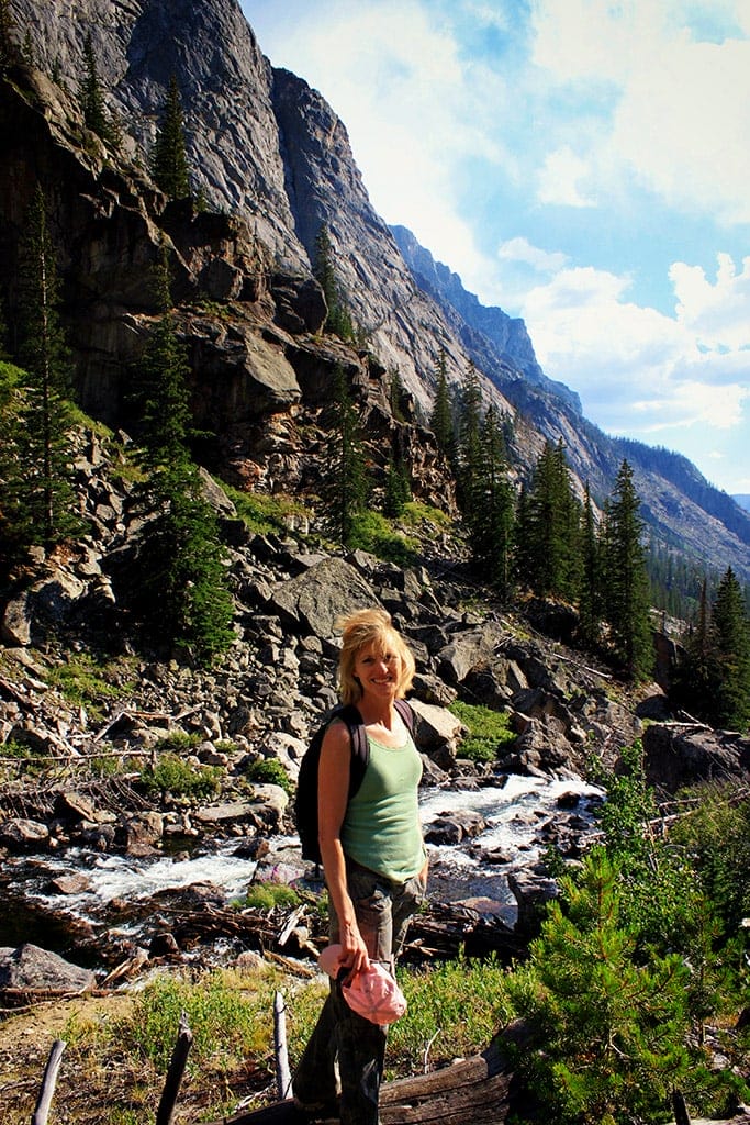
Review: Day Hike to Clear Lake, Wind River Range
From the trailhead we went over the hill and walked down to the bridge which crosses the outlet. Past the outlet the trail crosses Mill Creek, and you can easily hop that crossing. Shortly beyond the trail splits, though it is hard to see anymore. It used to be well marked, but at some point the sign for the upper, prettier trail fell down, and the USFS seems to have abandoned maintenance of it. Still, it offers a more consistent track in regard to elevation, and also has better views, including a nice scene with some aspens and Squaretop. For that reason, I prefer to take it. It does add a little bit of distance if you’re going to Upper Green River Lake, but is shorter if you’re going toward Slide Lake.
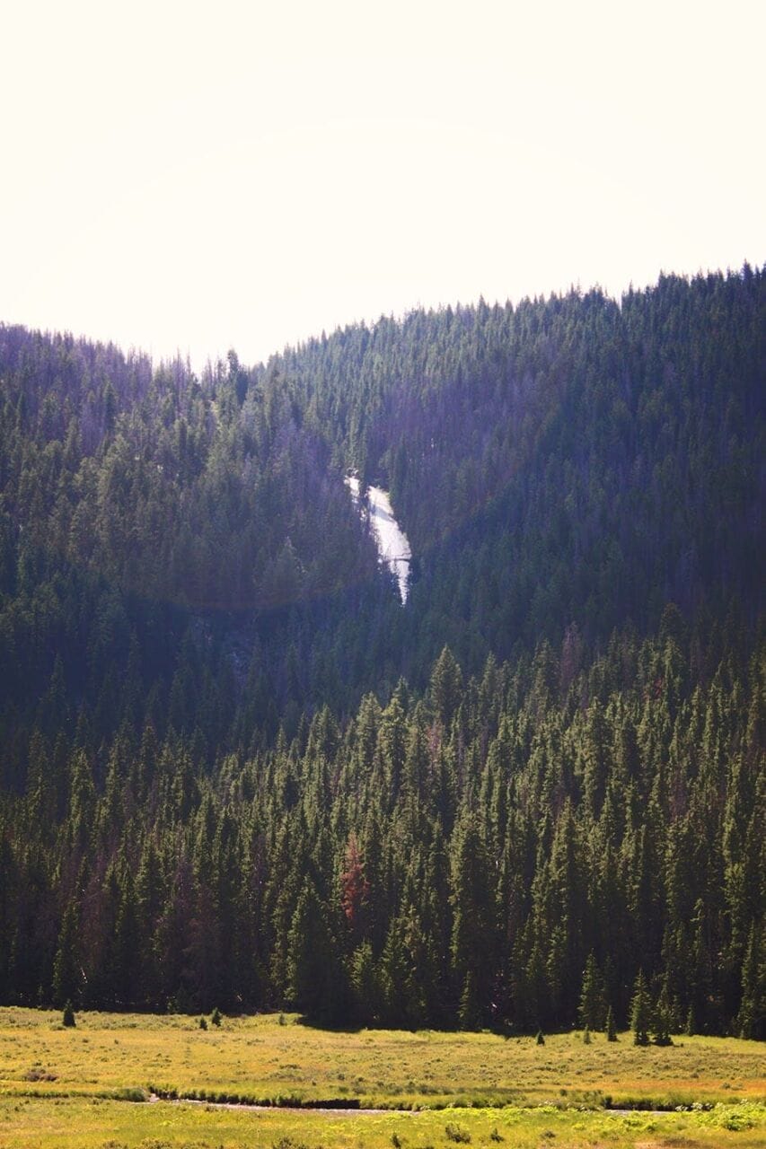
- Slide Creek Falls.
We made our way to trail 184 and took it past the beautiful meadows, marching slightly uphill toward Clear Creek Natural Bridge, which I climbed into to explore. The natural bridge can’t be crawled all the way through as the river fills up most of it, but you can see from one side to the other. As far as bridges go, it really gives off the appearance of being a natural hole punched through a ridge than the shape one would expect of a bridge. Effectively I guess they accomplish the same tasks, though. The upstream side is prettier than the downstream, and we stopped at some of the slack water to do some fishing. Brook trout were abundant and easily caught.


- Catching fish at the Natural Bridge area.
Now is where it gets terrible. The trail abruptly ends in the most horrific, painful deadfall. It’s feet thick as far as the eye can see, and filled with hard limbs that want to stab you to death if you dare fall on them. We battled that for about 15 minutes and then made our way to the edge of Clear Creek, where navigation was a pain but at least possible. On the opposite side of the river, we saw a lone, youn, bearded man with a pack, who didn’t exactly look like he was enjoying life. Although the creek was pretty and it was awesome to see the cliffs towering overhead, I ended up with bleeding stab wounds through my pants, and our progress was excruciatingly slow. Little hills block the view upstream, and every time we’d mount one, we’d find another to fight, but no sense that we were getting close to the lake.


- The marsh area was actually the best part!
The man on the other side of the river ended up ahead of us as we approached a marsh, where we saw him climbing a cliff at the far end. Although we tried our best to navigate the swampy area, taking downed logs when we could, my feet still got wet. We ended up following him up the cliff and making our way to the boulder-filled outlet of Clear Lake, where he was sitting and resting. He said that he was surprised that we made it, as we were day hiking. He was heading up to Bear Lake to hit the high route and would have turned around 20 times if he wasn’t on a schedule that demanded that he get quickly to that area (which, BTW, is much easier to hike). We said our parting goodbyes and then mom and I went on to the lake, which was gorgeous but mostly inhospitable to camping, as most of the waterline is simply long, straight falls from cliffs directly into the lake. Beaches? Not here, mate!


- Clear Lake, including fishing the outlet area. It was very green for a clear lake.
A couple of young men were fishing at the lake, as they’d heard that it had goldens, but they said that they hadn’t caught a dang thing. After a while they left, and I tried my own hand, but I’d say that I probably had a better chance of catching the nearby pikas.
As we fished, towering cumulus clouds started to develop, and both of us began to fret about getting wet, so after about 30 minutes, we packed up and headed back toward the trailhead. Rather than go through the hell that we experienced on the way up, we decided to stick to the boulderfields to the west as much as possible, which you can see in the reconstructed GPS file. (The program I was using was deprecated by Google, sadly.) This was much better, but eventually we were forced back into the hellish burn. We did at least catch fish on the way down. By the time we got back into the thickest of the burned areas, both of us remarked that it might be better to just die. The utter, creeping pace is made so much worse by the energy exerted just to maintain it. I got quite cut up from the trek.


- Views from the hike out. In the dense burn area, I didn’t take photos as I was exhausted.
When we reached the natural bridge, we were happy but also fatigued. Without a doubt, this is the worst hike we’d ever been on, and it remains so to do this very day. We reached the trailhead at sunset, having spent almost 9 hours on this short, 12-mile hike.

➤Conclusion and Rating of Clear Lake
Numerous people want to know which day hikes to do from Green River Lakes. Slide Lake is the best one you can do, followed by Upper Green River Lake (somewhat boring), followed by Valaite, Shirley and Twin Lakes, which require a great deal of elevation gain and are better as overnighters. You can also stay at Green River Lakes campground, which is nice.
No one should ever do Clear Lake. Period.
- My scientific rating system. The only being that appreciates this hike is likely Lucifer. I hated it.
- Beauty. Not. Worth. It.
- Camping spots. No.
- Crowds. No one wants this.
- Difficulty. You’ll probably die.
- Fishing. Ha!
- History. Nah bruh.
Let me know if you have any questions. I’d love to help you do more with that time of yours, and I’m here to serve you!
