Jade Lakes, Rainbow Lake, and Upper and Lower Brooks Lakes are easily accessed and quite tame as a day or overnight hike. There are some important downsides to the area, however.
➻ Quick Facts
Info at a Glance
- Date of Visit: End of August
- Notable Features: Lower Brooks Lake, Upper Jade Lake, Lower Jade Lake, Rainbow Lake, Upper Brooks Lake, Sublette Peak, Pinnacle Buttes
- Total Miles: ~9.3 (10 with a little exploration around the lakes)
- Elevation Gain/Loss: +/-1768
- Elevation Min, Avg, Max: 9057, 9285, 9622
- General Route: Jade Lakes Trail, Rainbow Lake Trail, Brooks Lakes Trail
- GaiaGPS Page for GPS Track Download Grab a free Gaia account to download the GPS file for your phone or Google Earth.
- Images: I deliver pictures via a CDN at low quality to save speed and increase speed. Feel free to contact me if you’d like full-size images.
Interactive GPS Map (Click to See)
Elevation Profile

⤷Introduction
I was going to, once again, have exactly one day off to hike. I wanted to assess whether or not Jade Lakes had golden trout in them still, so I decided to tackle this tame hike. I’d planned on my wife hiking with me, but once again she was sadly unable to come due to her work.
⤑Day 1: Late Hike in to Upper Jade Lake


I got off work late and drove up to Brooks Lake. Well, the lower one. The trailhead is located near the boat loading area, so I parked there and got dressed for the hike; there was only one truck at the trailhead. It was somewhat late in the evening for the time of year, and I didn’t get on the trail until about 6:40PM. The temperature was a very cool 53 degrees, which for me is just the best.
The lakes were once again listing cyanobacterial blooms being present, so caution was advised. I walked through the horse gate entrance and made my way toward Jade Lake trail. There are numerous trails that meander around the flats around Brooks Lake, but aiming oneself toward Jade Lake, there’s a straight path that goes right up a grassy hill and into the forest, sans any switchbacks. That’s the trail to take.


I passed a couple of ladies who were day-hiking as they left. They must have thought me a bit strange as the sun was setting behind Sublette Peak, and if they did, they were not much off, unlike myself. Anyway, I got a few pictures as the sun set over the Pinnacle Buttes, and then I booked it all the way up the hill and into the forest. You may see people online complain about it being a steep climb, but it’s not really. Little kids can do it. If you are incredibly out of shape or suffering from advanced hyper-degenerative foot-and-mouth-and-butt disease, then it might be a little hard for you. Or if a bear has just mauled your feet or legs. Otherwise, I think it’s a very small little climb that will only leave you slightly winded.


At such a lower temperature, despite still recovering from my COVIDITIS (inflammation of my COVID), I was really booking it along on this trip. Seriously, the silly little trip I did the week prior was 1/6th of this one, but felt 10 times as hard due to the heat. With the cold air, I was able to zip along without feeling the least bit absolutely horrible. I even ran some portions.
The trail quickly reaches something of a high point along the bluff and has some areas of barren ground. I passed a group of 3 men who warned me about the bacteria and told me to stick to where the water was clear, then showed off their impressive catch of what appeared to be all rainbow trout. Perhaps goldens had not made it since the last stocking? (Not that they wear such clothes as a habit.) Anyway, I bid the fine gentleman goodbye and then came across a split in the path: one way, up the hill, and the other alongside the hill. I went up the hill, but really alongside is just fine if you don’t roll down; they come out at the same spot, but up and over gives you a little elevation gain and loss.


From there, I had a beautiful view of Sublette Peak before going back into the woods and up to the first lake—correction, pond—of the journey. A lone duck was happily burbling about, though the sounds were drowned out by hideous camp bandits. I hate those birds so much that their very existence alone invalidates PETA. Ugh!
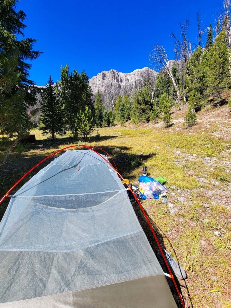
Quickly I entered the slight climb above the pond, coming out overlooking Upper Jade Lake. It was well past the sun having gone behind the mountains, though less than an hour since I’d started, even having taken pictures. I decided to camp at Upper Jade, which is by far more scenic than Lower Jade. Another benefit is that Upper Jade has a high-volume spring just to the west of it, whereas Lower Jade has some issues with water coming in from Upper Jade Lake, which as you know gets you back to the bacteria nonsense. The bloom was everywhere and thick in Upper Jade this time.
Below: From the pond to Upper Jade Lake, plus the creek I got water from.


I hiked south along the lake to the western side and found a bear box there! Yay! That saves you some time. There was also a campfire ring (verboten these days) with some wood in it. The ground was still pretty wet from the torrential August rains we’d had, but there was some firewood in the ring. With darkness falling, I set up my tent and put my food in the bear box, then scuttled off to get plenty of water. I’d also packed in FOUR WHOLE DIET WILD CHERRY PEPSIS! (I no longer drink Coca-Cola as I am trying to be less white.) Why would I pack in that many drinks? Because I knew that the cyanobacteria stuff might be a problem, yes, but mostly because I’m a grown-derriere man and I can do what I please. And I really like them. And it was only a 10-miler. And I had run out of propel and hate the taste of plain water. And because it was good exercise. And because I only brought one camera lens, so I had the weight savings.
Below: An Emirates A380 and FedEx MD-11 go overhead.


Anyway, it was already below freezing, with frost clinging to everything, so I started my Peak Refuel meal (marinara and meat) as well as a fire. I wasn’t sweaty, so I wouldn’t need a full bath, which allowed me to leave some of the heated water for the morning’s drink. While my meal was going, I clipped my flashlight to my hat and got about the rest of the required domestications, once again missing having my wife with me. (Just kidding!!! I did miss her, though.)
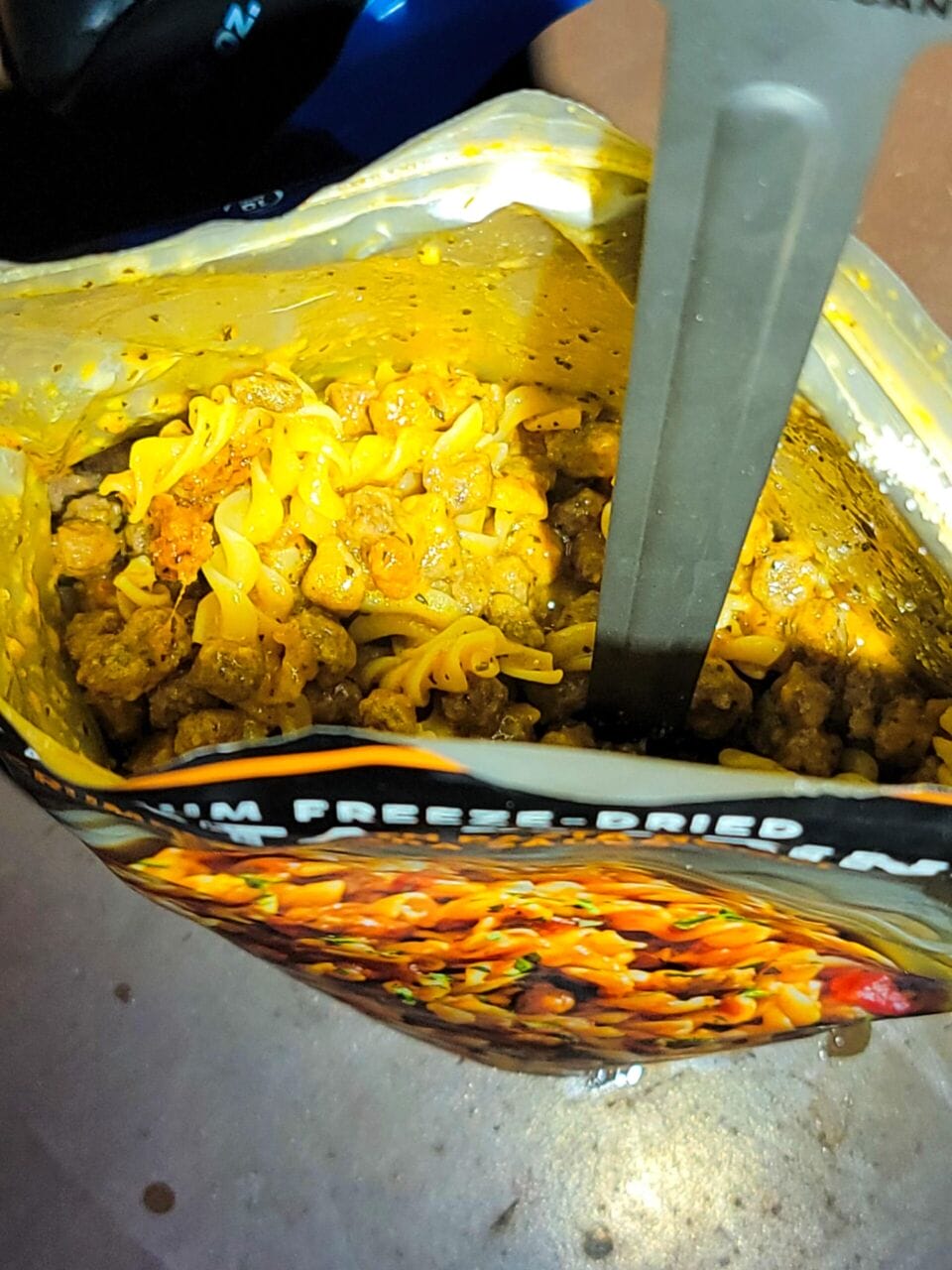
THEN IT WAS DINNER TIME! My goodness, let me tell you guys and gals, Peak Refuel is the best. For about an ounce or perhaps two more than a Mountain House, you get like double the calories and 100x better flavor. This thing rocked! It had real grease, 1040 amazing calories, and flavor out the wazoo. I don’t think I cooked it quite long enough (meat pieces were very, very slightly underhydrated), but it was really to kill for. I am going to be investing more heavily in their brand.
Below: frost and the Peak Refuel beef pasta marinara, which was the bomb.


Oh, and I ate a chocolate Honey Stinger waffle, some Doritos, and a dadgum cherry handpie. Guess there would be no weight loss for this little trip. Seriously, I ate like a glutton king. It was awesome.
With dinner consumed, I waddled around stashing my food away like some overgrown hamster, then climbed into my bed. I’d brought my heavier coat and TWO feather coverings, plus my insulated sleeping pad, and and a feather-down hood. Once again, heavy and kingly. If only I had some peasant to oppress and carry it for me. I watched some TV, read a little, and made sure that my drinks and water filter were tucked under my warming blankets so that they wouldn’t explode and stop filtering, respectively. The night was calm and clear, and I fell asleep having forgotten to get astrophotography pictures.
⤑Day 2: Exploring Lower Jade Lake, Rainbow Lake, and Unnamed Lake, and Upper Brooks Lake
I woke up a few times thought-out the night, mostly due to being a bit hot. Still, my sleep was undisturbed. When the sun finally came up, I decided to sleep a bit more, then just read, since I didn’t have far to go. Unfortunately, somewhere along the Sublette Trail to the west, people were cutting trees. It was a bit loud, but I’m glad that people were rehabbing the trails. I ate breakfast while this was all going on.
I finally left my tent at 1030, mostly because it was hot. Outside, the temperatures were still brisk and pleasant. Given that I really had very few miles to put in, I didn’t leave my little area until 1230. One man on horseback was fishing at the lake, but other than that, it was just me. As soon as I hit the Sublette Trail (which was just north of my tent-site), my sternum strap popped off. DANG IT. I hate having to repair sternum straps. I always carry a spare strap in case it’s an outright break, but I didn’t want to go through the trouble of finding it in the bottom of my bag. Since this one had just…well, popped loose, I tried to get it back on. If only I had had the voice of Tom Woods, the very failed podcaster, to sooth me as I worked on it. Sadly, I was not listening to the Tom Woods Show at the time.
Below: Camp cleanup at Upper Jade Lake, plus my repaired strap.


Ok, it was the end of the world, and I knew it. I was so irked. But then, thanks be to God, I was able to jimmy it back on. Would it hold? Yes! Praise the Lord. Disaster encountered and then deflected, I made my around the edge of the lake and then down the slope to Lower Jade Lake.
Below: Upper Jade Lake from west side trail/Sublette Pass Trail. This trail goes to Wind River Lake along the highway. Also note the HCBs.


Lower Jade isn’t the prettiest, and certainly not when it’s low and bacteria ridden. A couple and their kid were hanging out at the edge of the lake, but I don’t think that they saw me. I briefly stopped and fished, but with the water so low, I didn’t feel like stressing the little fellers too much, so I only spent about 10 minutes and then headed on out toward Rainbow Lake.
Below: Lower Jade Lake and Minnows. The water level was quite low.


Since the Jade Lakes are on a little elevated shelf, it’s a couple of hundred feet back down to Upper Brooks Lake and Rainbow Lake. I decided to cut cross-country rather than stay on the trail to the switchbacks, as I might get to see some animals, plus there was a marsh listed on the map.
The hiking through the forest was benign without much in the way of diversions around downed trees. I almost immediately crossed a creek, but was in no need of water, so I continued on while listening to the Babylon Bee. It was only about 10-20 minutes or perhaps really more like 7 before I arrived at the marsh. Pretty enough. Ethan Nicole’s wife had had a bad reaction to her first COVID shot (she is pro-vax but has autoimmune issues) and ended up in the ER. As an RN in CA, she was required to get the second shot or be terminated, but after the incident, all of her specialists and the other physicians told her that there were no exemptions to be had, and that she’d have to risk it. Crazy.
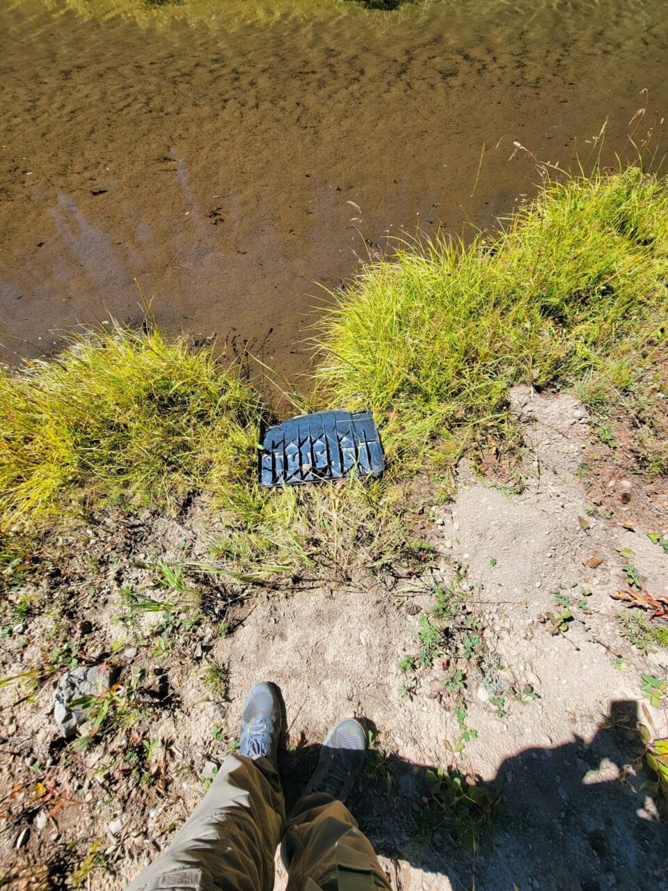
Below: Off-trail toward Rainbow Lake. Someone lost part of a snowmobile.


Anyway, a little game trail followed the creek downhill, and I followed it. The creek is rather pleasant, sans cyanobacteria, so I got some water from it. If you follow it the whole way, it bends north and comes out between Rainbow and Upper Brooks, just after another pond. At the pond, I branched off to look at Upper Brooks. The view from Upper Brooks was pleasant, but with so much time left, I was considering going across country to Morgan Lake. I really love adding new places to my belt, but at the same time, the thought of bushwhacking before work the next day, in the frigid cold, was not that appealing, especially as the mountain that Morgan sits under didn’t seem impressive.
Below: Upper Brooks Lake and the pond between it and Rainbow Lake.


While I considered it, I went northwest along Upper Brooks, passing the intersection to Rainbow. I decided to visit the unnamed lake between the two. Getting there was easy (took about 5 minutes off trail), but the little lake wasn’t very pretty, and had no views of the mountains. I left it and crossed through the forest over to Rainbow Lake. Rainbow isn’t pretty, either, and it really smelled weird. The HCB blooms were pretty intense. I quickly left it and went back to Upper Brooks, where I sat down and ate some food, sending a satcom message to my wife. I was only a few miles from my Jeep and it wasn’t even 4PM, so I felt pretty bummed. It wasn’t exactly a very wilderness experience.
Below: Rainbow Lake and North Breccia Cliffs.


Yurena messaged me back and said she’d like me to come home if it was all the same to me, and while I wanted to spend an extra night out, it seemed a decent thing to head on back—especially given the fact that she offered to make me one of my favorite meals. As I was texting, a group of people on horses went by less than 15 feet from me. None of them noticed me at all.
The trail back from Upper Brooks is pretty much flat (I forgot my glasses for 90 feet, though) and crosses many creeks. For easy camping, Upper Brooks is the best bet, as it has very nice views of the mountains. I met another group on horseback on the upper trail and they were quite kind toward me. Passing over the creek I met a lone man who was quite standoffish. I hustled across the plains in front of me and soon was looking at Lower Brooks again. I made it back to my Jeep about an hour after leaving Upper Brooks Lake. I got to scare a wild animal along the way.
Below: The walk from Upper Brooks to the trailhead.


During the drive back, I found out that—BUMMER—Yurena couldn’t make the dinner I wanted, so I ended up with Wendy’s. YUCK! Still, I love being with my family.
➤Conclusion and Rating
This hike is fine as an overnight, but really not worth two nights. The mileage itself really makes it best as a day hike, but if you want to do it as an overnight, you’ll be best served to go to Upper Brooks and then the Jade Lakes. Even then, it’s really hard to avoid having a ton of “camp time.” Because the harmful cyanobacteria blooms seem to be getting worse, I can no longer recommend the hike, unless you need something very docile and have very little time…and are in the Jackson or Dubois area or passing through. With that said, it’s still pleasant and has pretty views.
- My scientific rating system. I found this hike pleasant enough but wasn’t interested in spending much time on it.
- Beauty. The breccia of the peaks and pinnacles are quite pretty. Upper Jade Lake and Upper and Lower Brooks Lakes are quite scenic, though not that large. HCBs ruin the beauty of some of the lakes.
- Camping spots. Plenty, but good water limits where you want to stay.
- Crowds. Highly trafficked by outfitters from the Brooks Lake Lodge. The campgrounds at Brooks Lake are always packed. The area has a lot of boondocking, too.
- Difficulty. Easy.
- Fishing. Plenty of fish, but with the HCBs, I didn’t partake much.
- History. Nothing of much note.
Let me know if you have any questions. I’d love to help you do more with that time of yours, and I’m here to serve you!
