Review: Stupendously Short Overnight Hike to Lost Lake, WY
Lost Lake is a very short hike to a picturesque, colorful lake. It’s good for people who aren’t in shape, or for families with little children.
➻ Quick Facts
Info at a Glance
- Date of Visit: Late August
- Notable Features: Breccia Peak, Breccia Cliffs, Lost Lake
- Total Miles: ~3.3 miles
- Elevation Gain/Loss: +/-514
- Elevation Min/Max: 9092/9519′
- General Route: Lost Lake Trail
- GaiaGPS Page for GPS Track Download Grab a free Gaia account to download the GPS file for your phone or Google Earth.
- Images: I deliver pictures via a CDN at low quality to save speed and increase speed. Feel free to contact me if you’d like full-size images.
Interactive GPS Map (Click to See)
Elevation Profile

⤷Introduction
I wanted to hike to Kisinger Lakes via either an old dirt road or via the Pinnacles Trail. The weather ended up being HORRIBLE on Saturday night, so I was left with only Sunday and Monday for hiking. Additionally, because of work, I needed to be back by 1PM on Monday. Oof! It snowed in the higher mountains (mostly above 9500 feet), so my choices were limited.
⤑Day 1: Hike in to Lost Lake
I drove myself up to the Pinnacles trailhead and saw signs warning of grizzlies along the roadside near Dunoir/DNW. Great! Continuing up and over Togwotee Pass, I took the turn to Brooks Lake. When I was about to the Pinnacles TH, I saw a young hiker leaving the area. She waved at me and I wondered if she needed a ride and why she was walking down the dirt road from Brooks Lake. Strange. Unfortunately, once I arrived at the Pinnacles TH, there was a notice that a huge rockslide had made the trail impassable. I didn’t really want to go over an unstable rockpile—a young gal died in Montana from such a rockpile, and was only found with a small portion of her body not completely covered in boulders. Also of note, my doctor recently died hiking in the Winds.


That left me with a +1300 feet, all off-trail adventure from a different road. I assessed the quality of the forest traversal and noted that there was a ton of deadfall. With only one day off, I didn’t want to tackle anything too challenging. Also, as much as I hate to admit it, I didn’t relish walking through dense understory after all the torrential rains. That sort of water isn’t needed or appreciated in my life or on my clothes. I grudgingly decided to go check out Lost Lake and just camp there overnight. The upside was that it was an incredibly short “hike” and would allow me a lot of time to unwind. The downside was that it was an incredibly short “hike.”
It didn’t take me long to make it to the unmarked “trailhead.” This trailhead is really just a dirt road (on old USGS maps, it’s marked as a 4×4 road) that goes off the side of the highway and parallels it uphill. At the very beginning there is a small parking area. A small car from Indiana was parked there, just short of a massive, deep mud pit. My little Jeep made it across and I continued up the road, which will just keep taking you into the forest if you let it. Instead, stop by an old, closed road off to your left. A sign marks it as being a trail, and that’s the most-used way to Lost Lake. (Note: if you want a more scenic hike with some ponds, follow the old Jeep trail and take the first left—near a pond—then go uphill, where it terminates at another pond. From there, it’s a short bushwhack to Lost Lake.)

Right before I got my pack on, the couple from Indiana came out of the woods and left. Maybe that meant I’d have the woods to myself! I’m pretty solitary and don’t care to see people when I’m out camping, which is one reason that I don’t do the whole Tetons-thru hiking stuff. It’s a seething mass of flesh in those mountains. (Which I appreciate, as they absorb the brunt of the impact.)
My pack was pretty light. I didn’t have any camera gear, as the weather said it had a slight chance of rain, and I didn’t bring any food to cook, as I was only going out for one night and didn’t want the extra smell in griz territory. I crossed the little barrier and began walking up the old 4×4 trail. It was sunny and in the low 60s, which was a blessing. This late in the season, I also didn’t need bug spray! Praise the Lord!
The road is easy to walk and only has a few spots where you have to leave due to deadfall. The most difficult part was the mud, which was worse in areas where there were also springs. On the way up, I considered going cross country the whole way, as it seemed easy, but the amount of water clinging to the plants disabused me of that notion. I did do one little walk through the trees, and it was as wet as expected.


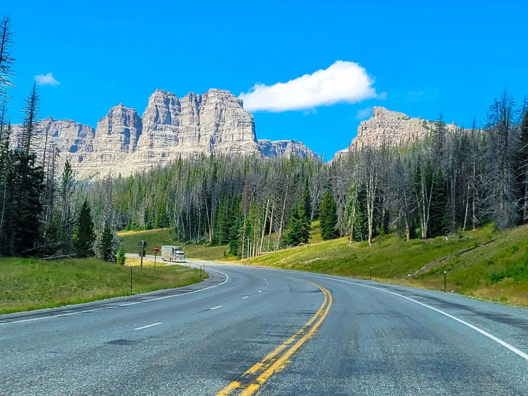
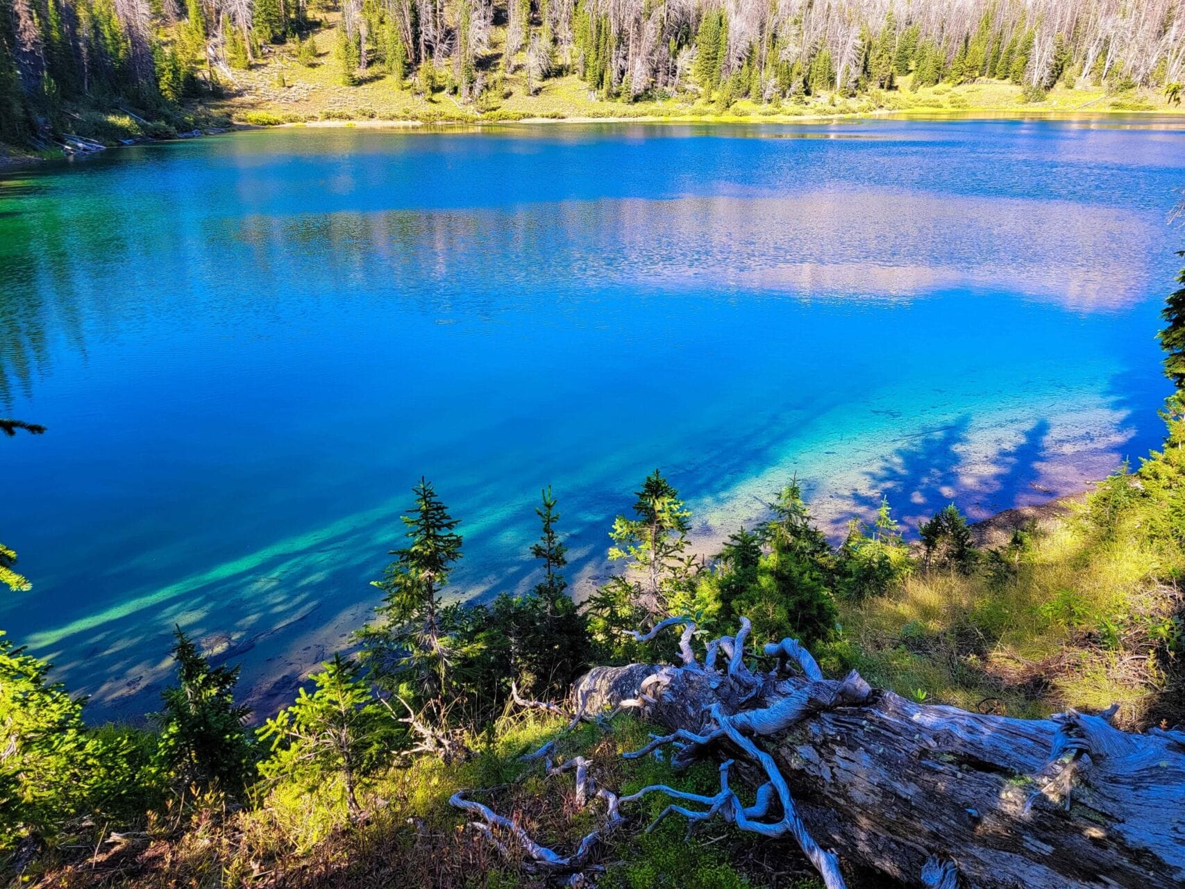
Within about 40 minutes I’d reached the lake, and that was at a very leisurely pace, stopping to examine all the old trash from decades prior that I’d intermittently see. (Mostly old cans, tools, etc.) The lake sits in a little bowl and is very picturesque, with a gorgeous shade of greenish-blue. It doesn’t really have beaches, and on the south edge the banks are steep, but it’s accessible nonetheless. I decided to circle the lake anti-clockwise in search of a good camping spot. HINT: the best spot is almost exactly opposite where you first arrive at the lake. The entire way, the Breccia Cliffs were in view. They’re a very neat bit of geology.


The trek around was unpleasant, wet, and about as fast as molasses spreading across a sheet of ice, given the terrain. I got to see some baby killdeer, which are one of my favorite birds.


I was surprised that they were so young still. I moved on and found a place to camp. Rather than camp right by the lake, where I might ruin the view for any latecomers or early risers, I set up just out of sight. While I typically want to put my tent where I can get pictures of it with the cool scenery, this wasn’t really possible thanks to the trees.


I ate some chips as I set up, and listened to the Tom Woods Show (FANTASTIC!). One episode feature Murray Sabrin discussing how single-payer healthcare (ie., every person pays individually and insurance is only for catastrophes) has been reducing medical costs by wild factors in the places it’s being implemented. Yurena is also a big fan of the TWS, as well as the Babylon Bee Podcast, and of course Dave Smith’s “Part of the Problem,” and Michael Malice’s “Your Welcome.”
I collected water and about froze my fingers off doing it, as the temperature was falling rapidly. Even with my coat on, it was a wee bit nippy. I then tried some fishing with my recently-repaired tenkara rod, but the fish were far out and languid. There was no alpenglow on the Breccia Cliffs (yes, lots of volcanism), and instead the light just slowly turned greyer.


My bed was calling me to watch a movie and read, so I retired just before darkness to do just that, watching what was probably United 1283 whiz over my head en route to Jackson. I had downloaded Jolt, an Amazon Original 2021 action-thriller-boring movie about a woman who gets upset a lot. The main action set pieces feature her playing Lightning Reaction Reloaded by herself and always losing. I was barely able to keep my eyes open watching it, but I finished and considered watching something else…and then woke up at 0145. Wow! I had fallen right asleep.


I was using both my REI Magma 10 and my wife’s Enlightened Equipment Revelation 10, and I’m glad I was. I woke up to drops of rain hitting my face. What? Yes, it was raining something fierce, and there was lightning, too. I don’t know if I was just breathing gallons of vapor out, but the rain was making tons of droplets fall in my tent. To top it off, I had to pee very bad, so out of the tent I went, with my FNX-45, bear spray, and flashlight strapped to me.
Once I was back in, I dried off with my Rainleaf towel and then put some dry bags over my top quilt. My other Big Agnes Copper Spur doesn’t have this problem, so I don’t know if it’s ventilation, waterproofing, or what. I suppose I’ll waterproof it myself and see if that helps.
I fell back asleep and woke up a couple of times to incredible storming.
⤑Day 2: Hike Out


I finally got up at 0900 to the sound of an airplane circling. I’m not sure if it was doing surveying or aerial mapping, but it stayed around for quite a while as I snuggled in my bed and let the world warm up. It was rather cloudy out, and I finally got up at 1030 and packed, heading to my Jeep at 1140. I had to be at work at KJAC/JAC ATCT by 1315, so I hoofed it on out.


Reaching the trailhead at 1205, I was pleased to see that I was still the only person there. Throwing my gear in my Jeep, I booked it on down to the control tower, arriving around 1300.

➤Conclusion and Rating
This hike wasn’t really a “hike.” It’s more like a short, pleasant walk followed by setting down a tent. You certainly won’t feel like you’re really out in the wilderness, or at least I sure didn’t. Still, given my time constraints, it was the best I could do. My other options would have bitten me in the butt given the bad weather and the distance needed to travel back to work. In that respect, this hike was a true blessing. If you have friends who aren’t in shape, or perhaps little kids, this seems like a really decent option.
- My scientific rating system. This was a very pleasant little neature walk. [sic]
- Beauty. It’s mostly forest with views of some mountains of volcanic origin. Nice, but it is not spectacular.
- Camping spots. There are enough around that you’ll be fine. It does not seem popular for camping.
- Crowds. I was the only one there.
- Difficulty. Easy. You can bring little kids, even. Use caution for grizzlies.
- Fishing. There are plenty of fish, but I only tried three casts, as it was late in season and cold when I was there.
- History. Not really any significant history, but I like the very old Jeep trails.
Let me know if you have any questions. I’d love to help you do more with that time of yours, and I’m here to serve you!

