Review: AWFUL—30 Miles to Lake Victor and North Fork Lake
Should you hike to North Fork Lake and Lake Victor from Boulder Lake Trailhead? No, no you shouldn’t.
➻Quick Facts and GPS Map
- Date of Visit: 24 Sep – 26 Sep
- Notable Features: Boulder Lake, Blueberry Lake, Cross Lake, Coyote Lake, Edmond Lake, North Fork Lake, Lake Victor, Mount Victor, North Fork Peak, Macs Lake, Perry Lake, Lake Christina, Eds Lake, Lake Ethel, Boulder Canyon, Boulder Creek
- Total Miles: ~28.3 miles
- Elevation Gain/Loss: +/-5085′
- Elevation Min, Avg, Max: 7301, 9055, 9989
- General Route: Boulder Creek Trailhead – Blueberry Lake Trail 172 – Highline Trail 094 – Lake Victor Trail 115 – Highline Trail 094 – Lake Ethel Trail 164 – Boulder Canyon Trail 113 – Boulder Creek Trailhead
- GaiaGPS Page for GPS Track Download With a free GaiaGPS account, you can download either my KML file—which just has the track I recorded—or the GPX file, which has the track plus all the data, such as time, speed, heading, etc., for every recorded GPS point. Most people will just want the KML.
- Special Thanks: To God for making sure it wasn’t filled with terrible wind and snow!
- Housekeeping: Feel free to contact me if you’d like full-rez/high-quality images or more information about anything. I’m here to serve you!
⤷Introduction
My mother inquired as to whether or not I’d be hiking again, and if it would be during a time that allowed her to come along. The answer was yes! My main decisions were between Timico Lake and North Fork/Lake Victor, since we’d only get 2.5 days for the hike. I settled on Lake Victor as high winds were in the forecast and Timico had much less in the way of sheltering winds, plus appeared to be much more of a wind funnel.
Because this entire hike was such utter garbage, my review of it will be quite limited. It’s a real dumpster fire of a trip.
⤑September 24th: Boulder Trailhead to Coyote Lake
We took one vehicle up, stopped at McDonald’s on the way, and arrived somewhat later in the day than I’d like. The air held all the symbols of fall, with sun that made you sweat, but gentle breezes that rattled dry, dead leaves on the ground.
The trailhead was deserted, so we crossed the vehicle bridge and walked through the campground. Instead of taking the riverside trail, we went straight to the “end” of the campground road loop where it makes its circle back and used a use trail to access the main trail. This saves you a lot of redundant hiking. Snakes were everywhere…they always are here.
The trail (Blueberry Lake Trail 172) goes through forest briefly, and then basically mounts the hill straight up through scrabbly gravel with no switchbacks. It’s in the blazing heat and across a bald hillside, so you won’t get any reprieve from the sun’s baking rays. Well, actually you will for about 5 seconds, when you cross a creek.
At 2.4 miles of hiking and +1300 aggregate feet, you’ll come across Blueberry Lake. I met a very beautiful girl just short of the lake years ago—she was alone, had a dog, and probably weighed 190lbs! A true giant, but looked like some sort of model. It was a remarkable encounter, because she stopped me and asked if she was near a trailhead. When I told her that she was about 2 miles or so from it, she asked, “Which trailhead is it?” That one question really changed the conversation in my mind. Not long after that encounter, I came across a man who was also confused as to his location. How downright odd.

- Blueberry Lake
This time we saw no one, and only briefly stopped at Blueberry Lake. The changing leaf colors were pretty, but it still wasn’t exactly a gorgeous area. As for Blueberry Lake itself, I’ve fished it before and only caught boring brassy minnows. I don’t know if it actually has game fish at all.
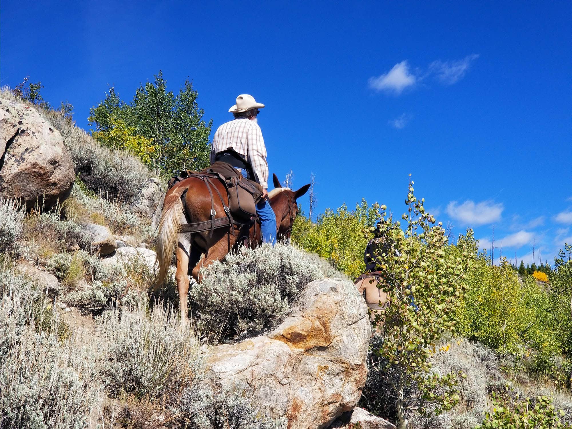
The trail then climbed out of Blueberry Lake and up the sides of another bald hill, though most of the balding appeared to be due to ancient fires—maybe the fires of 88? We reached Blueberry at 2:15 and got some water. From Blueberry the trail goes uphill through dry forest and fire-burned land, makes one switchback, and throws you out on a bald hillside with views of Blueberry and Boulder. Mom’s phone went off and it was client, so we stopped there while she attended to business. A couple of southern folks from Alabama passed us on horses. They’d recently been in the Gros Ventre just as I had.


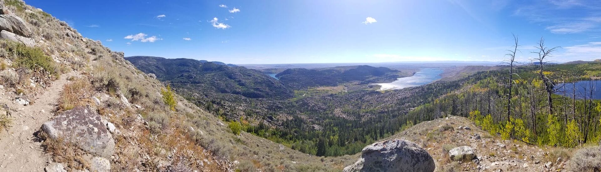


- Views of Boulder Lake and Blueberry Lake.
We discussed the forecast, which was for heavy snow and high wind in the coming week. They said that they were going to lay low during that time, but that the extended outlook was for an Indian summer. They left us at 2:52, but we’d end up seeing them again at 4:09 as they headed back downhill.
Ingressing via Blueberry Lake trail is exactly a mile shorter (9.6 vs 10.6) than going via Lake Ethel trail, but is much steeper. Thankfully, from the bald hillside, the trail is less steep and basically just continues straight into damaged forests, rising gradually. It’s exceedingly ugly, though.


- Above: mountains in distance feature Pronghorn Peak and Dragonhead.
At mile 5.1 you’ll be as close as you’ll get to Lovatt Lake, which is rather large but also burned to a crisp. We didn’t walk down the meadow to it because, well, it looked ugly. We did hear a gunshot, though. From Lovatt we went down a but to a pond, where an outfitting train went the opposite direction. They asked us if we’d heard any gunshots. We had and told them about it. Two members that they were supposed to meet up with were MIA, so they were listening for gunshots to locate them. I talked to a very old man on horseback and he said that they’d already bagged two deer that day! Good for them.


- Lovatt Lake area in first picture, rest are hiking near Cross Lake.
We were making very bad time for what I would have liked, but I was in much better shape than my mom, and we’d gotten a late start. I decided to simply view the whole thing as more of a stroll through the woods than anything exciting and plan-driven.
1/3 of a mile later we hit Cross Lake, which also isn’t pretty. There was a pond to the left, so we took the landbridge to a fork in the trail and then decided to go right. This took us to a nice camping spot on a hill which seemed outfitter developed, but which was away from the water. We decided to move on to Coyote Lake which was about 1500 feet away. Mom and I ruminated on how Trump does like word salad, but so do we in our own ways. (We were listening to the Reason podcast.) The shadows were deepening even though it was only 4:50, but so late in the season, darkness comes early.


- Coyote Lake Camp. Notice that I brought an apple handpie! (I shared!)
Coyote Lake had an abundance of ripe berries around, so we ate them, and the started searching for a spot to camp. We were beside a wet field that I didn’t really want anything to do with, but it did yield a small stream…which ended up being worse for water than the lake. I meandered behind a rock buttress and found a level spot for camping that was protected from the increasing wind, and which had some large, old-growth trees. Score! Mom was also agreeable to it, so we got the tent set up and a fire going as darkness fell.
For dinner, I had Backpacker’s Pantry mac-n-cheese, which is ok. It was the heaviest food item, so I wanted it gone first. We also both shared some cheesecake. I let mom use my brand new Big Agnes Q-Core SLX while I used my very new Air Core Ultra. My Jetboil MiniMo had issues with assembling and disassembling, but we saved the “why” of it for the morning.
Day 1 Totals: 6 miles, +2627/-388.’ Elevation min/avg/max: 7303, 8734, 9602′
⤑25th: North Fork Lake and Lake Victor
The morning was cold, so we slept in for a bit, then decided to make a small fire to warm up. My MiniMo was bent…dang it. Fixable, though. By 1040 we were walking through forests rather than heading back to the trail, since backtracking and then taking the path all the way around the lake (and it swings even further to the NW) seemed silly. We effectively followed the nearby stream up through some very marshy areas and along natural, long-distance split-lines in the granite outcroppings.


At 9700 feet we stopped and I had to deal with some work problems from my phone. Mostly just working with some real baboons. Mom talked to a client, and I got the weather, which was bad, and then we continued on. Within a few hundred feet, we were on Highline Trail 094, having saved time, and listening to issues about school choice from Reason.
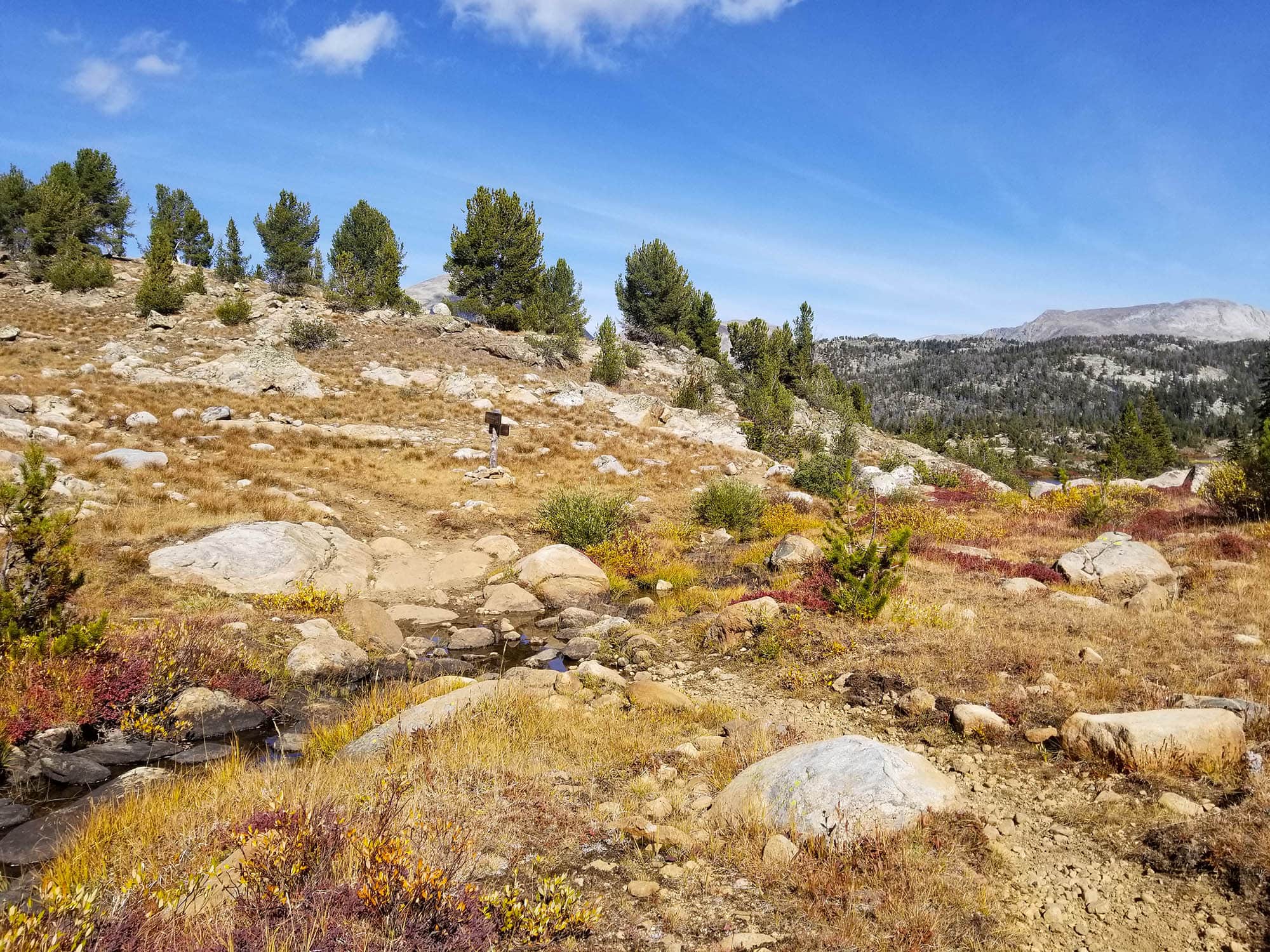
The trail itself…oh my. It’s dusty, not sheltered from the sun, and surrounded by thick, burned deadfall. It can’t make a straight line to save itself. Just so ugly. And places like Lake George…you never even see them. At Edmond Lake we stopped and got water, but there seemed to be no fish.

- Edmond Lake, named after my grandfather!
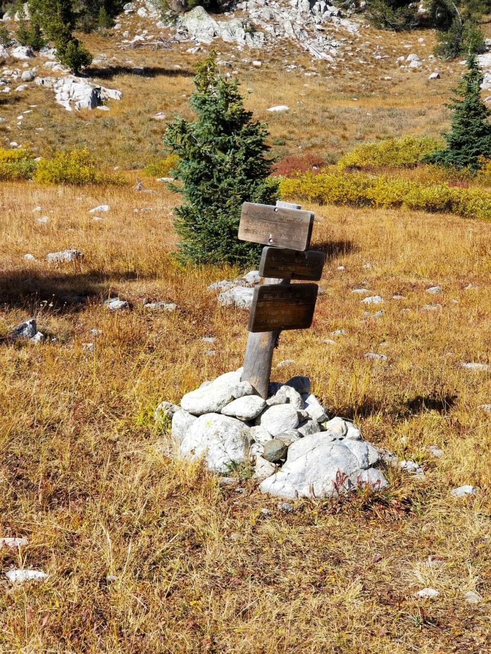
Shortly after, we walked downhill (saw some outfitters, booming season) and took the connector trail (115/164) to North Fork where it intersects with Ethel Lake trail 164, passing a few little ponds until finally, at mile 10.6, we entered into forests! Blessed forests. 1/2 a mile beyond that we walked past North Fork Lake, which is itself only a mile from Lake Victor. North Fork wasn’t very pretty as far as setting, but the lake itself had many great places to camp and was nice enough. If you’re walking the fronts, it’s a nice option, though Victor is better. I thought about walking the 800 feet to August Lake, but didn’t really feel like bagging a lake that wasn’t going to be pretty.
As a weird side note, there are two similar passes: Hat Pass and Hay Pass. It struck me as funny that they were so close together.


- The hike from Edmond Lake to Lake Victor.
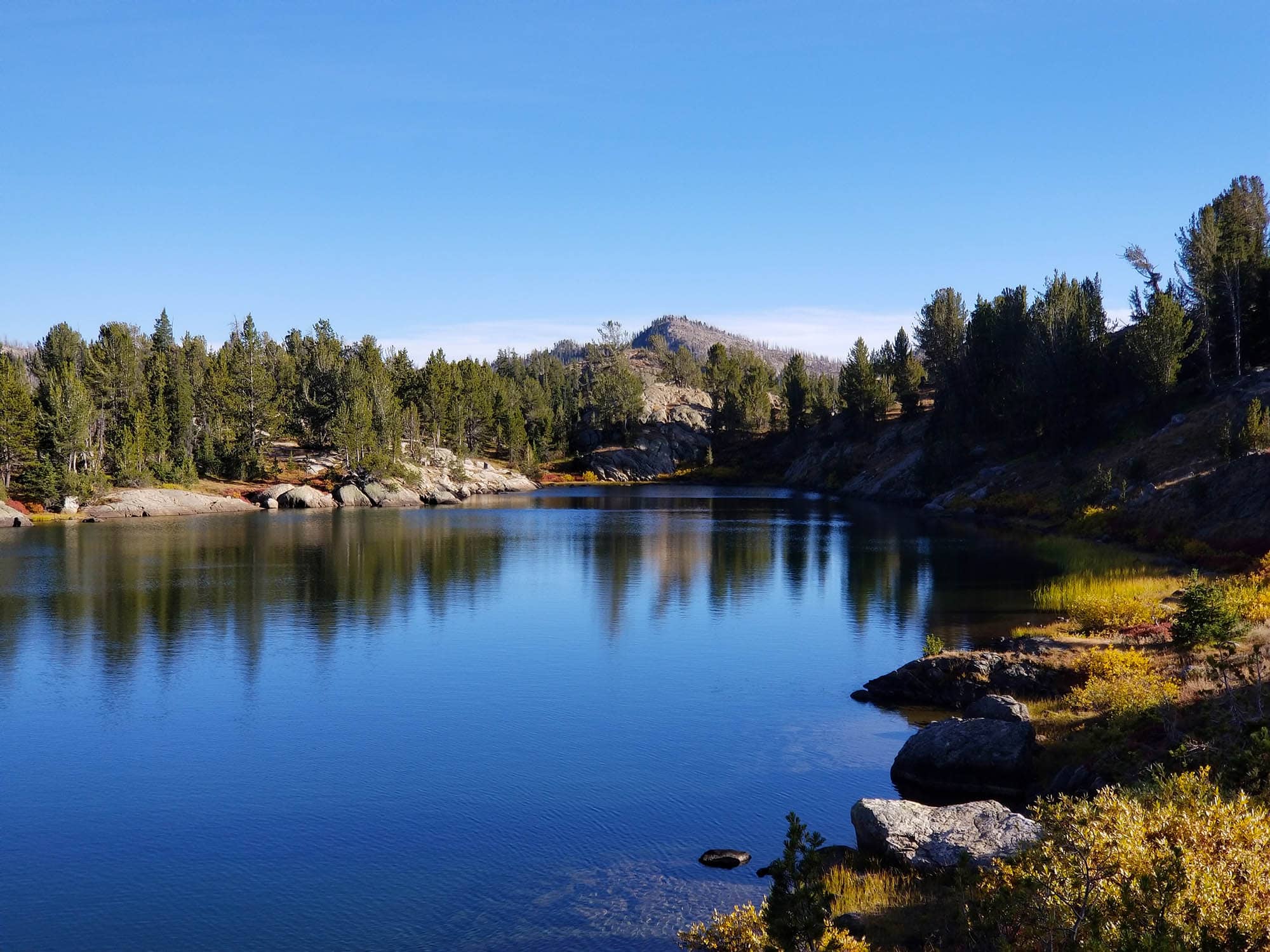
Lake Victor wasn’t ugly, but for the Winds, well, it was nothing to write online about. Dang it! What am I doing? We decided to camp on a spit of land, and found a nice spot somewhat close to the water but very protected from wind. We set up camp and I hooked a number of very large trout, but they were very languid. Giving up on that endeavor, we decided to walk to the inlet which comes down from Glacier Lake (after following a long horseshoe around the mountains).
The area around Victor is very nice for camping, with plenty of meadowy areas surrounded by stands of trees, and all sorts of places to sprawl out. We also found plenty of spots that outfitters had developed, though one place was very close to the water and had been worn out by excess horse and mule packing.
The inlet itself was nice, with excellent visuals of Round Top Mountain and the pass to Timico. We both regretted that we wouldn’t make it to Timico, and realized just how much we both didn’t like this trip. In the sandy areas along the shore, we saw many elk prints, and I fished for a while before realizing that nothing was biting.


- Of most note above is the pass to Timico!
We made our way back to camp the way that we came, since it was shorter, and regretted not having time to see Valley Lake. On the way back, I found an old solar charger…it still worked! Wow! Tough boy.
We made it back to camp around 7, and the forecast winds never arose. It was a cold night, though!
Day 2 Totals: 8.8 miles, +1446/-1150.’ Elevation min/avg/max: 9458, 9826, 9989′
⤑26th: Lake Ethel Trail Return
I hooked some more large trout in the morning, but caught none. The only possible reason to camp here must be for the fishing. We were walking out by 1100 and stopped by North Fork on the way out, but saw no fish. There we contemplated taking Trail 094 to Lake Winona and out via Lake Vera and 113, but that didn’t seem like a worthwhile endeavor given the increased mileage.


- Victor, Victor, Victor, North Fork, North Fork


- Macs Lake,
- above Perry Lake,
- Perry Lake,
- Lake Christina,
- hiking,
- raspberry,
- Eds Lake x2,
- Ethel Lake x3,
- Trail and bridge to Lake Vera.
We walked back to where we’d seen some outfitters the previous day and passed Macs Lake. Not pretty. Then Perry Lake…not pretty. It was all boulders and dust, this Lake Ethel Trail 164, and not pleasant. Around Lake Christina, we listened to a Ted Talk on the most important question: What if God exists? The presenter rambled into postmodernism, concluded that truth was nothing that could be known, and that such an important question was actually not worth thinking about. What an idiot. (I say that while wishing him well, but postmodernism is a blight.)

- Ethel Lake outlet.
At Eds Lake we got some water and I started to think that my filter wasn’t working right. The water tasted like sulfur and mud. Yuck. Finally we reached Lake Ethel…also ugly, but with a pretty outlet. From there we descended Boulder Canyon Trail 113, which I’ve hiked before, and which has great fishing at its lower reaches. We were running late (mom stopped to talk to my half-Venezuelan brother about some life issue that came up), so we didn’t fish, and pressed on, passing the mosquito factory zone (beaver dam area), through the dust and out to the trailhead, which we reached at 5:38PM. Ours was the only vehicle.


Day 3 Totals: 13.3 miles, +1014/-3560.’ Elevation min/avg/max: 7303, 8679, 9869′
➤Conclusion and Rating
I didn’t like this hike. It’s long, winding, not made for easy walking, exposed to the sun, dusty, arid, and with terrible views. Its only redeeming feature is the fishing (maybe), which went poorly for me. I didn’t HATE it, which implies actively wishing it to never exist, but I’d certainly never do it again, and you shouldn’t do it in the first place.
- My scientific rating system. I didn’t like this hike. It has little or perhaps even no value for the area.
- Beauty. Ugly all the day long.
- Camping spots. Not pretty for most of the hike.
- Crowds. No one wants to be here.
- Difficulty. Strenuous. Hot. Dusty. Interminable. No reward.
- Fishing. A spot that tries to be bright in the midst of dark clouds.
- History. Fires.

4 thoughts on “Review: AWFUL—30 Miles to Lake Victor and North Fork Lake”
Appreciated your comments and pictures. Agree some, however, disagreed more. Yes the burned areas were not a highlight. But we took some of the best pictures we have done anywhere. Various scenes of the boulder canyon river and of Victor Lake were exquisite. The trail switchbacks up the steep canyon side out of Boulder Canyon were well constructed and easy to ride. We loved the camping sites and fishing at Victor Lake. The scenery and vegetation color between North Fork Lake and Ethyl were hard to beat. The worst part of the area for us, considering we were on horseback, was all the trails chocked of with dead fallen trees. We plan to go back.
Greg, thank you so much for leaving such a thoughtful comment. It really made my day. Someone emailed me some time ago with a very similar comment to yours. I am very appreciative that my own negative experience was redeemed by the good experiences of others. I wonder if I would have found it more pleasant if I’d been riding–might have to take my daughter up there some day and see if I can change my opinion via horseback.
I also agree that that the scenery color is pretty amazing, so perhaps my attitude at the time was a bit less than stellar.
Oh, and a last note: if you liked the colors, I would highly suggest a fall horseback ride to Simpson Lake, if you haven’t done it. The OHV trail makes ingress unpleasant on foot, but if you have horses, that area is the place to be.
Blessings,
Lucas
Love your trip reports! I completely agree on your conclusions on this one. A buddy and I went to Lake Victor area from Boulder TH in Aug 2019. Our purpose was fishing. We caught small fish in North Fork and Victor. There were a couple of other lakes on that trip that ended up being worth fishing. But, overall, not worth it. You missed nothing regarding scenery or fishing with August or Valley lakes. We’re not going back. God bless. Thanks.
Thank you, Shoe! I’m glad to know that I didn’t miss much. Sometimes I’ll get mail from people telling me, “Man, that hike that you hated was great from us,” but this one takes some real doing to overcome the pertinent negatives. This summer I’m hoping to spend more time over on the east side of the range, as well as some of the far northern reaches that I’ve only zipped around.