MacLeod Lake (also spelled McLeod and Macleod) is a scenic lake in a rocky bowl best accessed from Swift Creek Trailhead by those who win competitions climbing the Empire State Building and by those who just hate their lives and want them to be a little bit more miserable.
➻ Quick Facts
Info at a Glance
- Date of Visit: Early August
- Notable Features: Swift Creek, Macleod Lake
- Total Miles: ~9.8
- Elevation Gain/Loss: +/-3968′
- Elevation Min, Avg, Max: 6800, 8473, 10230
- General Route: Swift Creek Trail, MacLeod Lake Trail (unofficial)
- GaiaGPS Page for GPS Track Download Grab a free Gaia account to download the GPS file for your phone or Google Earth. (Under “data.”)
- Images: I deliver pictures via a CDN at low quality to save speed and increase speed. Feel free to contact me if you’d like full-size images.
Interactive GPS Map (Click to See)
Elevation Profile

⤷Introduction
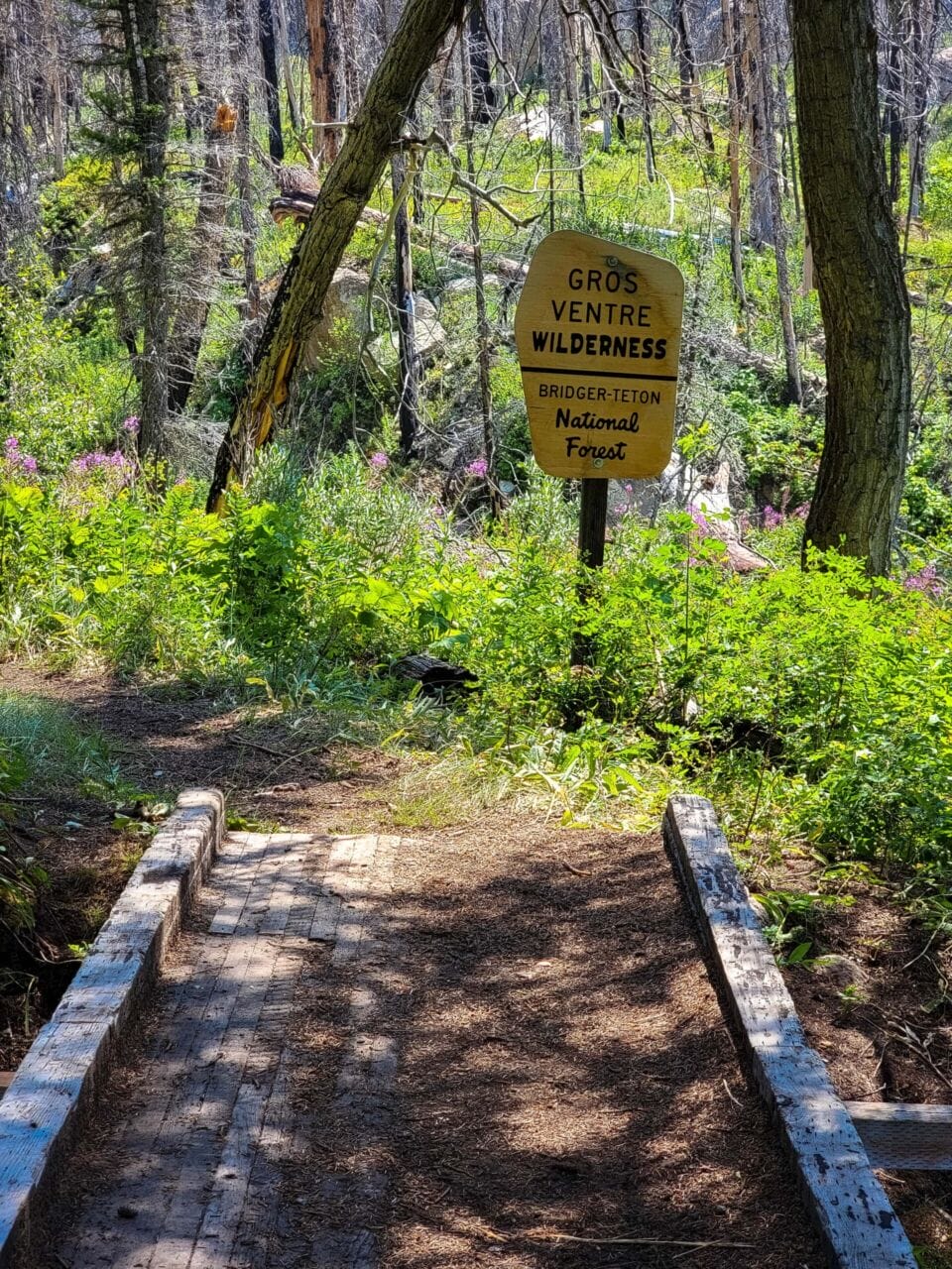
Because of the lack of staffing and number of operations, I was unable to acquire anything less than 6-on-1-off at work. My wife was gracious enough to suggest that I take my day off to go backpacking. My hope was to be off by 5PM on Saturday, head to some trailhead, and then to hike for an hour or so, using the next day to hike to some lake, and then a rapid exit and back to work on Monday by 1:15PM. When it came to the day before my hike, I realized that I probably couldn’t make any trailhead until 730PM given traffic, so I ended up scrubbing that. Instead, I decided to hike up to MacLeod Lake in the Gros Ventre and camp there overnight.
MacLeod Lake has no official trail, but I’d heard that there was a path to it. After downloading a variety of maps for it on Gaia GPS (the best ended up being Satellite with Labels) and Avenza (Grand Teton National Park/Jackson Hole, Wyoming Trail Map by Adventure Maps, Inc.), I headed out Sunday morning for the quick jaunt. I was recovering (and still am as I type this) from some sort of lung infection/sinus/ear thing. Still, working 6-and-1s into late September, I needed some time to hike.
⤑Day 1: Hike in to MacLeod Lake
I got to the trailhead near Granite Hot Springs at 11. There weren’t many vehicles there, which I prefer. I dislike being around too many people. (This little, digital scrapbook is good at not having visitors, too—hi mom, I know that you’re snooping to see what you, Hank, and Peggy can do! Don’t do this one!)
The day was hot and smoky from the wildfires in California, and I knew that I’d be going through lots of areas of burn. Since I’m as white as the driven snow, I always clothe up as much as possible. Today, my long sleeves and hat felt very hot, but there was nothing for it, so I set off uphill, taking the trail nearest the sign and on the trailhead side of the creek. (Another trail goes immediately across Swift Creek, but they both go to the same places in the end.) About 0.4 miles into the hike I came across a creek crossing and took it. This involved a terrible leap that I barely made, and, on the other side, I quickly realized that this wasn’t the official place to cross. I found that a couple hundred feet upstream. It also led the stupid way to Shoal Falls that only imbeciles or the exceedingly, confoundingly lost trek. Oh well.


The hike from there went through burned creekside. It certainly wasn’t beautiful or shady, but there were plenty of serviceberries and thimbleberries, which I grazed on as I went. Just short of a mile into the trip, a family passed me outbound. They were all wearing packs but it was hard to tell if they were coming out of the deeper Gros or from MacLeod. They politely let me stumble by them.


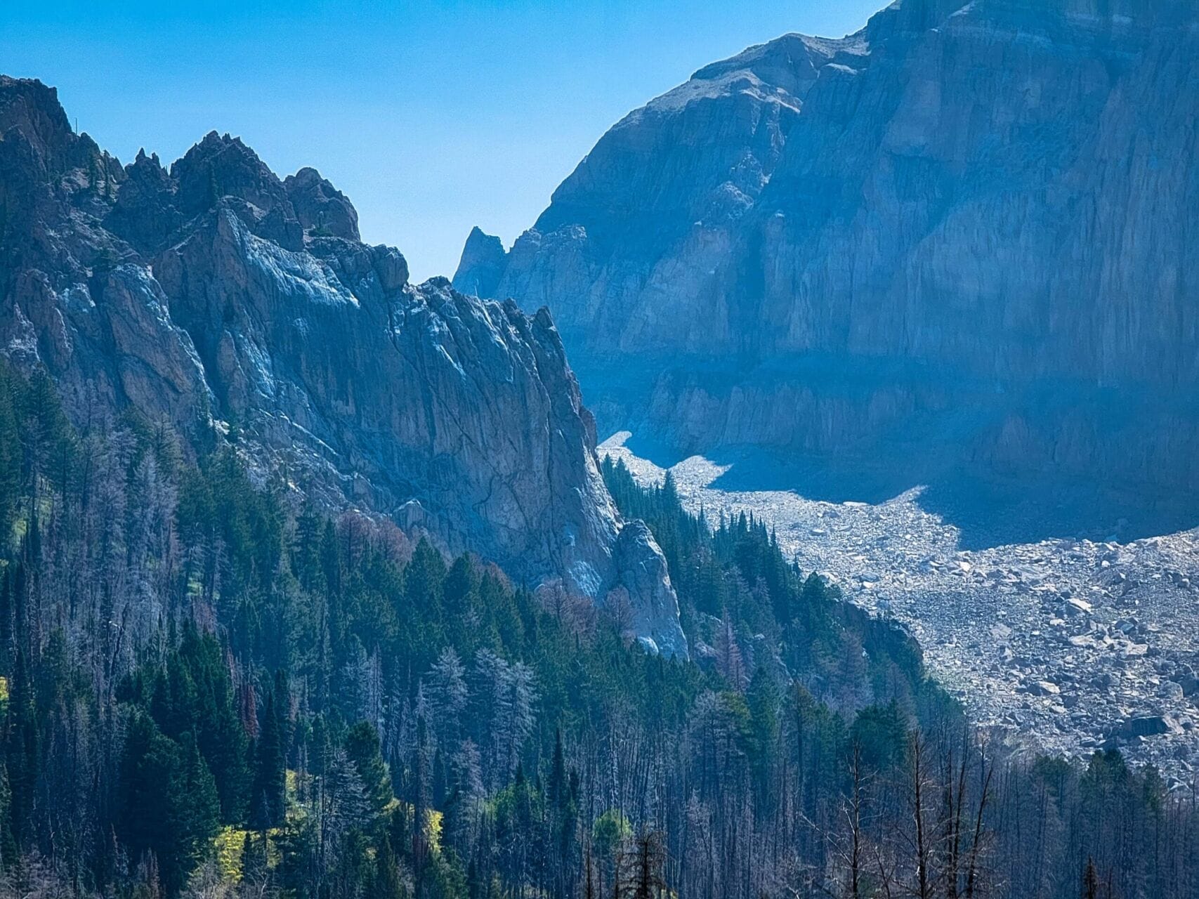
A half mile past my meeting of the family, I crossed the creek and soon found myself at the unofficial trail leading to MacLeod. The mountains had looked inhospitable from the parking lot and didn’t look better as I continued toward them from the fork. I made my way through fields of broad-leafed vegetation which rattled slightly as I brushed past. While I’d already climbed up 800 feet, it was clearer and clearer that I was about to become very miserable indeed with the elevation gain. To the west, limestone cliffs looked down on me without care.


Still, soaked with sweat I pressed on. Entering a brief stand of trees, the trail petered out, with two vague paths going different ways. I went uphill while going in and found myself orienteering toward where I thought I might pick up the actual trail again…soon the little path I was on was gone entirely. How strange.


And as suddenly as it had vanished, as a tendril of smoke in the wind, it was back. It wasn’t back as good as smoke from California, which nearly chokes you to death, but it was back. After entering a field, it decided to show me a lack of respect and climb sans switchbacks…I shortly after decided to sit down and read my book. I was already coughing from what variant of COVID was attempting to lay me low, and thus reading seemed a fitting way to ameliorate my desire to simply perish on the spot. (I continued such breaks intermittently, as I found it a worthwhile solution.)
After climbing through more fields, I recognized that I was going to lose sight of the trailhead, where my lovely, filthy, little Jeep Patriot remained in my absence. I took a picture or four of the scene, and then walked ten feet, which led me to a sigh of rage: the trail plunged down probably 70 feet, all of which I’d have to regain. I was still carrying a bottle of water (hadn’t been sure of the agua sitch), plus I’d brought all of my Canon gear, so I was none too pleased. But plunge down the path I did, which led me to two…marshy, trickle crossings. I avoided getting wet, but they could scarcely be called creeks.


Below: My Jeep from various zooms as taken from my phone.


Beyond this it was into some forest, where I soon after reached a dry stream crossing. Multiple trails exist throughout the area, so one simply picks one’s preference and presses on. I still wanted to lay down, snot myself to death, and decompose, but I just kept going…until I got to the rockpile (you will know it), which had a steep ingress. Again I stopped to read. The cliffs above me seemed taller than the sky, and yet I knew that I had to climb well above them. What had I done to myself?
Below: The rockfield crossing.


Given that one cannot stop forever, I soon got back up and negotiated the field of rocks and slidey pebbles. This was better than what followed: a completely dry creek/avalanche chute that one could not get near thanks to steep, dirt walls. It was filled with large boulders. The trail obviously went left from my position, but a small one kept right…perhaps I could not go over the ridge so far above me? Well no, I could not not go over it, so I ended up on the trail heading up. It was scrabbly and so steep that I could not look up. As I climbed, I muttered, “Please let it end.” It was immediately after I said it that a man carrying a 357 said hello to me as he carefully made his way down.


“Are you going overnight? Oh, it seems you are,” he commented. We said goodbye and parted ways. Eventually I made it to the top….where I then had to go back down to the creek/avalanche chute. The climb on the other side looked terrible. I calculated how far I would need to go in multiples of 500. Blast. A lot of up still.
I had some water at the dry bed and ate some jerky, then crossed and headed uphill. A gentleman with a fishing rod passed me heading out. Like the man before him, he didn’t seem happy, and it was obvious that this was a day hike for him. One heck of a hike!
At the top of the switchbacks, the area became very karst-y, with limestone sinks all around. I made my way toward a little pond on my map, hoping to get more water. Perhaps, if it were attractive, I’d set down my backpack and set up shop there, going farther without the weight on my back.
The pond was scenic and it was obvious that plenty of others had camped there. A couple of little streams entered it to the east, so I gathered water from them after ditching my backpack. Following some internal debate, I decided to continue up to MacLeod with my entire pack. The views were likely to be better, though the lack of trees would surely make the camping less pleasant. I just couldn’t get within 3/4 of a mile and drop my plans.


With newfound strength—wait, no, I didn’t have that—I headed kind of back toward the trail, though at an angle to offset some of the backtrack. A creek erupted from the ground and then made a waterfall down into depression [considering how bad this hike was, not sure if you meant to say that or not–ed]; on the other side of the ridge, where I’d hiked with Beatriz, we’d found the same thing, but with a cave attached. Beside this feature of karst topography were two velveted bucks. They got within 15 feet of me before noticing and bolting, but I was able to get a picture when they stopped about 100 feet away.


And then I kept going up while listening to the Futility Closet. Those folks always keep my mind off of the pain. A few creeks existed intermittently here and there, but I was still plenty juicy [this is just gross–ed] from the previous water stop, so I advanced. The trail follows the edges of a rockpile, and it seemed that I might have to go over parts of it in the near future. I wondered if it was worth cutting straight up along the piles, but decided that such wouldn’t be worth the effort.
I’m glad that I didn’t, as upon leaving the forest proper, the trail became actually pretty decent. It was intermittent bouts of small climbs that were easily accomplished and split far enough apart that I didn’t feel any grueling impact. I still stopped to read every now and then, and also got a tiny bit of service, so I texted my beloved wife. (Always save that sat data when you can.) Even the areas of rock piles were absolutely docile and mostly well-established.


I climbed a high point and observed the lake nearby: it sat atop a bowl lined with trees near its steep edges; an impressive gash for its creek ran out of the limestone, though the creek soon disappeared back into its subterranean recesses. With MacLeod in sight, I made my way back to the trail and soon crossed MacLeod Creek, making a beeline for a small stand of trees by which I might camp.


The wind was picking up as I approached the wayward grove, so I very much desired those little trees to accompany my presence. The stand of spruces had been stripped of their lower branches, probably for fuel, and had a small space inside where one might put a 1-man tent; some large boulders around the trees would provide extra protection from the elements.
My tent wouldn’t fit among the trees, and I wasn’t quite sure that it was the best place to be yet—an open field led to the trees ringing the bowl in which I stood, and alongside the lake to the west were some little ledges that had some trees. Perhaps they’d be a nicer spot to park it. I meandered down to the lakeside and up along the little ledges. There were plenty of places to camp, but none of them were better than where I already was, and the way down to the lakeside was steeper. For the lawbreakers among us, the best place to camp was right by the lake on a grassy patch in the southwest. I try to abide by the restrictions when I can, so I didn’t camp there.


After making my way back, I went on over to the tree-lined ring to see if there was cell service. There was not, so I got out my Somewear and sent some messages to Yurena. Then it was camp setup time with my brand new Big Agnes Copper Spur Ultralight High Volume III. (UL HV) This three person tent weighs in at about a pound per person, making it heavy for a single person tent. I’d loaned my Big Agnes Copper Spur UL HV II to my mother for a backpacking trip she was on, though, so I’d bought the 3 person in anticipation of Yurena hiking with me. (My mother then bought her own afterward so I needn’t have done that.) Anyway, I ended up with a heavier but exceedingly luxurious tent.


Setup went quickly, but the soil didn’t take stakes well. Despite that, it held its own in the wind. I got everything ready for the night (including my new Wind Hard, as Yurena accidentally totaled my old one, and my trusty REI Magma 10 bag), then took my tenkara rod to go fish in the lake. The wind was bad, but I did get a nice bite. As soon as I went to put tension on the fish, the base of the rod broke apart. Oh well! It was cold and windy, even with my coat on. At least I almost got one.


With fishing nixed, I started getting plenty of water, about freezing my hands off. Macleod Lake has very little protection from the wind. I’d brought Propel packets and boy did the water taste good, even if it was frigid outside. My dinner for tonight was a little Jackson Hole Buffalo Company jerky, some jalapeno Cheetos, a cherry handpie, and a meal I’d never had before—Peak Refuel’s Homestyle Chicken & Rice. While I was making it, I listened to some physicians, including the creator of the mRNA vaccination method, talking about over-vaccinating with the new vaccine technology.


Let me just say that the Peak Refuel meal was a BLESSING, as was the rock to eat it on. I mean, it was really, really good with a little salt and pepper, and it cooked perfectly. I only wished for more, it was just that tasty. I highly, highly recommend it. My goodness! After finishing the food, I washed up and put on the remainder of “The Good Liar,” which I’d started on an international flight the year before. I probably shouldn’t have, because I ended up staying up until past 11, and I worked the next day.


When it was done, I hit the hay to the wind howling against my tent. It really helped me sleep quite well.
⤑Day 2: Hike Out


The wind came and went throughout the night, but was merely a mild breeze by the morning. I got up at 0630, but it was cold, so I read some more and started packing my tent at 0730—hands went numb again. I got that done and slurped up some more water, hitting the trail out at 0845. The Futility Closet kept me company, teaching me about the first hippo in Great Britain. My legs were ridiculously tired going downhill and felt shaky, plus I was still snotting, but I knew that I could make it.


I had to work 11 miles north of Jackson Hole at 1PM, so I had incentive to make it fast. Still, a couple of times I stopped to get pictures, as the smoke was gone. I could see Bondurant which surprised me.
Intermittently I chose to run to make up for the portions of the trip where I had to go at a crawl given the steepness. I figured that I’d make it out probably in 2 hours or so, but I was worried that I’d be late, so I kept a hustle in my step the whole time. I reached the trailhead just before 11, so it was a pretty good pace down the mountain. I didn’t encounter anyone until I got to the parking lot.


➤Conclusion and Rating
This hike was truly miserable for me on the ingress, and not just because I was sick. It wasn’t pretty and seemed more daunting than any I’d done before, but I have to weigh that against not having walking pneumonia other times. I think some of it was the stress of wondering if I could make it back in time for work, but a lot of it was just the long walk through burn and then having to climb the Empire State Building a few times. It’s not really pleasant given the other hiking opportunities nearby that are also overnights. Overall, I don’t think that I can really recommend it, but you’d still have great memories from the trip. I certainly won’t do it again, though, because there are simply much better options in the same mileage category.
- My scientific rating system. I made good memories on this hike, but wouldn’t do it again.
- Beauty. It’s not a beautiful trip at all. The lake itself is scenic in a Coloradan way, but nothing to write home about.
- Camping spots. There are plenty of spots to camp, but none of them are super appealing. Well, none that are by the books.
- Crowds. I saw 2 people, both day hikers who didn’t seem happy.
- Difficulty. Strenuous. There’s almost 4000′ of combined elevation gain over a short distance, and much of the toughest parts are scrabbly.
- Fishing. You can!
- History. None.
Let me know if you have any questions. I’d love to help you do more with that time of yours, and I’m here to serve you!
