Little Sandy Lake is an adventure, but is it a good one? The road to the trailhead doesn’t want you to know the answer to that question.
➻ Quick Facts
- Date of Visit: 8/24
- Notable Features: Little Sandy Lake, Larsen Creek
- Total Miles: ~9.6
- Elevation Gain/Loss: +/-2579
- Elevation Min, Avg, Max: 8836, 9439, 10194
- General Route: Little Sandy Lake Trail 133
- GPS Download Grab a free Gaia account to download the GPS file for your phone or Google Earth.
- Images: I deliver pictures via a CDN at low quality to save server size and increase speed. Feel free to contact me if you’d like full-size images.

⤷Introduction and Notes on Forest Road 889 Trailhead
I have completed Little Sandy Lake Trail 133, and once attempted Little Sandy Lake Trail 098 from Forest Road 889’s “trailhead.” Both of these trailheads are basically abandoned with no upkeep on the roads. My Jeep was only able to make it about 1/2 a mile before the road became impassable due to boulders. Another road, 887, seems to head toward 889 on the map I use, but is shown to vanish. Satellite imagery shows road 887 having a connector road, 888, leading to 889, but crossing a creek in the process.


- Forest Road 889
Given that the lower section of road 889 was so terrible, I have never explored 887 or 888, and never made it to the upper section of 889. Some maps list the Little Sandy Trailhead as being at the terminus of 889, rather than of road 890, which is the only one I’ve been able to use successfully.
⤑Little Sandy Lake Hike
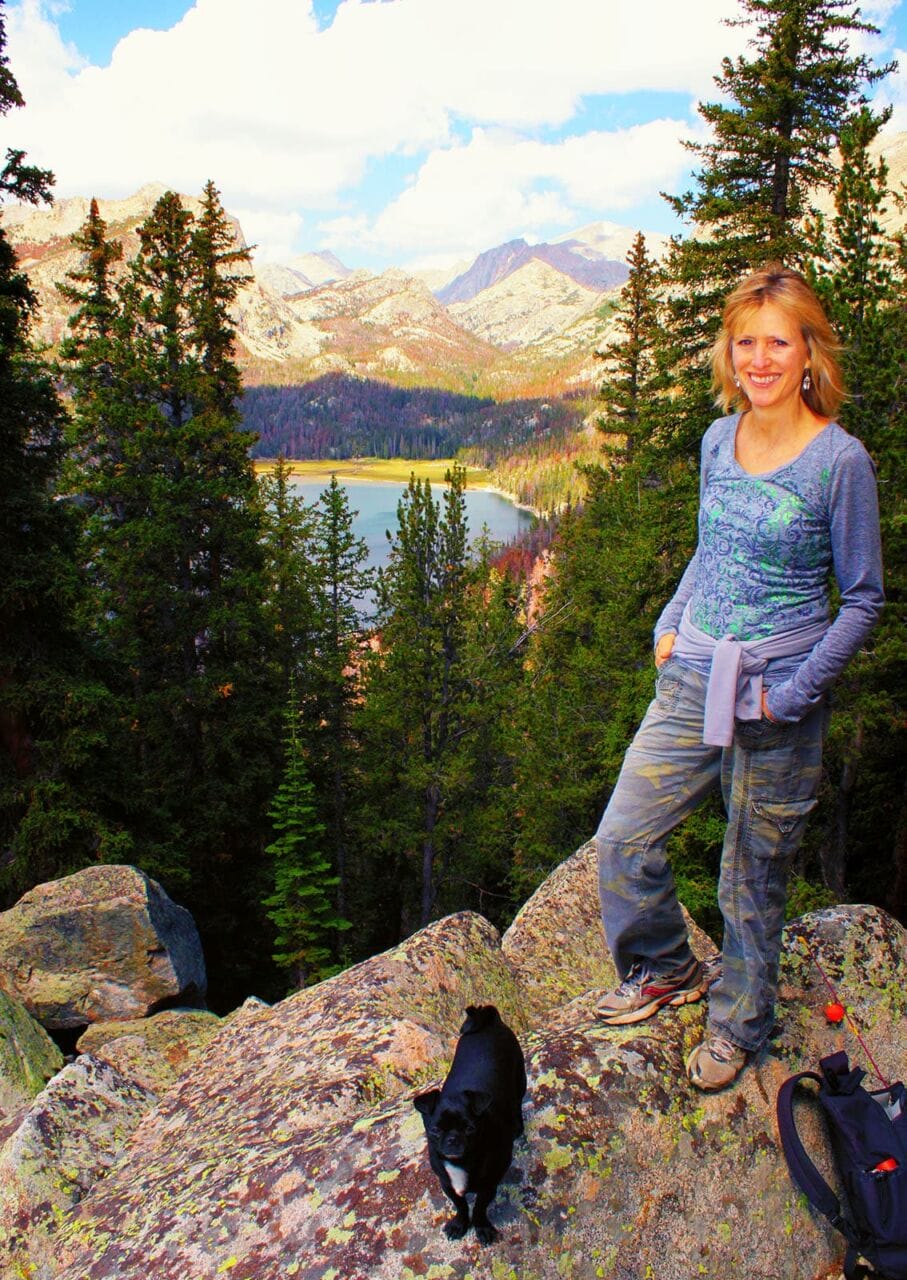
Whenever we can, my mother and I like to hike together. My sister used to join us, but has fallen out of the hobby mostly due to some medical issues. This was a time when mom and I could hike together, and even take Chadillac Fancyfoot with us, our chug dog who loves hiking like nobody’s business.
Getting to the trailhead was a horrifying experience. Even in my shortbox F-150, I thought that we might not make it, as my Jeep had not made the other trailhead. The ruts, boulders, and even cliffy ledges that we had to drive over were intense. At one point my mother got out of the truck out of fear of it rolling over. Anyway, you’ll work for this one.
Far before we reached the trailhead we found a Subaru that couldn’t make it, and were both surprised that it had made it that far. The trailhead, such as it was, appeared abandoned by the government, but one truck was present.

- Near the “trailhead.”
Around noon we began our journey on foot, mostly in scrub trees that were not pleasant to behold. After a couple of hills, we came to a meadow with a decent bridge over the marshy area. That was unexpected! Beyond this, the trail remained in the remnants of old fires, which I can’t say that I appreciated much, but as it approached Larsen Creek, we entered into older growth. Users had previously noted many downed trees across the path, but we didn’t see many of those. Sadly, even a number of the old -growth trees were dead from beetles, so even the dense forest was still an ugly experience visually. The relief from the sun was nice, though!


- Larsen Creek and the beautiful forest past it.
Crossing Larsen Creek at mile 1.75 presented an opportunity for water, which we collected from the stream. I also found a Continental Divide Trail placard on the ground, which I left for the time being, and determined to pick up if it was still there upon my return. From there, we climbed almost 1000 feet over about a mile and a half to the ridge above, which had a tiny meadow. Why do I mention it? Because it was pleasant to see some green grass after being in the ugly browns and greys of the dead forest.


- The trail down is pretty ugly and doesn’t reward one with especially great views of the lake.
We both briefly noted that climbing Mount Nystrom might be a pleasant activity at some point, as it has gentle slopes covered in rocks, and now that time has passed and I’ve hiked Coon Lake, I think that it could be a way to access Coon or Tayo…if you really hate yourself and are in league with Satan’s angels. Since one doesn’t get a great view of the lake from the trail, I’ll include pictures of it from near Coon Lake and on top of Wind River Peak. That hike was my favorite hike ever.


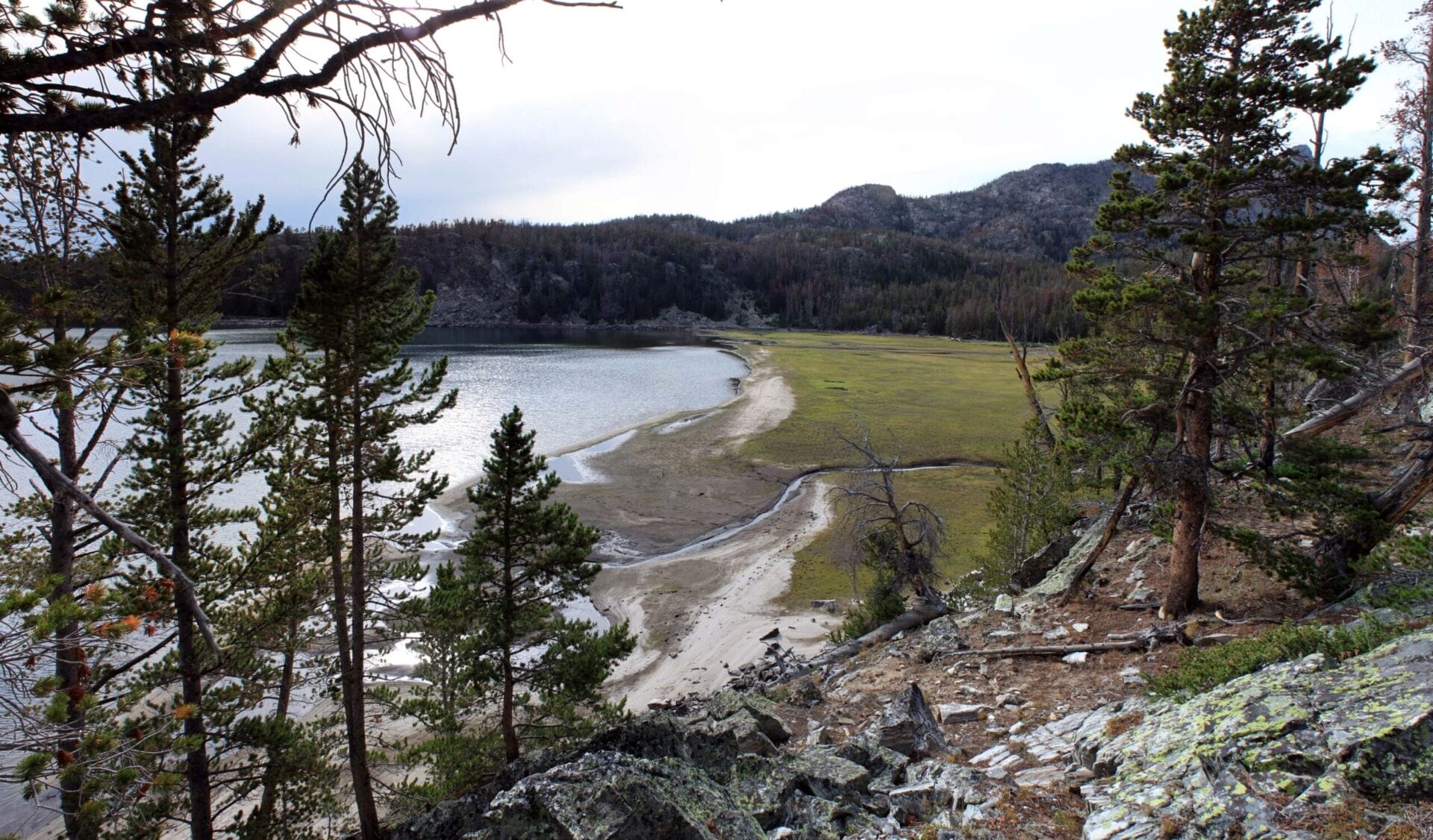
Although the walk wasn’t taking too long, and we’d been averaging about 2MPH even with little Chaddy, we both wanted it to be over sooner rather than later, so after taking a couple of switchbacks, we picked up Chad and walked down the steep, forested hillside to Little Sandy Lake, rather than following the trail. In the late season, the lake has a large, sandy beach, but in times of higher runoff, this is completely missing and the waterline is up to the trees. The northern edge of the lake fluctuates seasonally by a whopping 700 feet! Thankfully, we were visiting during low-water, so it was easy for us to navigate.


- Southern beach of Little Sandy Lake.
As we made our way along the eastern shoreline, both of us talked about how we’d like to explore the Little Sandy drainage, which seemed more interesting than the lake. We didn’t have time for that, but we did have time to fish. Only one fish seemed to be in the whole dadgum thing, though, and it mostly kept attacking the bobber rather than the bait. Switching to a lure, it wasn’t interested at all, and I didn’t have any of my fly rods with me. Eventually I caught it, and for a brook trout it was pretty nice. I’m not a fan of brookies for the most part just because of how prolific they are—give me a brown or rainbow any day!


- Low water and Chad!
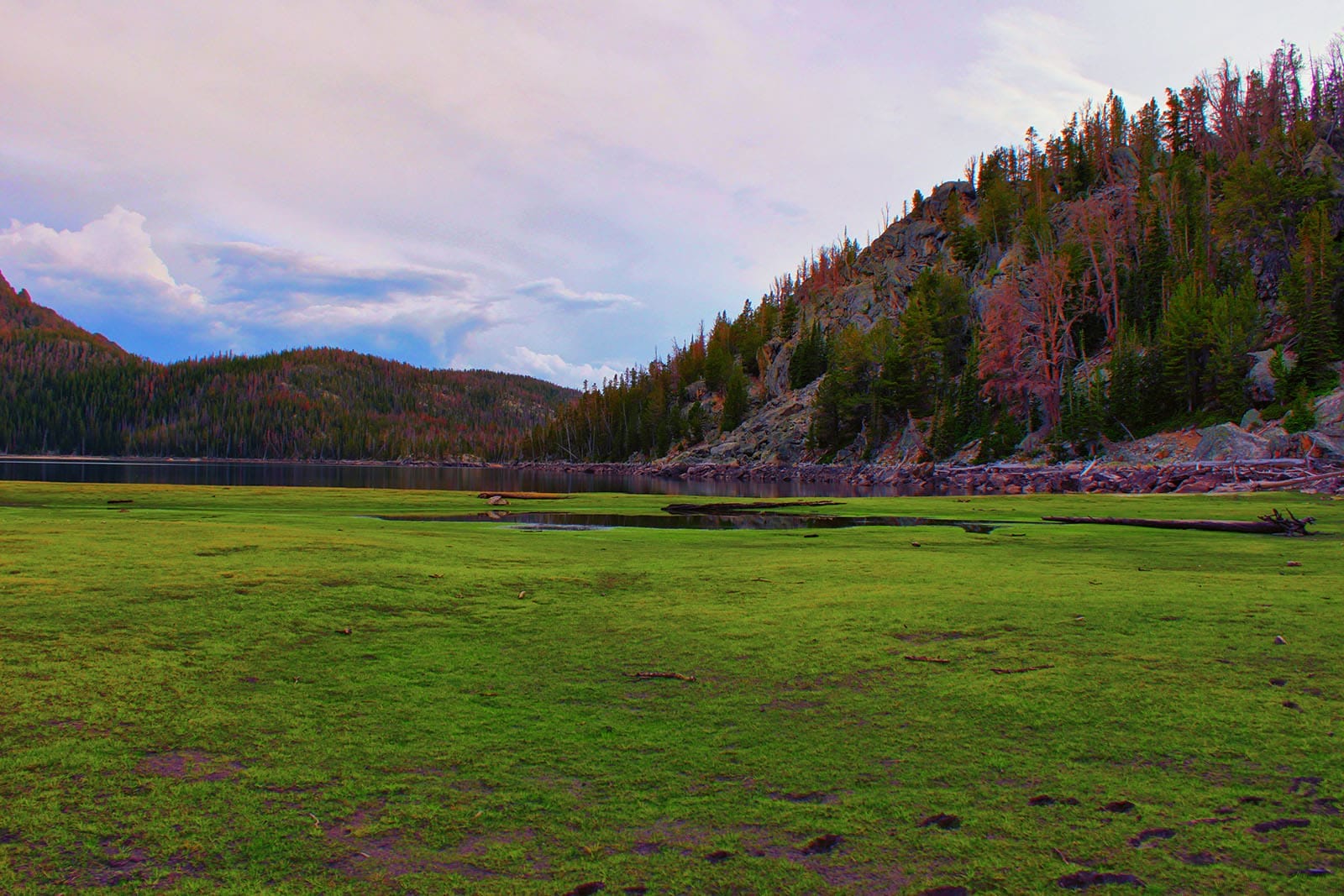
We continued along the eastern edge of the lake, which entailed a few excursions up rocky banks, but at this time of year was mostly along exposed shoreline. My reconstructed file (the GPS program I used was killed off, oof) doesn’t show that, as I didn’t want it to look on the satellite view like I’d been swimming around the entire lake. Toward the northern end of the lake we had to climb a small cliff, and then descend it, but it was nothing too bad. The exposed shore here was almost 700-feet deep and mostly covered in grass. It was marshy in areas, so we went up to the forest to cross the inlet, where the stream was also much narrower. Chad required assistance across!


- The northern shore. It is often underwater.
After climbing cliffs to the west, we found the trail that takes one up to Temple Pass, so we took it back toward the vehicle. Although it wasn’t on my map, I knew that this was called the “Loop Trail,” but as with many trails in the range, depictions of it vary. As we tromped along we heard…music? Somewhere someone had brought speakers into the wilderness. That’s a lot of weight, and I typically don’t do that so as not to disturb anyone else’s experience. I have engaged in the practice exactly one time, now that I think about it, but it was in an area where my hiking partner and I knew that we were alone, and we didn’t play it louder than we’d talk to each other, and even then we didn’t play music, but a podcast.


- Cool, right?
At the south end of the lake we found a channel of water that led to an old dam. I saw something similar at Divide Lakes but still am unclear on the history behind any of these structures. There were numerous mining claims, but for this one at least, the concern seemed limited to water retention. We got some pictures with it!
The trail then climbed back up toward the ridge, though we abandoned it for a bit as it was not the greatest pleasure underfoot and we reckoned that we could shoot straight up the hill and reach the top of the ridge faster. This proved to be true, and we reconnected with the path over halfway up.
Walking out was fine as it was downhill, but Chad ate a bunch of dust. Poor feller! The CDT placard was still on the ground, so I scooped it up. Another placard later on seemed to be about to fall down.


- The walk out isn’t beautiful.
Back in the burn area we were accosted by nighthawks, which make a very loud and scary thumping sound as they pelt you from above. I believe that the sound is accomplished by harmonic resonance of their wings.
We got back with the last light fading and drove to Rock Springs, where my mom lived. The drive took about 3.5 hours due to the incredibly terrible road.
➤Conclusion and Rating
Little Sandy Lake holds little appeal. During low-water season, the beaches are nice in a couple of areas, so it might be a decent spot to take younger hikers as a first overnight. There are much better options in the Winds to accomplish that goal, including Slide Lake (12 miles), Upper Silas Lake (8 miles), Divide Lake (different than the ones already mentioned, 8 miles, and also mentioned here), as well as Blue Lake and Black Joe Lake out of Big Sandy, which are around 12-14 miles each. Big Sandy itself is too crowded for my tastes.
- My scientific rating system.
- Beauty. Very little.
- Camping spots. You’ll find spots to park a tent, but none are gorgeous.
- Crowds. This is a very low-use area.
- Difficulty. Moderate for beginning hikers, easy for advanced hikers.
- Fishing. Brook trout.
- History. A dam.

2 thoughts on “Review: Little Sandy Lake Day Hike”
Thank you for this. When I was a 12, my scout troop horsebacked into here and spent a week for High Adventure. I wasn’t technically old enough, but my dad and my best friend’s dad were leaders, so we got to go along. Will always be some of my best memories. Unfortunately there aren’t many pictures left from that trip (just one really, from on that cliff above the NW shore you mentioned. It was framed on my dad’s wall until he retired, and now is on mine. Cherished!) so it is awesome to see yours. Especially how you described that rock dam. We had almost the same conversation when we were there in the mid-90s. Not the best destination for expansive scenic views. But it is (or at least was) secluded and quiet. We camped an entire week and only saw one couple walk through on the trail.
Thank you for this comment, Ryan. Those sorts of memories are the best. Now that I have been in the area a few times, you’re right that it’s quiet, and seems like it will remain that way as other parts of the range take the tourists. There is some sort of well-defined trail north near the Frozen Lakes that I want to explore one day, and I might go up via Little Sandy when I do it.
The rock dam also still fascinates me. As I’ve explored more, off-trail around the Winds, I’ve found a number of such old structures. The people that made these things must have been tough.